All posts by eJv1730

Coral Pink Sand Dunes State Park

It occurred to me in the last couple of days that when I first arrived here and posted all of the snow pictures, I had promised a bit of a follow up to my plan.

I moved into an RV park right in Kanab, Utah.  Although I’m “camped” right in town, rather than out more in the wilderness, this move made sense for two reasons; I needed to be able to run my heaters for health reasons, and two, it made no sense for me to move on from this area as quickly as I had planned.  So, I settled in for a week in Kanab and although I still am congested in the mornings, I feel much better than I did when I arrived.

cpsd2

cpsd3

cpsd1

As promised, here are a few shots of the what Coral Pink Sand Dunes State Park looks like when it isn’t covered with several inches of new snow.


windowvu


Here’s what the current view out my dining room window looks like. Kanab has been a nice place to hang.  On Tuesday I’m moving over to Monticello, Utah over in the southeast part of the state and wear out the roads over there for a week.

I am well and hope you all are too.

Zion, Day 2, Chapter 2

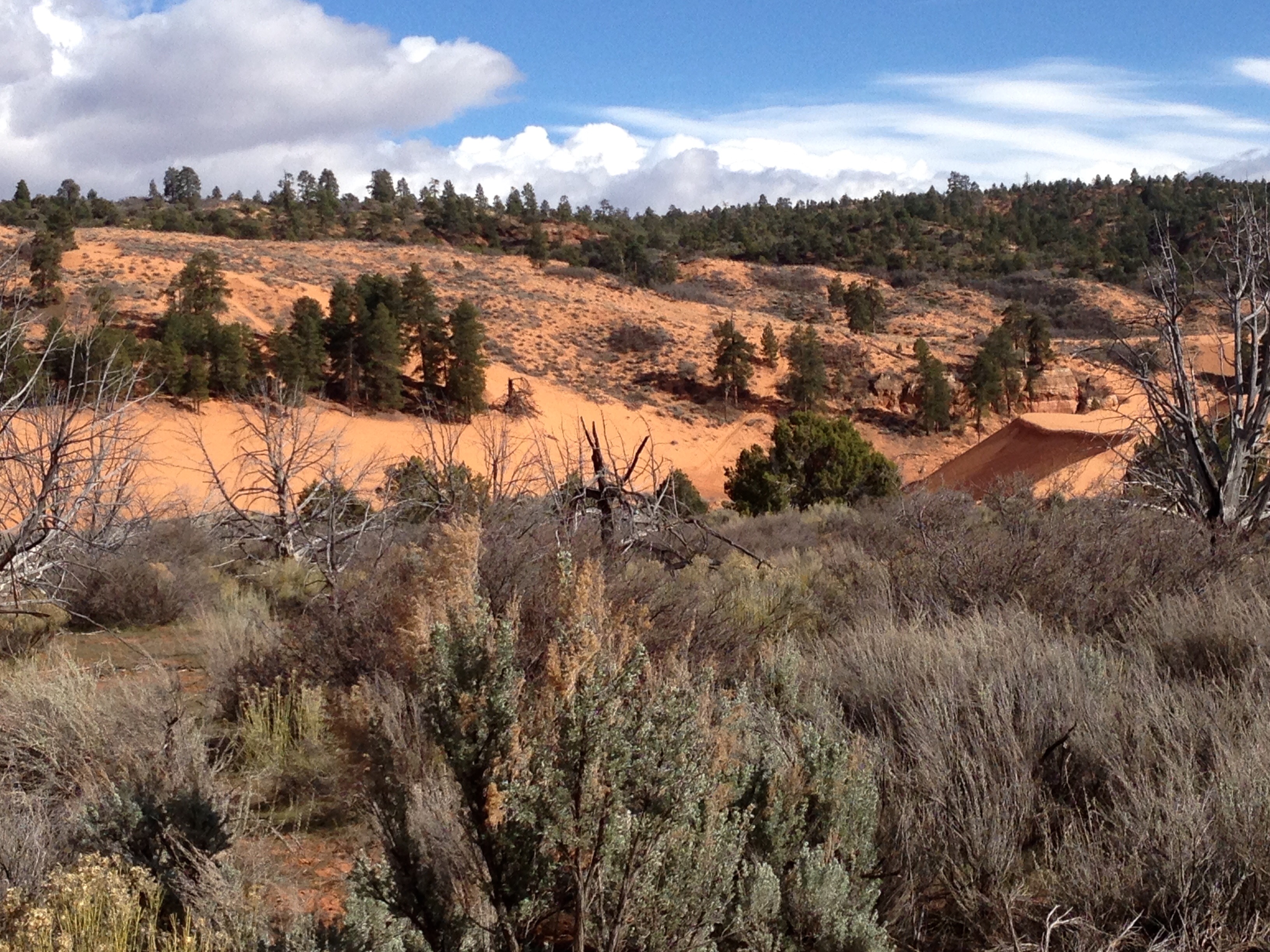
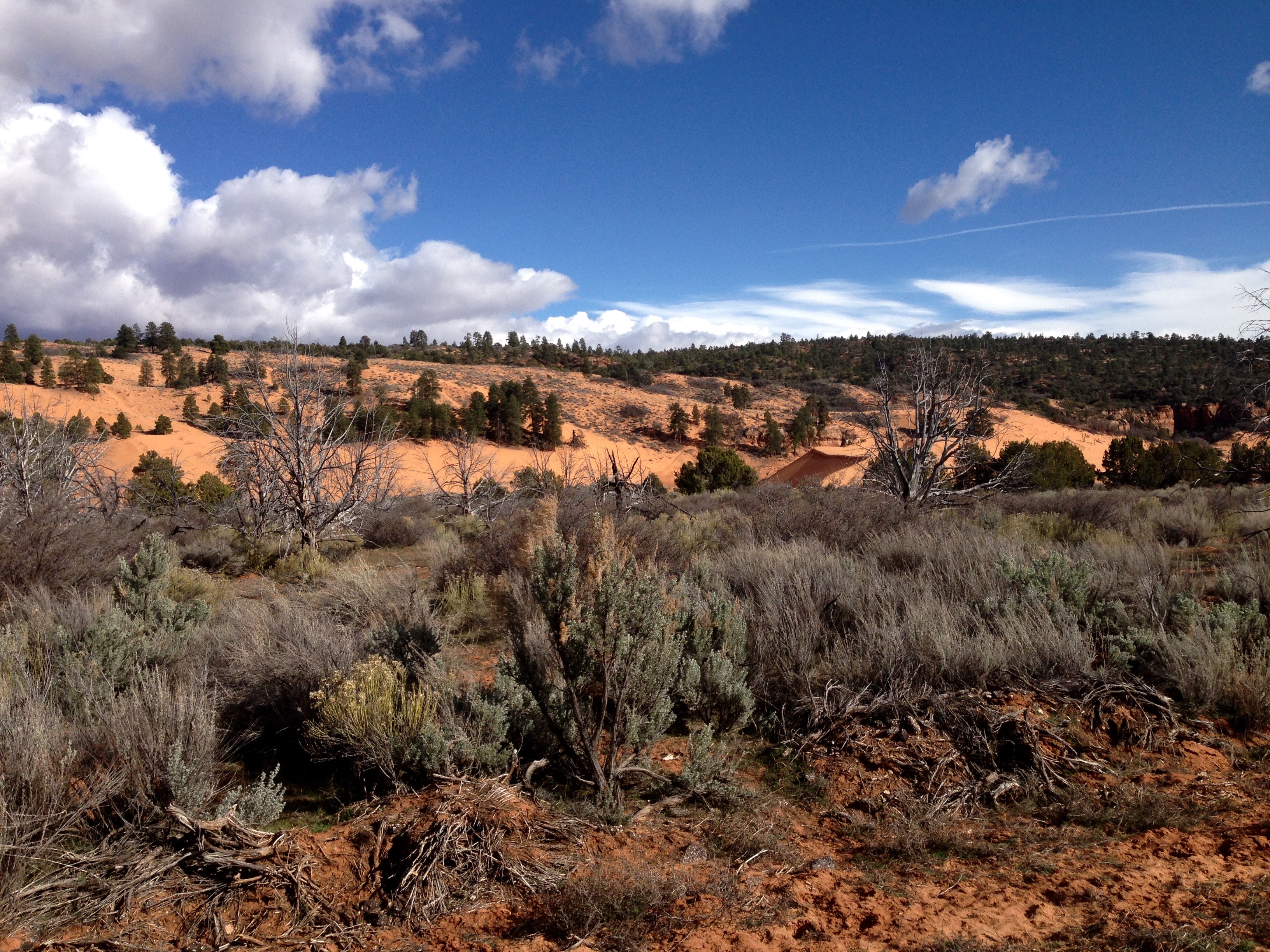
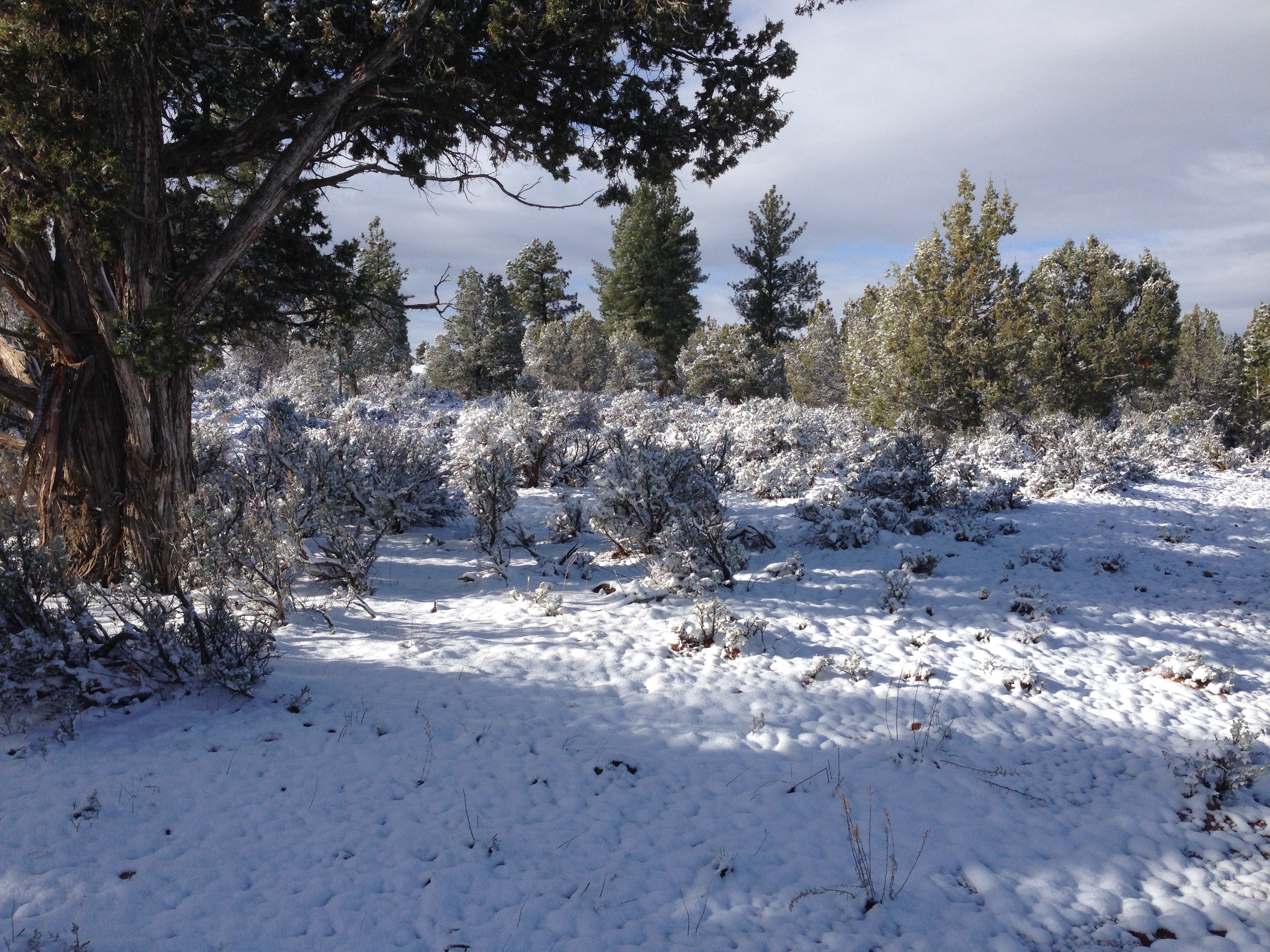
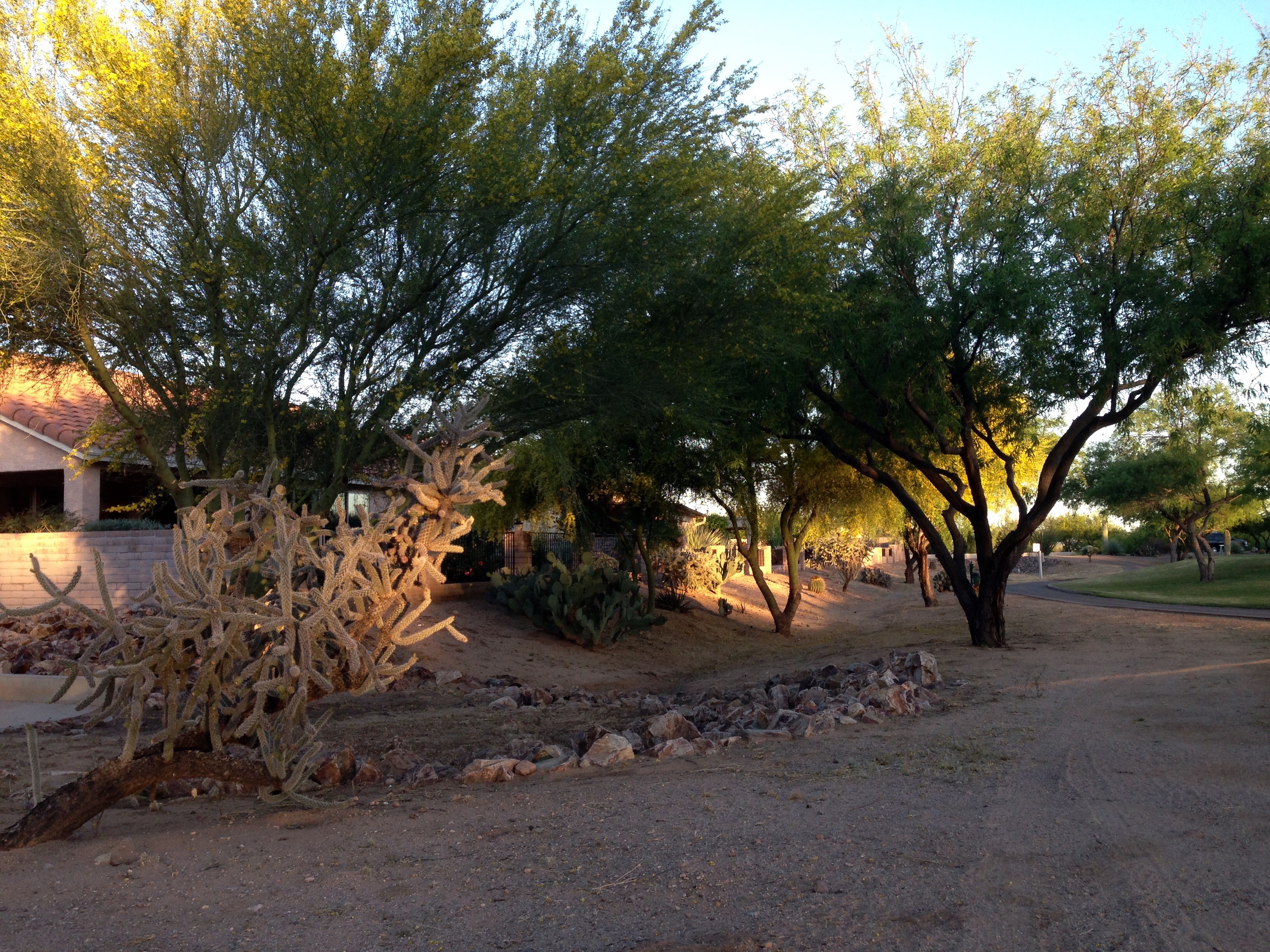
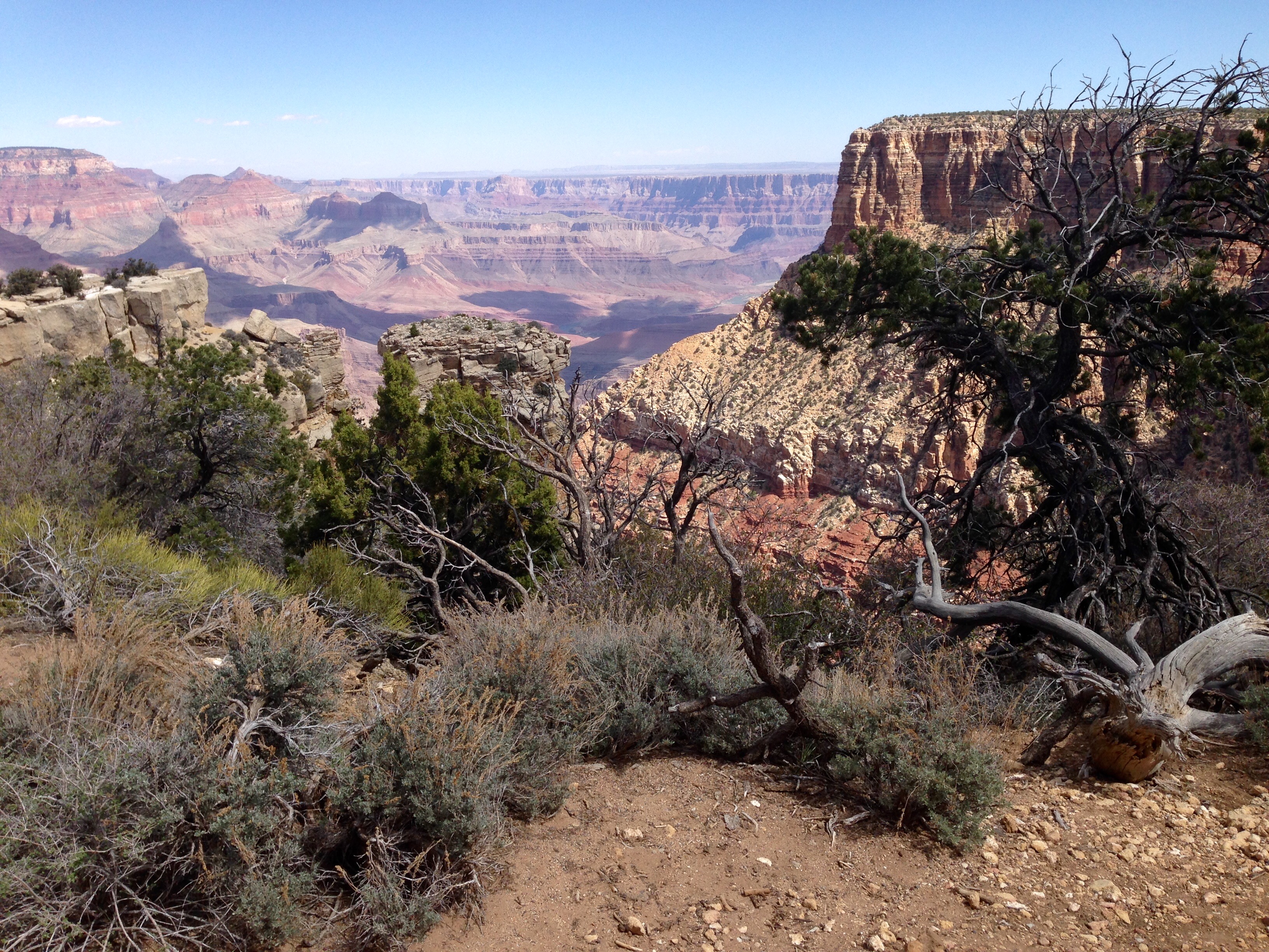
During the Spring, Summer, and Fall, you cannot drive your own vehicle up Zion Canyon.  The only way to go up into the canyon is walking or on shuttle busses.  This is really a good news bad news thing.  The good news is that many more people can enjoy the canyon in any given day.  Wait, isn’t that the bad news?  It is when they’re mostly Californians.  Can’t we just pass a law that says they have to stay in California?

Seriously, the shuttles aren’t that bad.  They run continuously and you can get on and off at the seven different stops at your own pace. The stops are well situated to the hiking areas.

grotto1

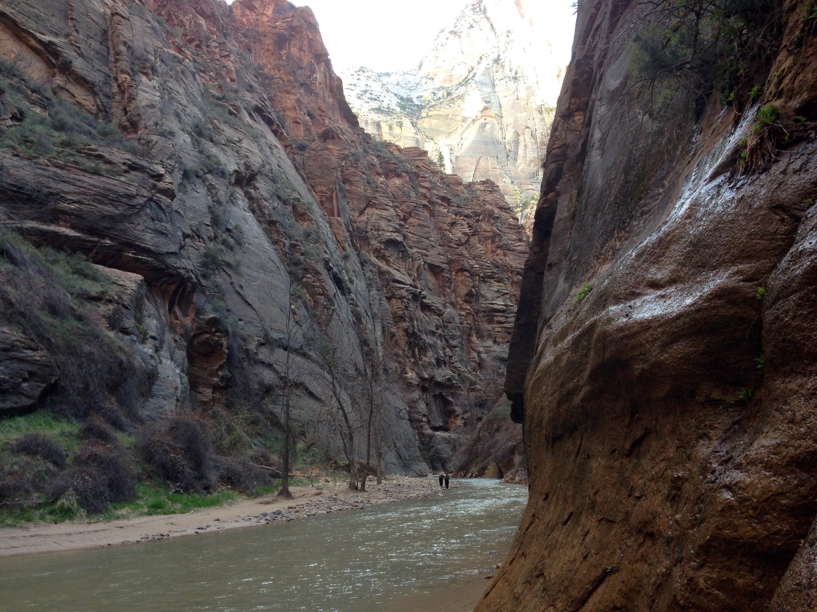
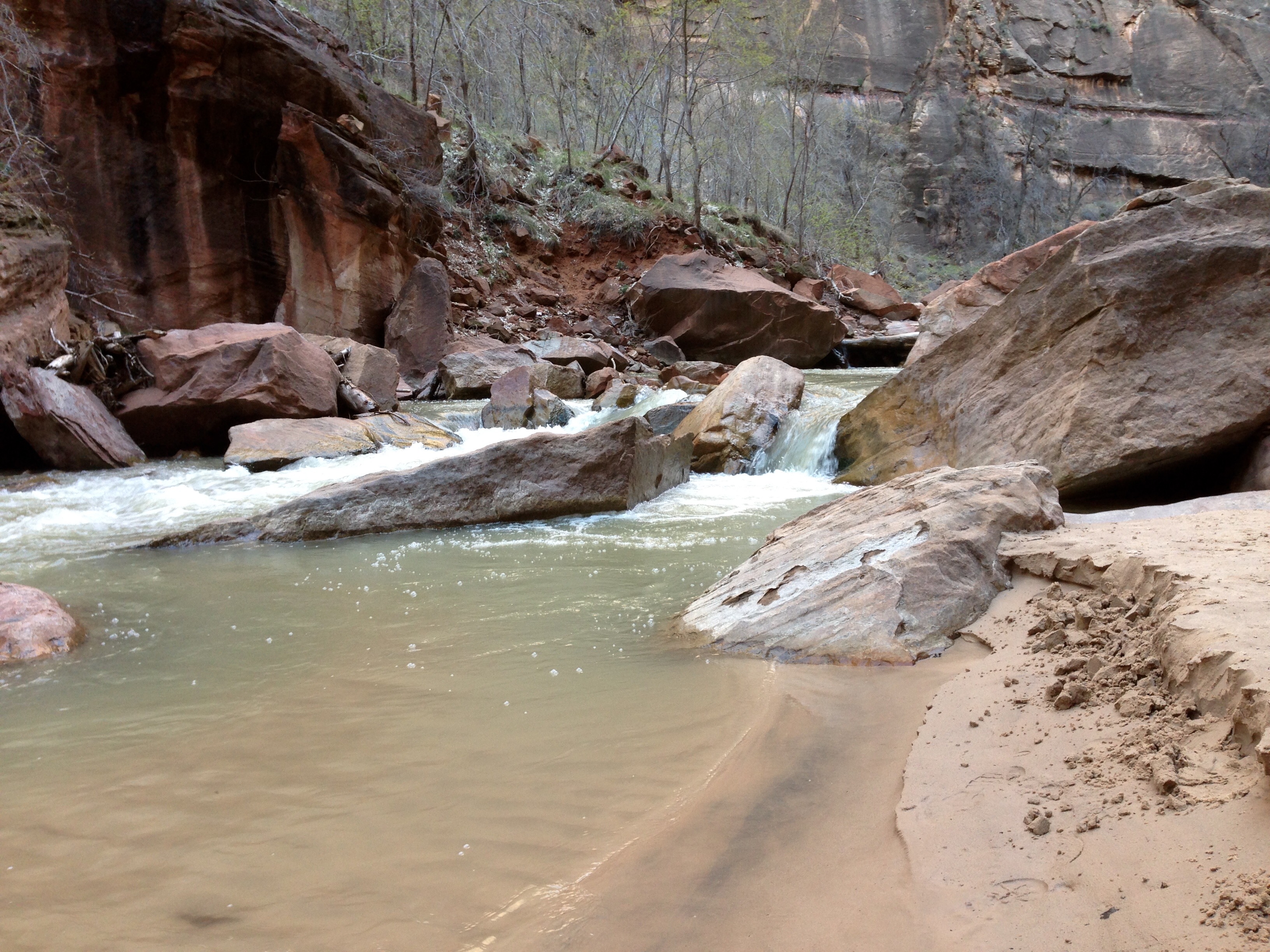
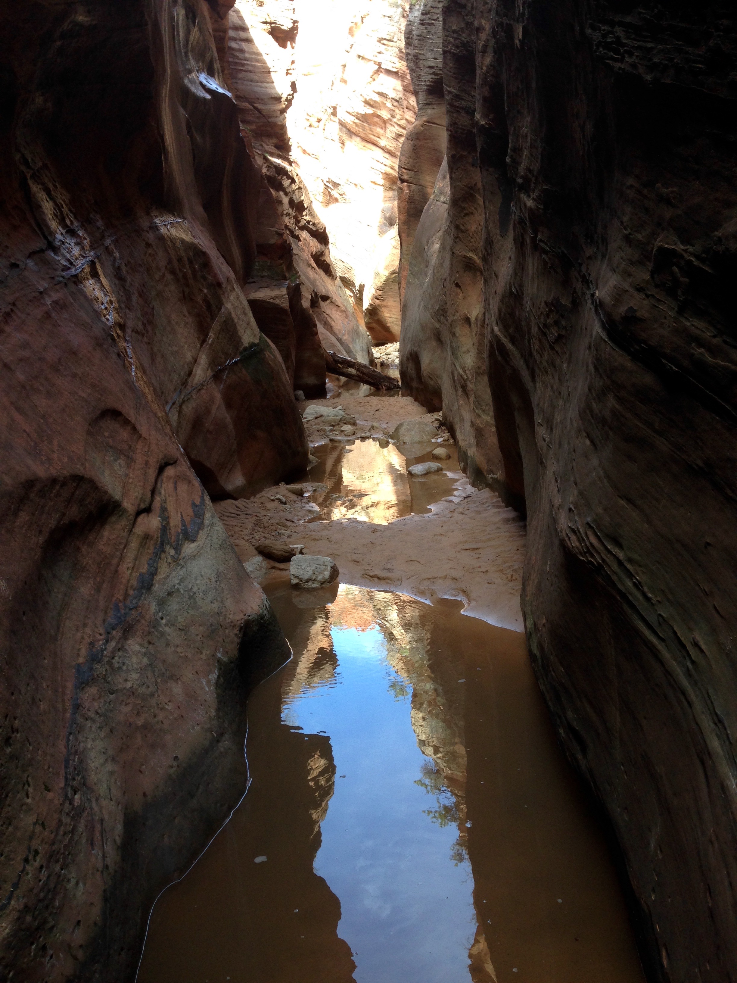
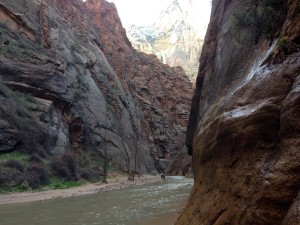
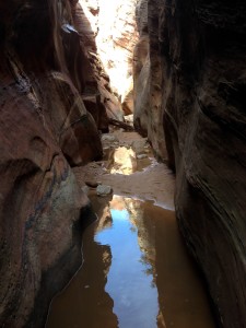
The very last stop is called Temple of Sinawava.  I love that name.  There’s a trail that goes up to the entrance to the Narrows, a very famous hiking spot.  You have to have the right gear (and a permit) because once inside the narrows, you are hiking in the water.

narrows


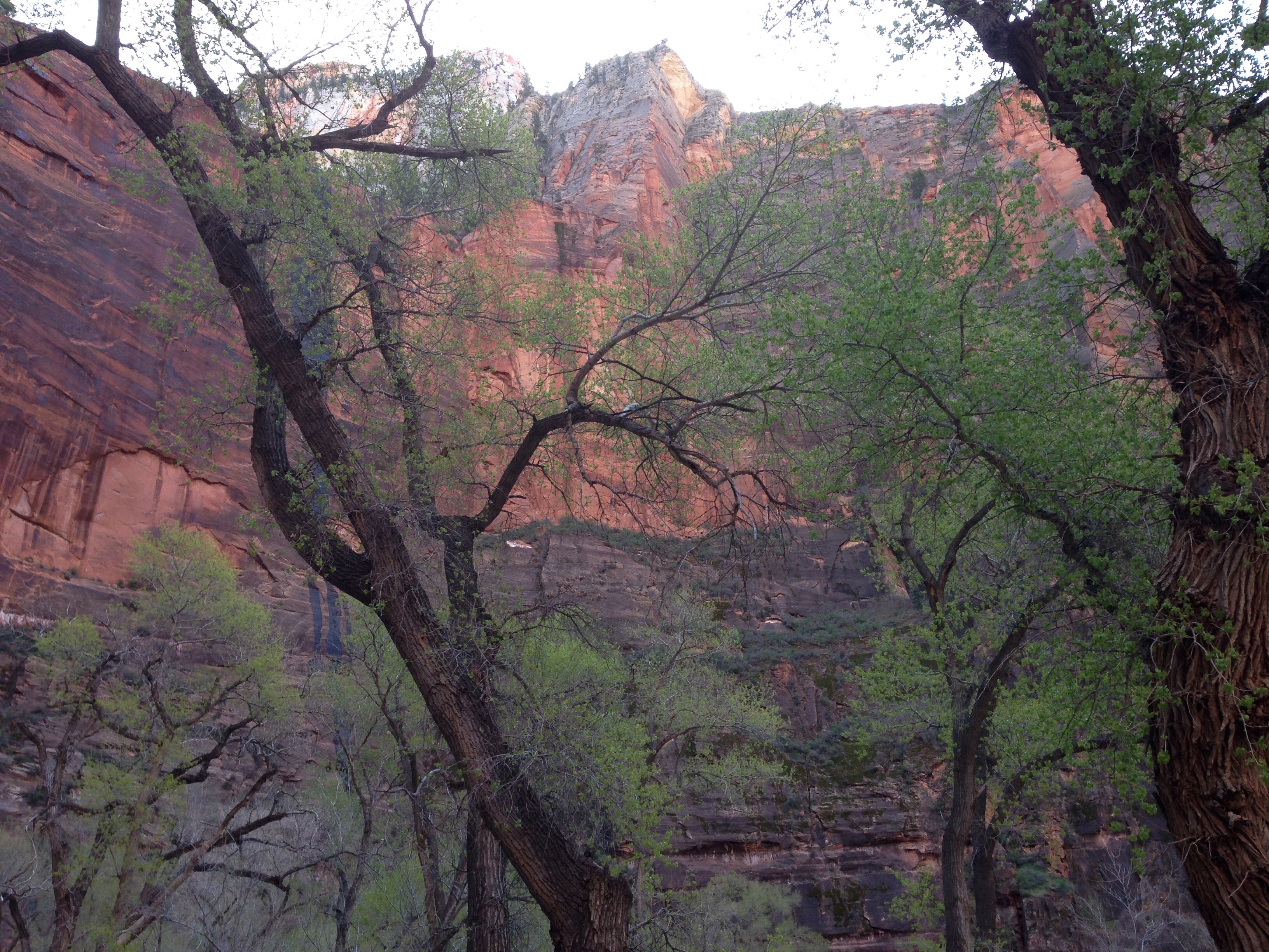
This is as far up as I could get and still keep my feet dry.  I may be back with the gear before I leave this area or I may save it for the very certain next time.


This is the North Fork of the Virgin River right near the entry to the Narrows.

virginriv

weeping
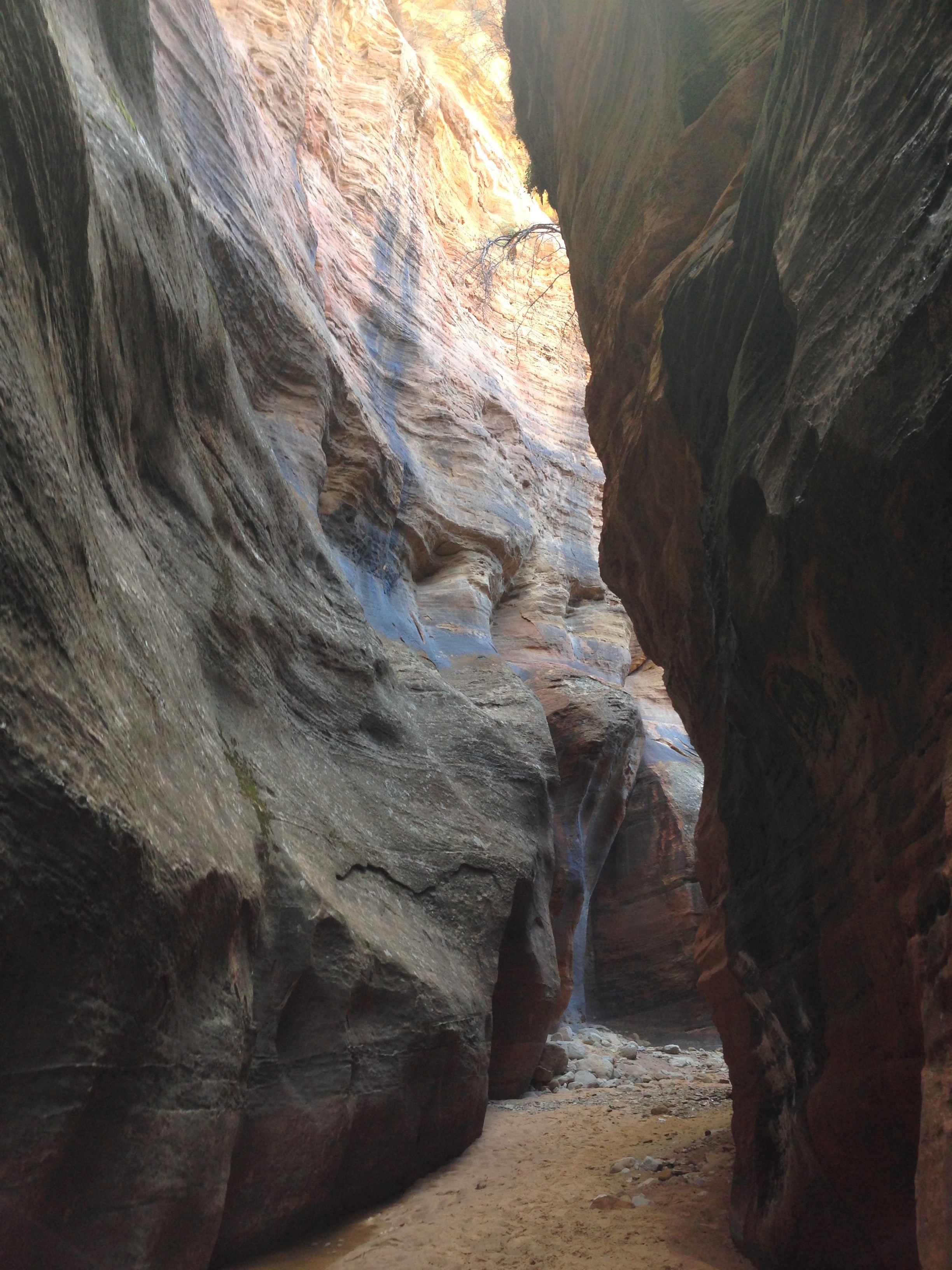
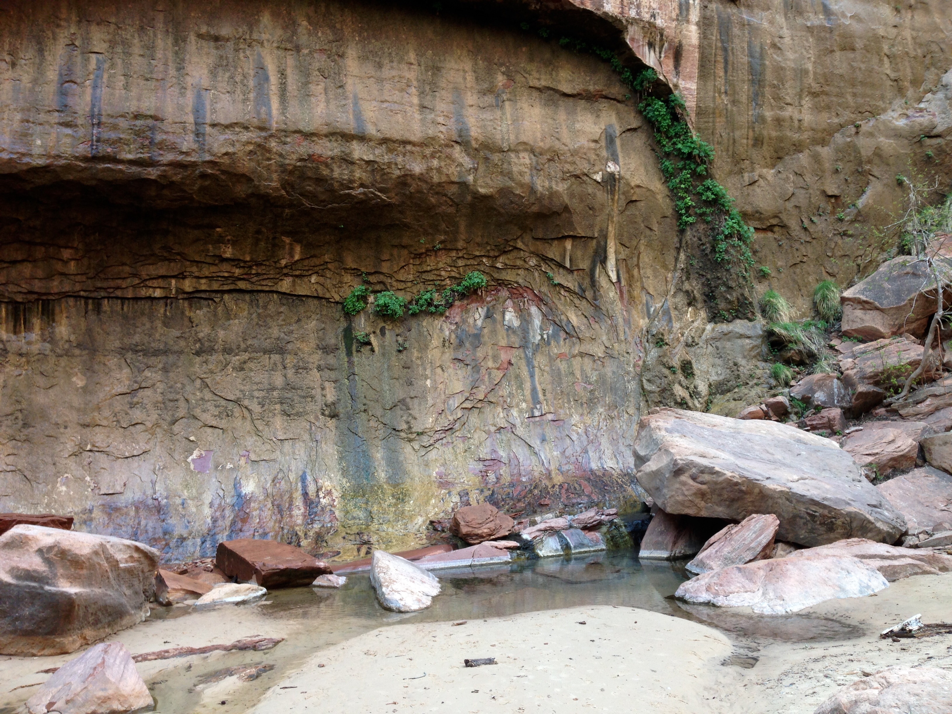
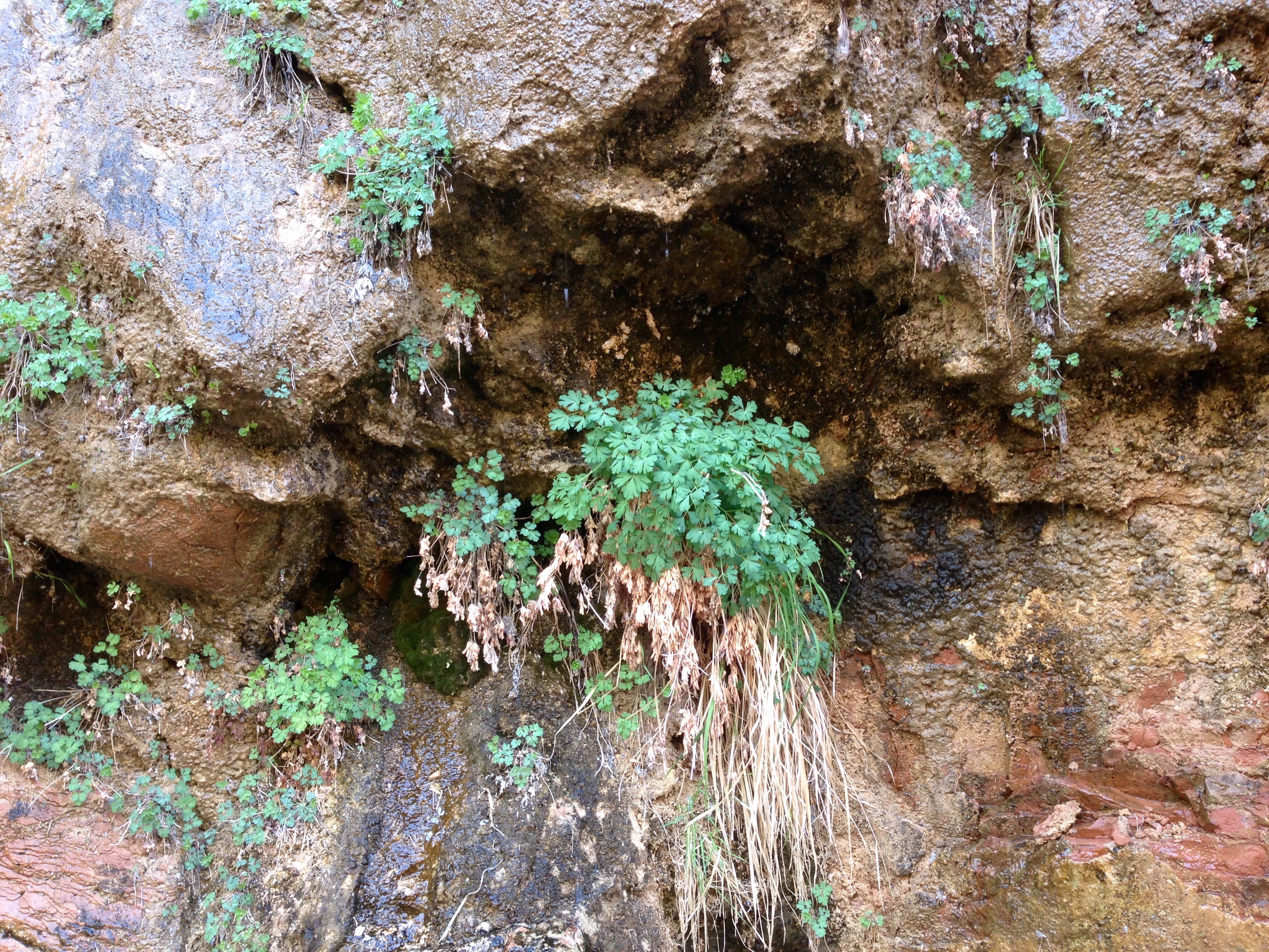
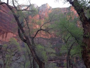
Weeping Rock.  It isn’t a very good photo ’cause I tried to lighten it up so the weeping would show.  That’s why there’s no sky.  Early in the morning would likely be better light but I can’t be everywhere early in the morning much as I’d like to be.  The “weeping” marks are water running out of the rock face.  They say that the water coming out today fell as rain or snow up to 1500 years ago.  That’s how long it can take to work it’s way down through the layers of rock and sandstone.  Now how do they figure that out?? This has one of the great severe hiking trails but I was saving myself for Angels Landing.

grotto

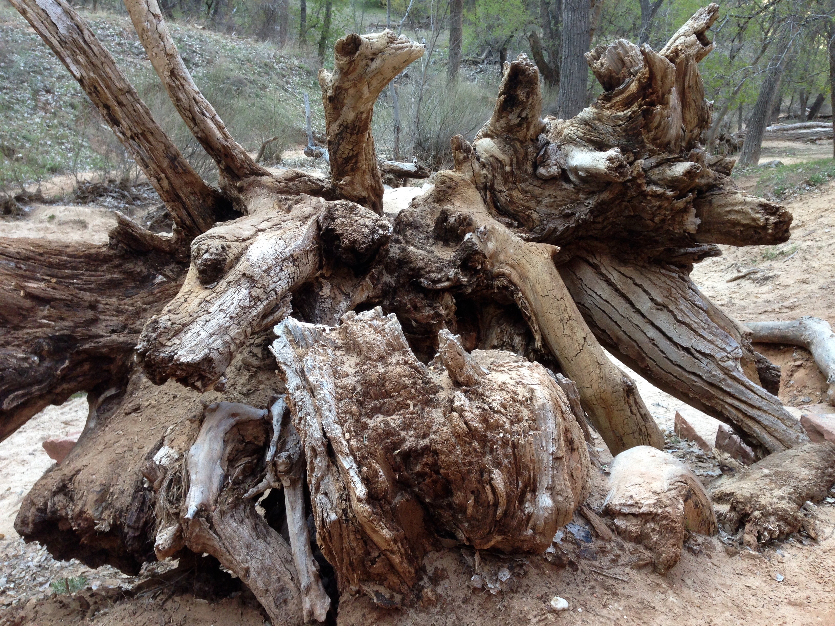
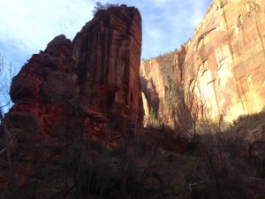
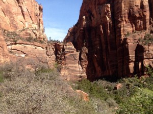
This photo is taken in an area called The Grotto.  It’s also at the trailhead of the Angels Landing Ascent.


specs

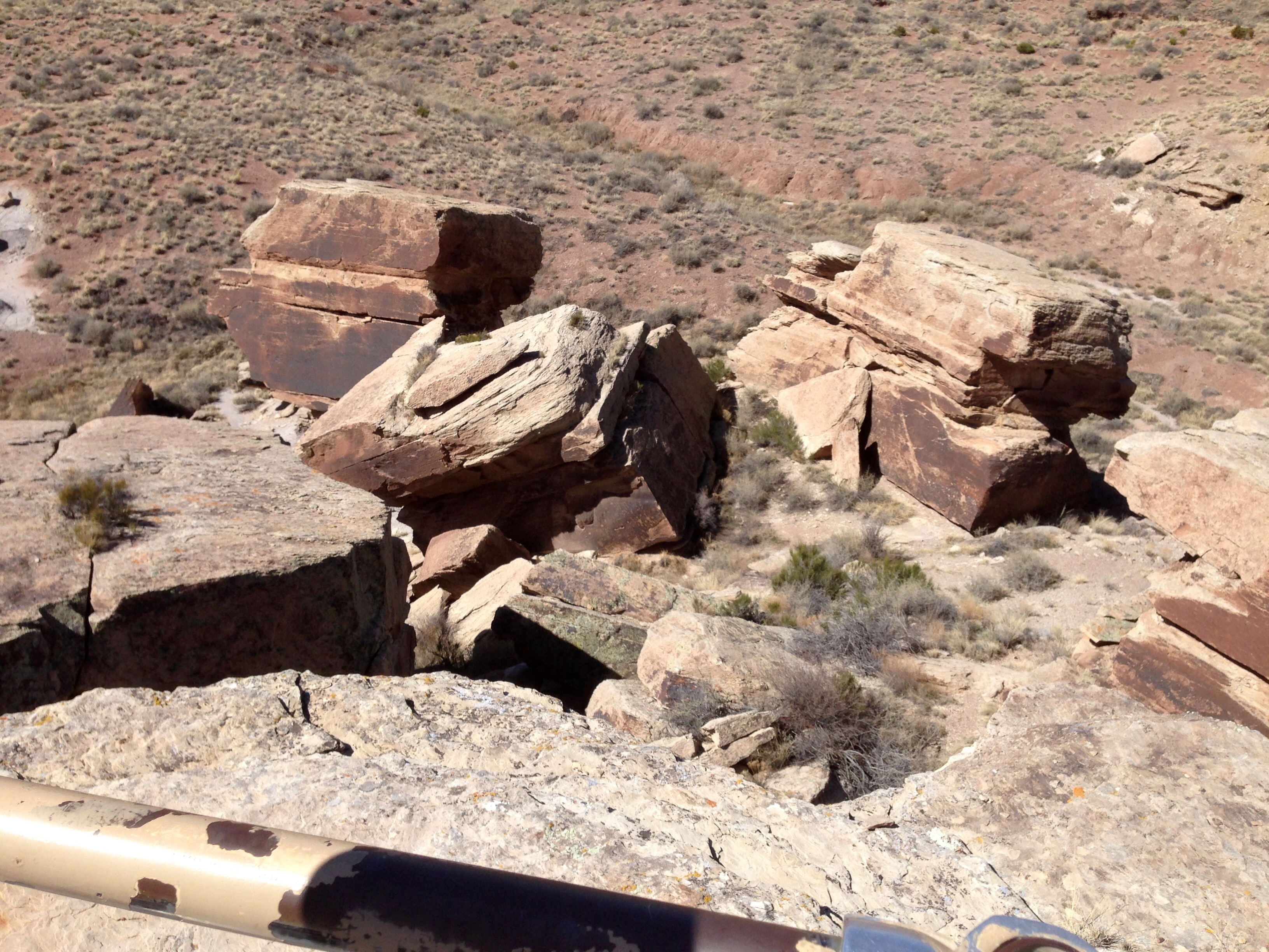
Wait, let’s back up one stop.  If you look right at the bottom of the saddle you can see some specs.  No?  Well take my word for it, they are there.  Hold that thought.

angelscut

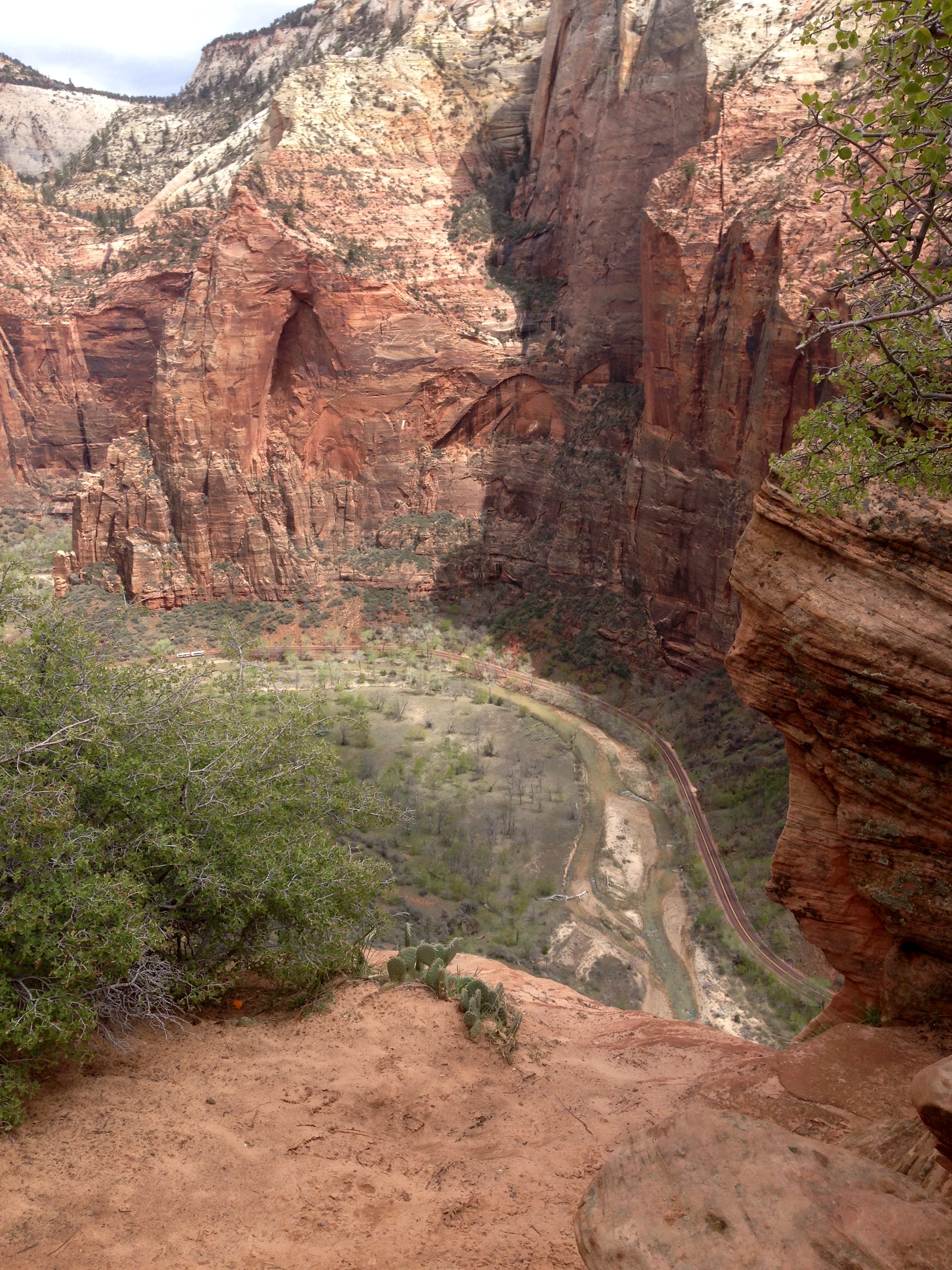
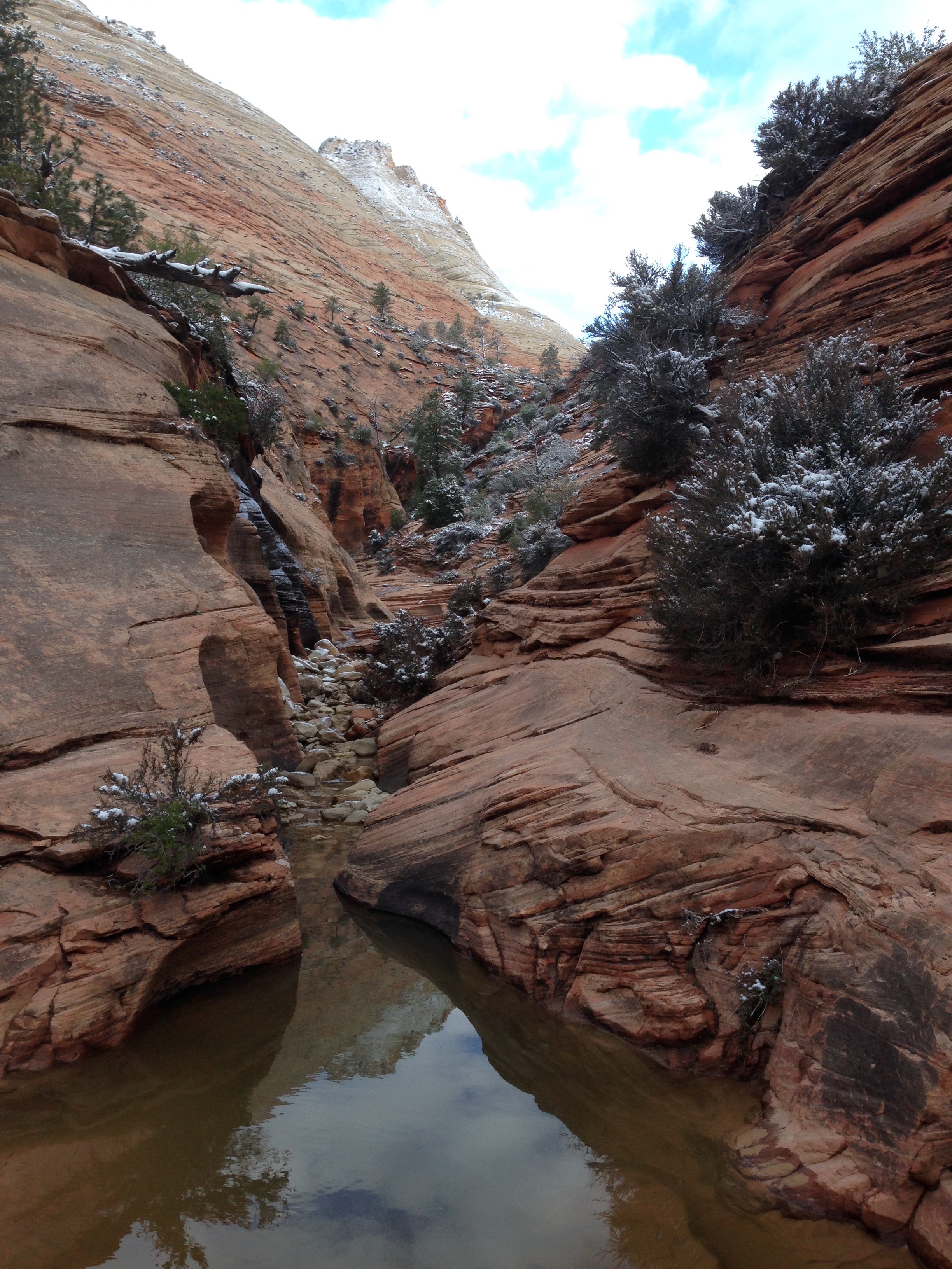
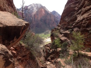
I zoomed this photo so you really can’t get a sense for how far away from it I was when I took it down near the trailhead.  Do you see on that rock face right in the center a cut that runs up from left to right?  That’s where I’m heading and up through that sky above it.

angelcut2

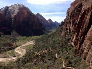
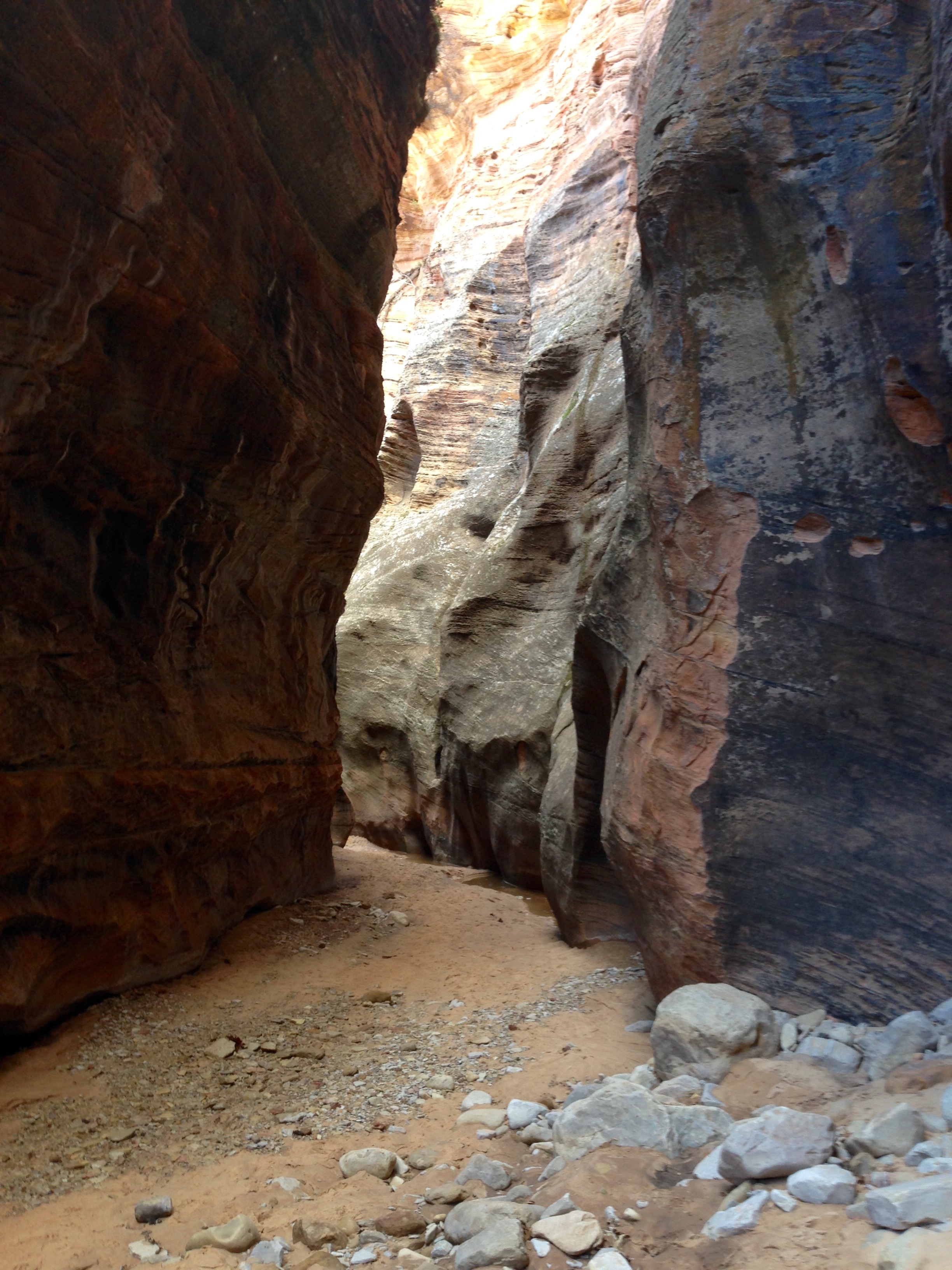
Here’s the view from the cut.  And no, there are no railings.  This is a well made trail but it is not for the faint of heart or body.

angeltop

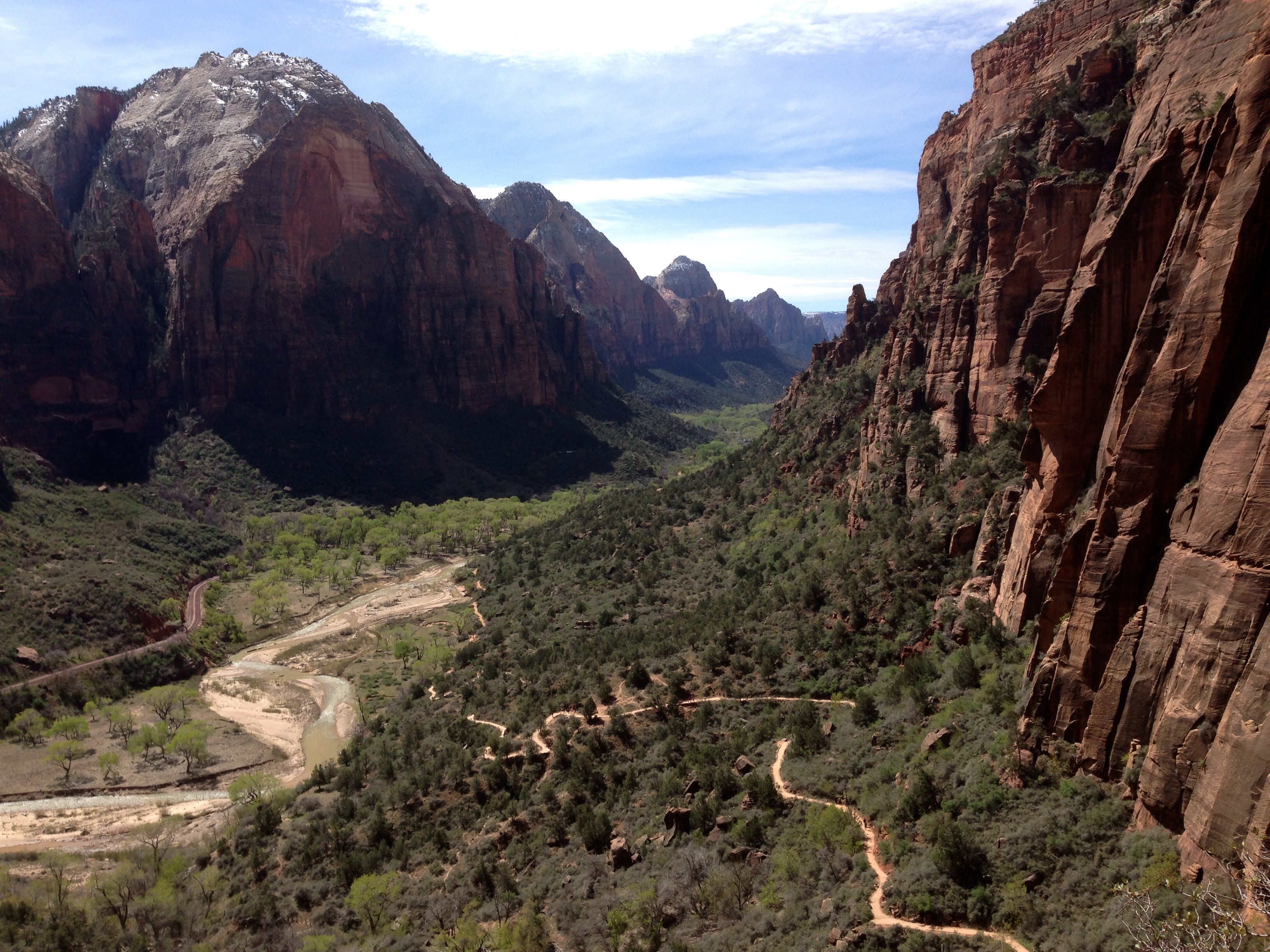
Ok, remember the specs?  I was standing on that sand bar down below when I took that picture.  The specs, if you haven’t figured it out, were people.


angeltop2

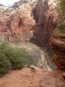
Here’s another shot of the view to the floor of the canyon.  This is looking down from an area called Scout Lookout.  It is at the bottom of the last pitch up to the top of Angels Landing.  The trail has chains affixed to the rock for hanging on.  I looked at that and decided it was not for me.  It was full of people all trying to move past each other going up and down.  I was tired and the trail itself had tested my vertigo enough.  It has two pitches of very steep switchbacks, one below the cut I showed you and one going up to Scout Lookout.  It’s 2 and a half miles and 1400 feet of ascent.  It’s so steep that going down is a workout as well.  Angels Landing was a test of my physical and mental will.  Oh, did I mention that, on average, a person dies on Angels Landing every other year?

angeldesc

Taken on the descent.  The cut is right around the corner of that rock face on the right.

box5


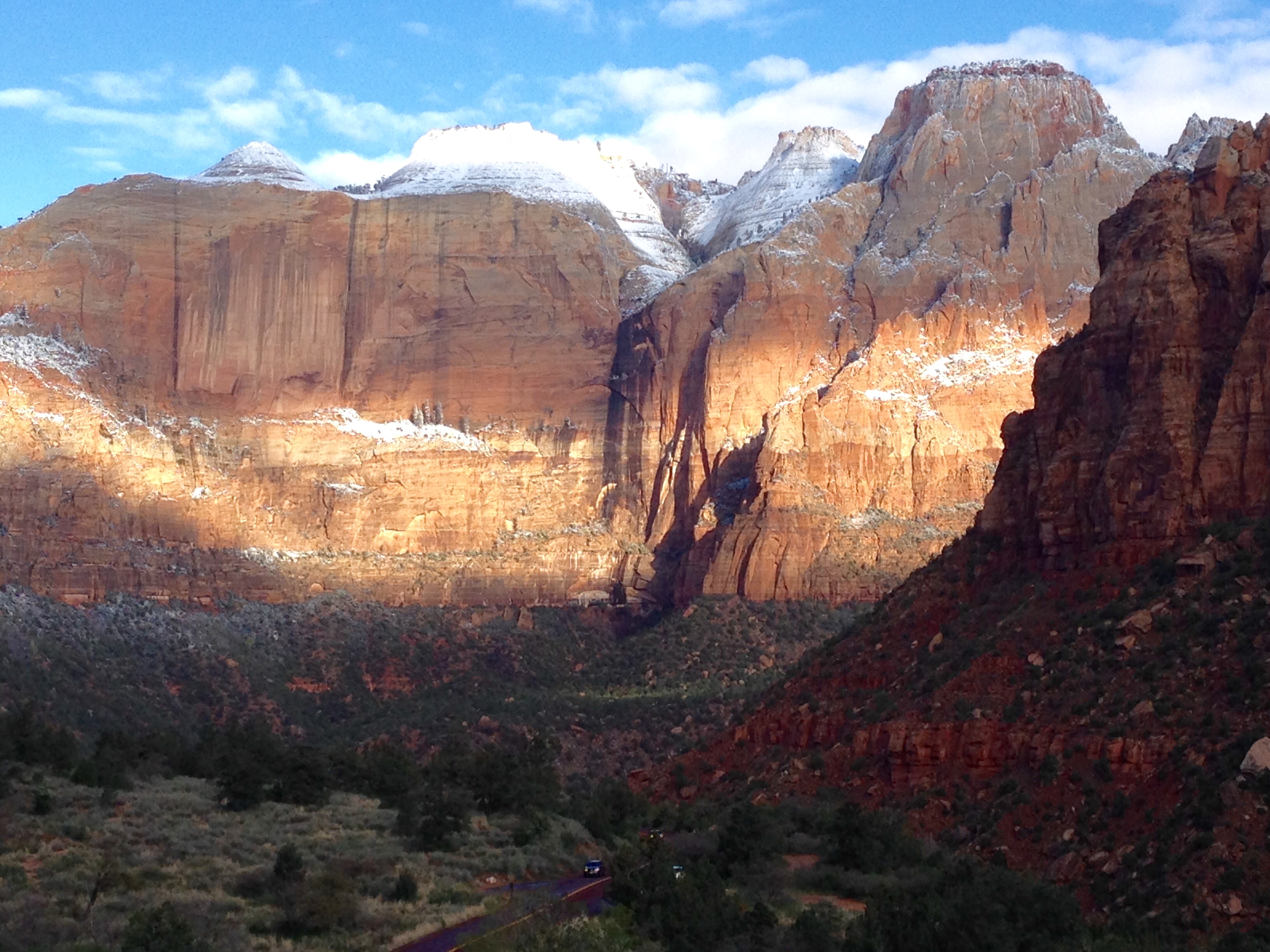
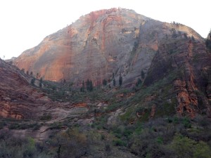
Remember the first shot from the morning in Chapter 1?  I returned to the spot as promised.  It was hard getting back down to this spot because I was spent from the Angels Landing ascent.  But I loved this spot and was determined.  It was worth the trip.


box3          box1


checkerboardrock

Last shot of the day.  This is called Checkerboard Rock because it has  horizontal cuts in it from rock layers and vertical cuts in it from years of water rivulets.  This isn’t the best angle to see it but it’s the shot I liked the best.

Zion, Day 2

We’ll call this Zion, Day 2, Chapter 1.  I have lots of photos and it will take me all night to get them uploaded.  So I’ve started with these.  These are just some things I shot because I thought they looked interesting.  They were taken at different times during the day in different areas of the park.

like1

box4

These were the first two shots I took in the morning.  I came back to this steep walled cut at the end of the day to get some different light into it.  You can find places like this but you have to hunt.


gardens

like3

Some hanging gardens.  If you look close on this second one you can see the drops of water.


like4


It goes every which way, but this is one big single old stump.

like2

holes

This little wall decoration was hiding right in plain sight.  I took it on the descent from Angels Landing.  More on Angels Landing in Chapter 2.

Zion, Day 1

I’m not sure what to say. Just like pictures sometimes don’t seem to do justice to what the eye sees, words sometimes feel like they fall short as well. I was able to do a drive through Zion National Park once years ago.  This would have been in the 80s sometime. Zion rushed up to, and blew past the line of both my memory and my expectations.

east

On the way into the park it was overcast, cold, foggy in places, and flurries.  But you just have to stop and look, and smell, and listen.


east2

I think every traveler has a favorite. Anyone could make the case that Zion is the treasure of treasures.  Whoever named this park……

eastcanyon

I wrote to my friend Mar in an exchange of texts that I didn’t think any one person deserved to see all that I have seen. So I’ll just say I’m trying to live up to the worthiness of God’s artistry.

eastcanyon2

FullSizeRender

I took these two shots standing in the same place.  The water and the high altitude wind were the only sounds.


kolobterrace2

These last shots were taken up in an area called the Kolob Terrace.  The Kolob Reservoir Road goes in and out of the park up the west side.  This time of year they only go so far with the plow.  Eventually it just turns into dirt.  I felt like I had the place to myself.  In a couple of hours I went from Spring to Winter and back to Spring.

kolobterrace

When you are off the park boundary, the canyon has some picturesque ranches.

ranch

Tomorrow, Zion, Day 2.

Easter Morn, +2

park2I knew that pushing this far north, this early, had some risk. This is at Coral Pink Sand Dunes State Park just south of Zion National Park. I wish I would have shot some pics yesterday coming in because they really are coral pink. Don’t’ worry, you’ll see them without snow cover eventually.

truck


For now, I’ve cancelled my camping reservations farther north and am reassessing my plan.

camper2

As this park does not have hook ups, as luck would have it, last night was my first night “dry camping” on this trip. Dry camping is the new euphemism for camping the old fashion way. (no electricity and water right at your site) I was warm enough and slept ok, but I’m trying to fight off a cold and so the whole heat in the camper thing is what I’m reassessing. I’ll let you know where it all lands. One thing is for sure; I’m not leavin’ this area until I’ve seen everything I came here to see.

camper1

park1

Cottonwood, Sonora, Flagstaff, and other points south of the Grand Canyon

I camped at the Dead Horse Ranch State Park in Cottonwood. I can see why a horse died there. Just kidding, it wasn’t that bad. The state park isn’t much but the area is great exploring. The towns of Cottonwood and Jerome both have historic town centers that are a nice visit and not nearly as crowded as Sonora.

cottonwood

I think I’ve posted a few sunrise shots, but no sunsets, so here’s one. Nothin’ special but I took it in the campground.


Adrianna’s is a great Mexican restaurant in historic Cottonwood. I made a couple of stops there, both for the food and the wifi.

Hippie

Across the street was this little gem. I had to go in. It smelled just like a lot of places I’ve been and sold all of the same stuff as “back in the day”.


Just north of Cottonwood on Page Springs Road there are several little wineries that are certainly worth the time if you like them. Go early though for breakfast wine, ‘cause they get busy in the afternoons. C’mon people, I’m just kidding.

Sonora is THE popular place in the area. When I say popular I mean crowded. It IS beautiful here. I give Sonora A+ for scenery and a D for all afternoon traffic jam. I also deduct points for spotting one woman with white, jeweled cowboy boots and one man with a starched denim shirt. Overall grade, C+. Ok, I’m still just messin’ with ya.

sonora1

Here’s some shots of the Sonora area. These are all essentially right in town.


sonora3

sonora2


sonora4

On the way up to the Grand Canyon I blew through Sonora bright and early so I could drive up the Oak Creek Canyon between Sonora and Flagstaff. Was rewarded with some great early morning light.

I stayed in Flagstaff one night. I sat in Adrianna’s and did a web search looking for an RV Park and Storage in the area. I had already decided that I was going to return to Tucson to celebrate Easter with friends and I was hoping to not have to pull the camper all the way down there and all the way back. I found Woody’s Mountain Camp and Storage in Flagstaff. When I called and told him I was looking for a place to camp one night, and then store my trailer through the weekend, he said sure we can do that. When I asked him if I should make a reservation he laughed and said, “We got plenty of room, it’s still a little cold up here overnight for most campers.” It had been 18 the night before. He was right of course. He had about 50 or 60 sites in his campground and there were about eight of us camping. It all worked out great. Woody and his wife are great people and I was able to find a church that night to celebrate The Lord’s Supper.

So, that’s it for a few days. I’m going to blow down to Tucson for Easter weekend, and Monday morning I’ll be off at O’ dark thirty heading back north, where next week I hope to regale you with adventures in southern Utah.

Have a great Easter weekend. I am well and hope you all are too.

The Grand Canyon

This was to be one of the crown jewels of this trip. I had never been, and it did not disappoint. I have “seen” the Grand Canyon many times. In books, posters, and paintings. I even have a memory from back many years of seeing an Omni or Imax film about the Grand Canyon. None of it compares to walking up to one of the rims for the first time. It was emotional for me.

I’m one who prefers to be on “my side” of the camera.  But I wish I could have a picture of me at that moment. An inward laugh rumbled inside at two things; one was just that my reaction surprised me. The other was remembering a theme that was repeated in the story of the Petrified Forest and the Painted Desert. “Water will always have it’s way.” I realized the scientific truth of that in much of what I have seen in these travels. The Grand Canyon is the ultimate example of water will always have its way.

Whoever first used the word grandeur had to be standing here.

The day was a mixed bag of weather. It was mostly sunny but the elevation of the south rim made for cold and windy conditions, temp in the fifties and wind gusts up to 40. That would prove to be consequential to my experience.

My first stop was at a viewing area over The Little Colorado River. If you come to Grand Canyon National Park from the east there are a couple of viewing areas outside the park that are run and maintained by the Navajo. It’s a great first look and a good opportunity, if you’re inclined, to buy some nice hand painted pottery right from the Navajos.

There was one spot in this viewing area that had a narrow U shaped railing where you could walk out on an equally narrow ledge and look straight down. I girded against my vertigo, got a white knuckle, two handed grip on the railing, and took a peek. Taking a picture was literally impossible the wind was blowing that hard.

tower2

Once inside the park the first viewing area and visitor’s center you come to has this tower. I have to admit was so caught up in the canyon itself that I didn’t pay any attention to the history or information about this tower.


tower1

You can get to the top walking up through a series of rooms and up narrow staircases. While I was up at the top, having exhausted every window view on the canyon side, I spent some time on the side on the side facing the parking area. Being the wandering people watcher that I am, it was a good people watching spot. There was a curious common thread through all of the people arriving. Everyone walking from the parking area down to the viewing area was walking fast. In some cases really fast. It was almost as if they were worried the Grand Canyon was going to close before they got there. I have to admit I probably looked the same. The sense of anticipation is something else.

So enough of my rambling, here’s some more pics.

gc3

gc2

pan

So, here’s a humorous one.  I was trying to do a panoramic in gale force winds.  The result speaks for itself.


What!?  That’s it you say.  Come on, you’ve seen lots of photos of the Grand Canyon.

On the south rim I stopped at every viewing area between the east entrance and the Grand Canyon Village at the west entrance. The Village was the only place I didn’t stop because by the time I got there in the early afternoon the entire population west of the Mississippi was there.

When I exited the gate there were four lanes open checking people into the park and two lanes of traffic backed up about a half mile waiting. I made my escape.

gc1

Here’s a shot I took on the way back to my campground in Cottonwood. It’s Humphrey’s Peak, the highest peak in AZ.


Tuzigoot

On Monday I moved from Show Low over to the Dead Horse Ranch State Park near Cottonwood, AZ. It was a gorgeous mountain drive through almost entirely National Forest Land. My trustee Honda Ridgeline really had to work hard on that drive. At times I felt like I should stop and unhook her, give her a rub down, and let her rest. 🙂

tuzigoot1

In the late afternoon I had time to visit the Tuzigoot National Monument which is just a stones throw from Dead Horse Ranch Campground. In the 1930s a major excavation project was undertaken at this site using out of work miners. One of the workers was a Yavapai Apache who gave the site it’s name, meaning crooked water.

tuzigoot2


These pueblo ruins were inhabited by the Sinagua People. They have a definite community plan in the way they were built.

tuzigoot3


The sides would have been built up and covered with the entrance being a hole in the roof with a ladder.


tuzigoot4

The inhabitants of these pueblos were contemporaries of the Cliff Dwellers down in Gila. There is a small cliff pueblo site called Montezuma’s Wall not far from this site at Tuzigoot. As at Gila, it is thought that they lived here for several hundred years and then just moved on. Up on the south rim of the Grand Canyon is a partially excavated pueblo ruins site called Tusayan. Historians seem to agree that these sites were home to a people for a definite period of time and then abandoned. As you read about and listen to guides at these sites, you get the impression that no one is certain if the people just died out or left. There is some evidence that a large migration happened throughout the southwest in this period. Whether it was caused or nomadic is uncertain.

March 20th, Palm Sunday

After church I headed north from Show Low to the Petrified Forest and Painted Desert National Monument. BTW, when I was in Big Bend National Park I purchased a Senior Pass for $10. It gets me in free in any National Site where there is an entrance fee. Most National Parks and Monuments have like a per vehicle/per person fee structure. I’ve already saved probably about $200. It does pay to get old sometimes. 🙂

It’s hard to do justice to this landscape with anything but the naked eye and morning or evening light with a camera. That said, this area presents another set of circumstances that stretch my ability to understand the geological and physical sciences that over time produce these extraordinary visual treasures.

Over time, what was once underwater became tropical, became buried, became arid and what was preserved and petrified forests were forced to the surface once again for us to marvel at. That’s the best I can do. 🙂

I just can’t get over the breadth of the things I’ve seen and experienced on this trip. And the people and friends. Really? Each day just makes the pile bigger.

logs2

logs

The whole of the Monument area is scattered with fields of petrified logs and remnants. You can stop or not, and take endless pictures or not.


log1

painted

This Monument area is the lower reaches of a large area called the Painted Desert. It starts up east of the Grand Canyon and swipes a long arc to the south and east. A lot of it is on the Navajo Reservation. While some of it is beautiful in any light conditions, the naked eye is the only way to let the Painted Desert speak to you.

petrosite

I took this photo to show a portion of a large field of rock that has numerous flat surfaces on them. It’s called  Newspaper Rock because of the numerous petroglyphs that adorn these flat surfaces. Petroglyphs are scratched into the rock as opposed to pictographs which were painted. These “stories” have many contributors over a period of about 1300 years.

petros

You can’t get close. If you could these things would be ruined by idiots in no time. I managed to hold the camera still enough on zoom to give you a taste.