Zion, Day 1

I’m not sure what to say. Just like pictures sometimes don’t seem to do justice to what the eye sees, words sometimes feel like they fall short as well. I was able to do a drive through Zion National Park once years ago.  This would have been in the 80s sometime. Zion rushed up to, and blew past the line of both my memory and my expectations.

east

On the way into the park it was overcast, cold, foggy in places, and flurries.  But you just have to stop and look, and smell, and listen.


east2

I think every traveler has a favorite. Anyone could make the case that Zion is the treasure of treasures.  Whoever named this park……

eastcanyon

I wrote to my friend Mar in an exchange of texts that I didn’t think any one person deserved to see all that I have seen. So I’ll just say I’m trying to live up to the worthiness of God’s artistry.

eastcanyon2

FullSizeRender

I took these two shots standing in the same place.  The water and the high altitude wind were the only sounds.


kolobterrace2

These last shots were taken up in an area called the Kolob Terrace.  The Kolob Reservoir Road goes in and out of the park up the west side.  This time of year they only go so far with the plow.  Eventually it just turns into dirt.  I felt like I had the place to myself.  In a couple of hours I went from Spring to Winter and back to Spring.

kolobterrace

When you are off the park boundary, the canyon has some picturesque ranches.

ranch

Tomorrow, Zion, Day 2.

Easter Morn, +2

park2I knew that pushing this far north, this early, had some risk. This is at Coral Pink Sand Dunes State Park just south of Zion National Park. I wish I would have shot some pics yesterday coming in because they really are coral pink. Don’t’ worry, you’ll see them without snow cover eventually.

truck


For now, I’ve cancelled my camping reservations farther north and am reassessing my plan.

camper2

As this park does not have hook ups, as luck would have it, last night was my first night “dry camping” on this trip. Dry camping is the new euphemism for camping the old fashion way. (no electricity and water right at your site) I was warm enough and slept ok, but I’m trying to fight off a cold and so the whole heat in the camper thing is what I’m reassessing. I’ll let you know where it all lands. One thing is for sure; I’m not leavin’ this area until I’ve seen everything I came here to see.

camper1

park1

Cottonwood, Sonora, Flagstaff, and other points south of the Grand Canyon

I camped at the Dead Horse Ranch State Park in Cottonwood. I can see why a horse died there. Just kidding, it wasn’t that bad. The state park isn’t much but the area is great exploring. The towns of Cottonwood and Jerome both have historic town centers that are a nice visit and not nearly as crowded as Sonora.

cottonwood

I think I’ve posted a few sunrise shots, but no sunsets, so here’s one. Nothin’ special but I took it in the campground.


Adrianna’s is a great Mexican restaurant in historic Cottonwood. I made a couple of stops there, both for the food and the wifi.

Hippie

Across the street was this little gem. I had to go in. It smelled just like a lot of places I’ve been and sold all of the same stuff as “back in the day”.


Just north of Cottonwood on Page Springs Road there are several little wineries that are certainly worth the time if you like them. Go early though for breakfast wine, ‘cause they get busy in the afternoons. C’mon people, I’m just kidding.

Sonora is THE popular place in the area. When I say popular I mean crowded. It IS beautiful here. I give Sonora A+ for scenery and a D for all afternoon traffic jam. I also deduct points for spotting one woman with white, jeweled cowboy boots and one man with a starched denim shirt. Overall grade, C+. Ok, I’m still just messin’ with ya.

sonora1

Here’s some shots of the Sonora area. These are all essentially right in town.


sonora3

sonora2


sonora4

On the way up to the Grand Canyon I blew through Sonora bright and early so I could drive up the Oak Creek Canyon between Sonora and Flagstaff. Was rewarded with some great early morning light.

I stayed in Flagstaff one night. I sat in Adrianna’s and did a web search looking for an RV Park and Storage in the area. I had already decided that I was going to return to Tucson to celebrate Easter with friends and I was hoping to not have to pull the camper all the way down there and all the way back. I found Woody’s Mountain Camp and Storage in Flagstaff. When I called and told him I was looking for a place to camp one night, and then store my trailer through the weekend, he said sure we can do that. When I asked him if I should make a reservation he laughed and said, “We got plenty of room, it’s still a little cold up here overnight for most campers.” It had been 18 the night before. He was right of course. He had about 50 or 60 sites in his campground and there were about eight of us camping. It all worked out great. Woody and his wife are great people and I was able to find a church that night to celebrate The Lord’s Supper.

So, that’s it for a few days. I’m going to blow down to Tucson for Easter weekend, and Monday morning I’ll be off at O’ dark thirty heading back north, where next week I hope to regale you with adventures in southern Utah.

Have a great Easter weekend. I am well and hope you all are too.

The Grand Canyon

This was to be one of the crown jewels of this trip. I had never been, and it did not disappoint. I have “seen” the Grand Canyon many times. In books, posters, and paintings. I even have a memory from back many years of seeing an Omni or Imax film about the Grand Canyon. None of it compares to walking up to one of the rims for the first time. It was emotional for me.

I’m one who prefers to be on “my side” of the camera.  But I wish I could have a picture of me at that moment. An inward laugh rumbled inside at two things; one was just that my reaction surprised me. The other was remembering a theme that was repeated in the story of the Petrified Forest and the Painted Desert. “Water will always have it’s way.” I realized the scientific truth of that in much of what I have seen in these travels. The Grand Canyon is the ultimate example of water will always have its way.

Whoever first used the word grandeur had to be standing here.

The day was a mixed bag of weather. It was mostly sunny but the elevation of the south rim made for cold and windy conditions, temp in the fifties and wind gusts up to 40. That would prove to be consequential to my experience.

My first stop was at a viewing area over The Little Colorado River. If you come to Grand Canyon National Park from the east there are a couple of viewing areas outside the park that are run and maintained by the Navajo. It’s a great first look and a good opportunity, if you’re inclined, to buy some nice hand painted pottery right from the Navajos.

There was one spot in this viewing area that had a narrow U shaped railing where you could walk out on an equally narrow ledge and look straight down. I girded against my vertigo, got a white knuckle, two handed grip on the railing, and took a peek. Taking a picture was literally impossible the wind was blowing that hard.

tower2

Once inside the park the first viewing area and visitor’s center you come to has this tower. I have to admit was so caught up in the canyon itself that I didn’t pay any attention to the history or information about this tower.


tower1

You can get to the top walking up through a series of rooms and up narrow staircases. While I was up at the top, having exhausted every window view on the canyon side, I spent some time on the side on the side facing the parking area. Being the wandering people watcher that I am, it was a good people watching spot. There was a curious common thread through all of the people arriving. Everyone walking from the parking area down to the viewing area was walking fast. In some cases really fast. It was almost as if they were worried the Grand Canyon was going to close before they got there. I have to admit I probably looked the same. The sense of anticipation is something else.

So enough of my rambling, here’s some more pics.

gc3

gc2

pan

So, here’s a humorous one.  I was trying to do a panoramic in gale force winds.  The result speaks for itself.


What!?  That’s it you say.  Come on, you’ve seen lots of photos of the Grand Canyon.

On the south rim I stopped at every viewing area between the east entrance and the Grand Canyon Village at the west entrance. The Village was the only place I didn’t stop because by the time I got there in the early afternoon the entire population west of the Mississippi was there.

When I exited the gate there were four lanes open checking people into the park and two lanes of traffic backed up about a half mile waiting. I made my escape.

gc1

Here’s a shot I took on the way back to my campground in Cottonwood. It’s Humphrey’s Peak, the highest peak in AZ.


Tuzigoot

On Monday I moved from Show Low over to the Dead Horse Ranch State Park near Cottonwood, AZ. It was a gorgeous mountain drive through almost entirely National Forest Land. My trustee Honda Ridgeline really had to work hard on that drive. At times I felt like I should stop and unhook her, give her a rub down, and let her rest. 🙂

tuzigoot1

In the late afternoon I had time to visit the Tuzigoot National Monument which is just a stones throw from Dead Horse Ranch Campground. In the 1930s a major excavation project was undertaken at this site using out of work miners. One of the workers was a Yavapai Apache who gave the site it’s name, meaning crooked water.

tuzigoot2


These pueblo ruins were inhabited by the Sinagua People. They have a definite community plan in the way they were built.

tuzigoot3


The sides would have been built up and covered with the entrance being a hole in the roof with a ladder.


tuzigoot4

The inhabitants of these pueblos were contemporaries of the Cliff Dwellers down in Gila. There is a small cliff pueblo site called Montezuma’s Wall not far from this site at Tuzigoot. As at Gila, it is thought that they lived here for several hundred years and then just moved on. Up on the south rim of the Grand Canyon is a partially excavated pueblo ruins site called Tusayan. Historians seem to agree that these sites were home to a people for a definite period of time and then abandoned. As you read about and listen to guides at these sites, you get the impression that no one is certain if the people just died out or left. There is some evidence that a large migration happened throughout the southwest in this period. Whether it was caused or nomadic is uncertain.

March 20th, Palm Sunday

After church I headed north from Show Low to the Petrified Forest and Painted Desert National Monument. BTW, when I was in Big Bend National Park I purchased a Senior Pass for $10. It gets me in free in any National Site where there is an entrance fee. Most National Parks and Monuments have like a per vehicle/per person fee structure. I’ve already saved probably about $200. It does pay to get old sometimes. 🙂

It’s hard to do justice to this landscape with anything but the naked eye and morning or evening light with a camera. That said, this area presents another set of circumstances that stretch my ability to understand the geological and physical sciences that over time produce these extraordinary visual treasures.

Over time, what was once underwater became tropical, became buried, became arid and what was preserved and petrified forests were forced to the surface once again for us to marvel at. That’s the best I can do. 🙂

I just can’t get over the breadth of the things I’ve seen and experienced on this trip. And the people and friends. Really? Each day just makes the pile bigger.

logs2

logs

The whole of the Monument area is scattered with fields of petrified logs and remnants. You can stop or not, and take endless pictures or not.


log1

painted

This Monument area is the lower reaches of a large area called the Painted Desert. It starts up east of the Grand Canyon and swipes a long arc to the south and east. A lot of it is on the Navajo Reservation. While some of it is beautiful in any light conditions, the naked eye is the only way to let the Painted Desert speak to you.

petrosite

I took this photo to show a portion of a large field of rock that has numerous flat surfaces on them. It’s called  Newspaper Rock because of the numerous petroglyphs that adorn these flat surfaces. Petroglyphs are scratched into the rock as opposed to pictographs which were painted. These “stories” have many contributors over a period of about 1300 years.

petros

You can’t get close. If you could these things would be ruined by idiots in no time. I managed to hold the camera still enough on zoom to give you a taste.

Saturday, March 19th, Fort Apache, White River, AZ

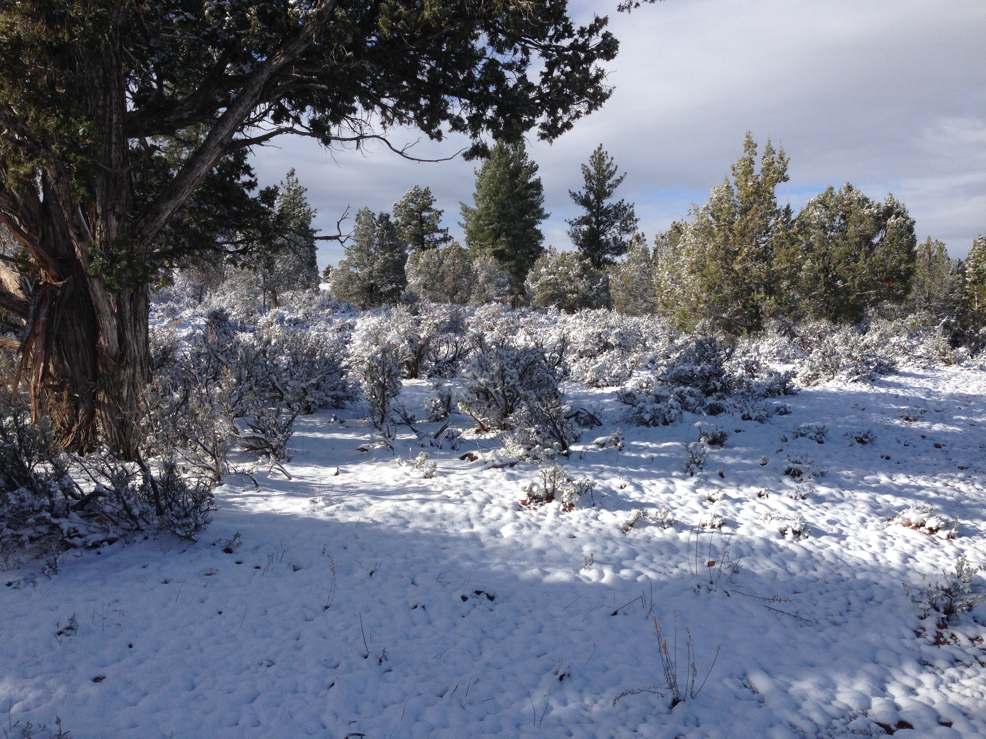
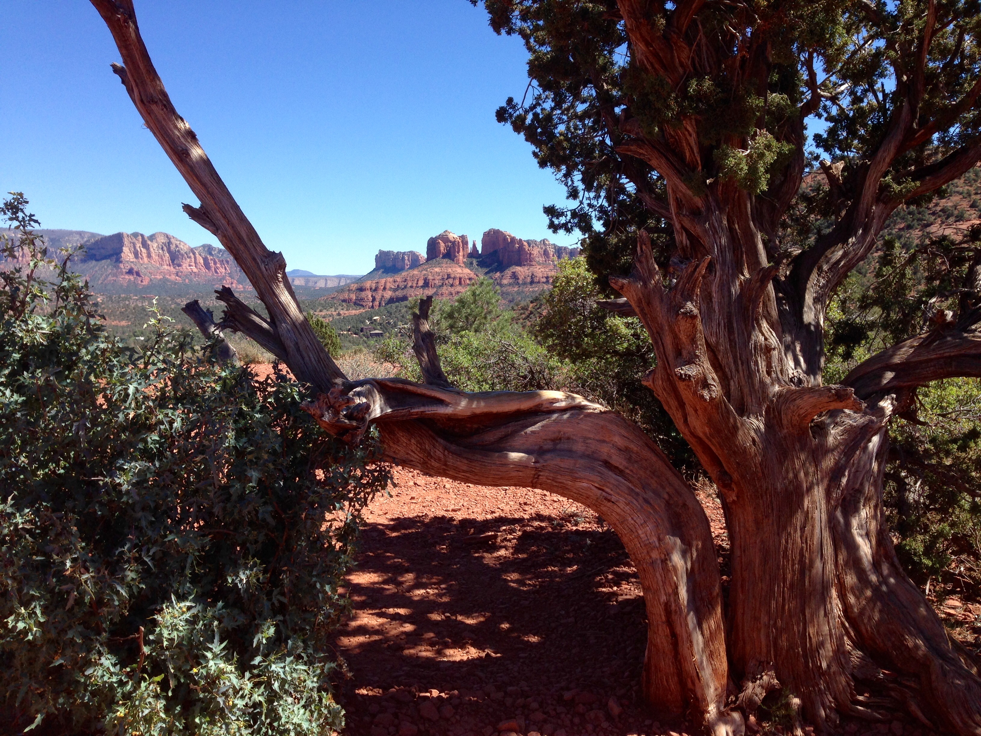
I’m going to start this post at the end, then go back to the beginning, back to the end, and then back to the beginning of this day trip. I know, I know, just work with me here.

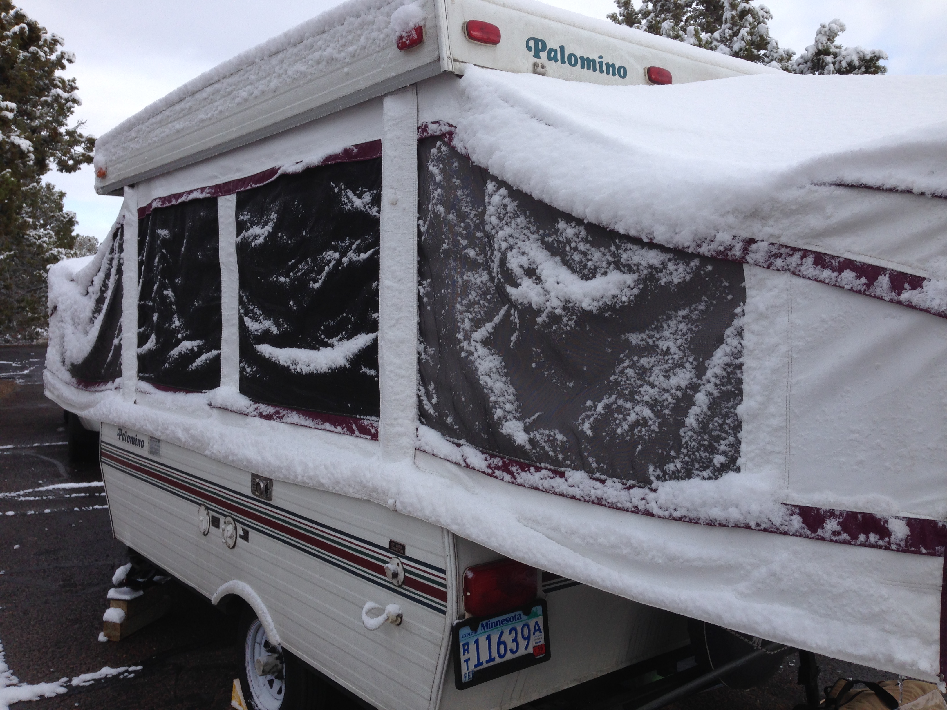
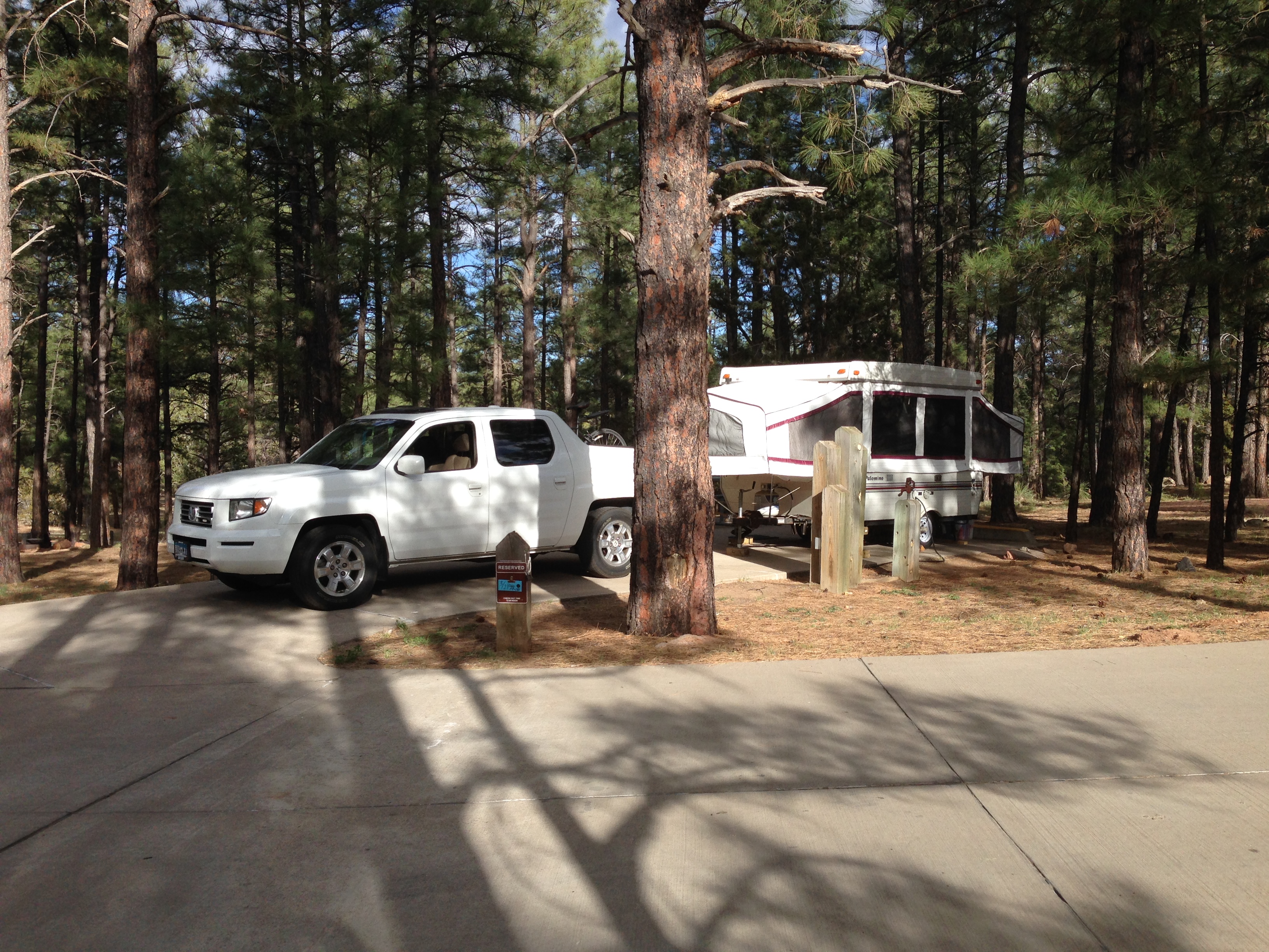
Tonight was the first night in a long time I had a chance to have a fire. Everywhere I’ve been for quite awhile there’s been open fire bans. I still have the very last of the wood I bought from Earl. Remember Earl?

This morning these words were in Jesus Calling for today.

Pause before responding to people or situations, giving My Spirit space to act through you.

Back to my stare down with the fire. Somehow these words seem to fit the day, but I was unable to identify exactly why that seemed so. Maybe it’s just because they fit so well with every day.

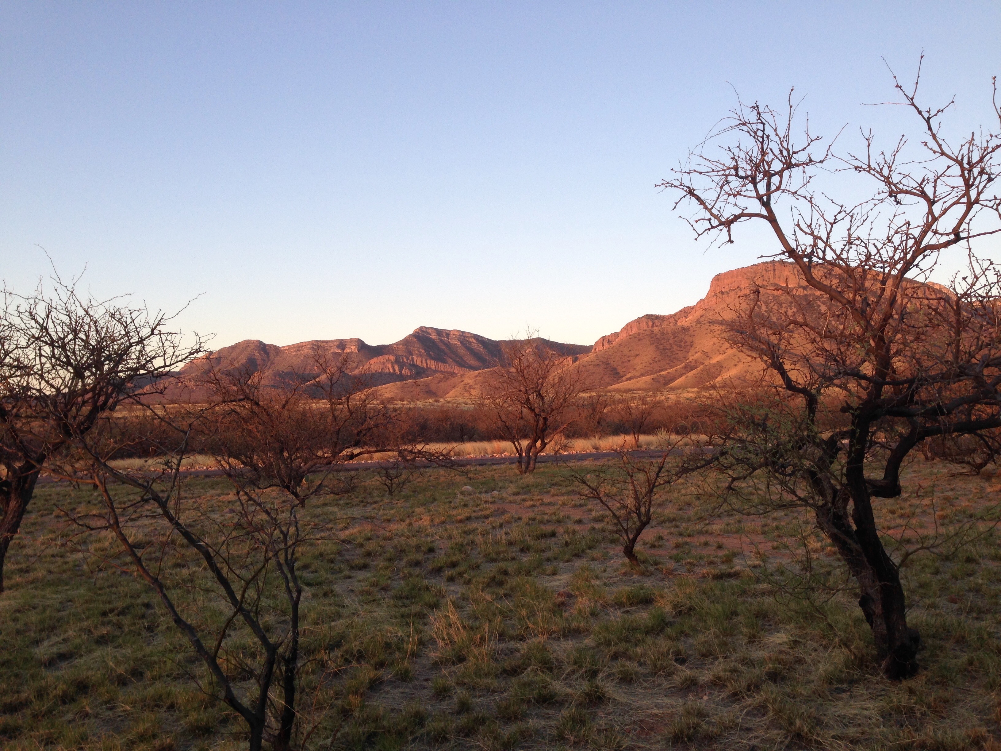
I thought a lot about Reservations as I know them. In my younger days I knew Native Americans from the Cass Lake and Red Lake Reservations. I thought about casinos and my own perceived good and bad about them. I feel conflicted. My conservative friends would role their eyes, but the part of me that craves social justice on all levels was rekindling guilt. Not just the guilt about the historical treatment of Native Americans, but even more aggravating, the guilt that I have these feelings just because it’s been right in front of me for a couple of days. The Scouts that worked for the army and tracked Geronimo, believing that things would be better when the war between the Apaches and the army ended, took the screwing of all time. Once Geronimo came in they were disarmed, detained, and shipped in the same trains that Geronimo and his people rode when banished to Oklahoma and Florida.

The army came to Ft. Apache to kill Indians but instead they came to the village of White River and found people waving white flags and welcoming them. It didn’t last.

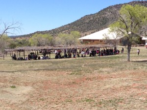
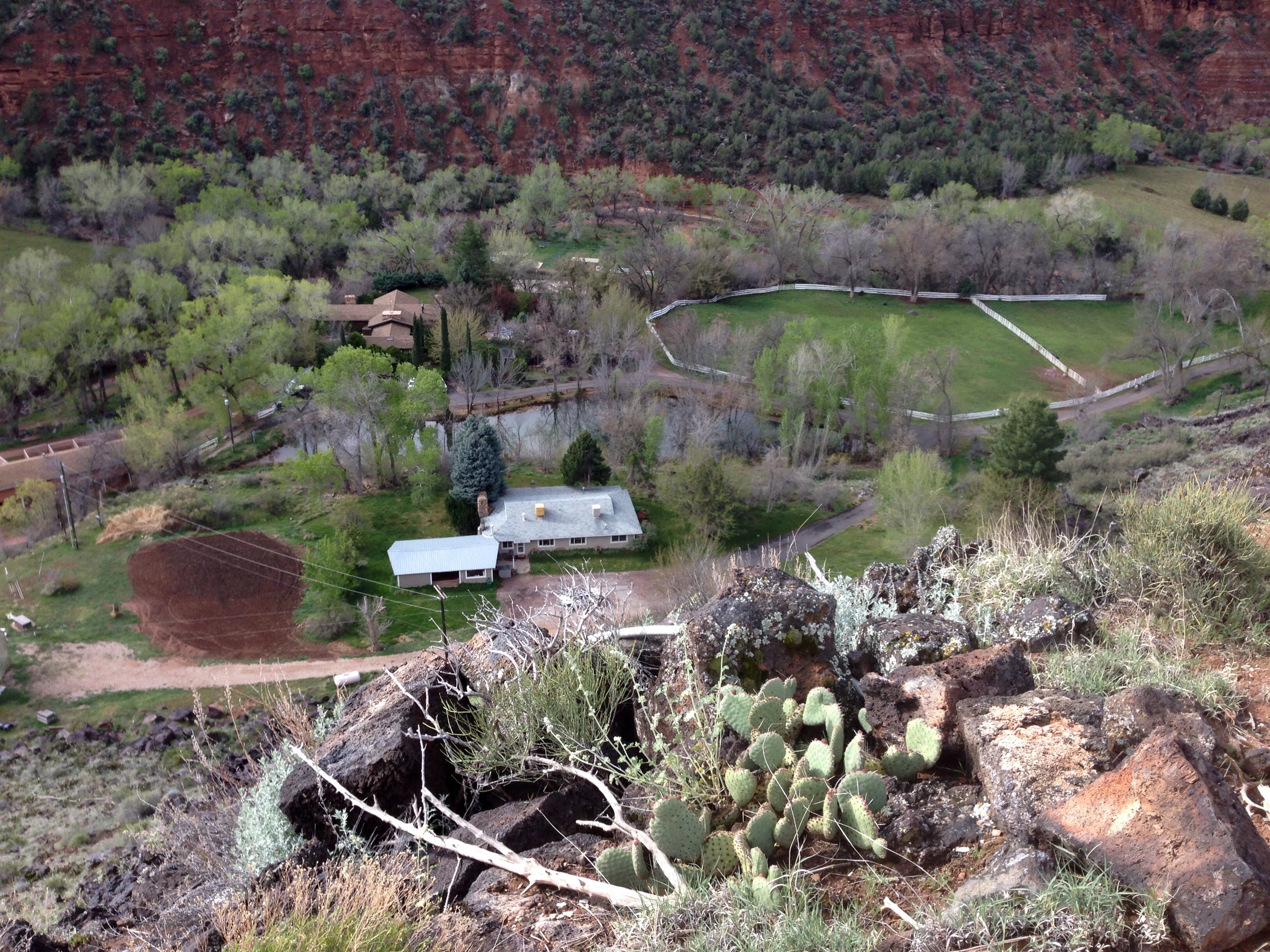
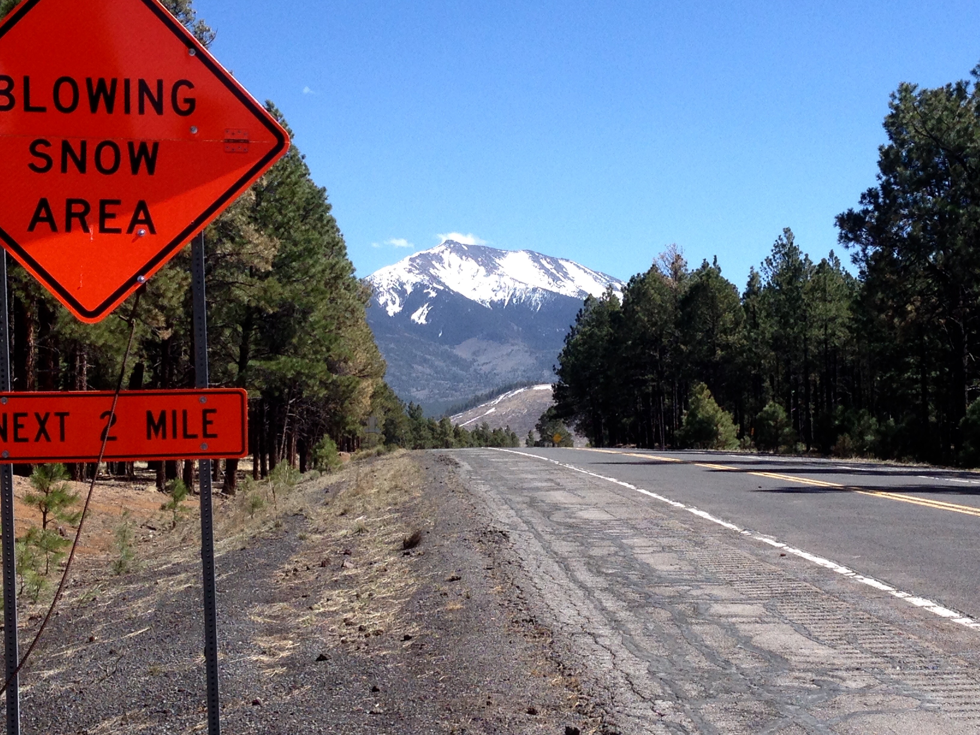
Today, White River is a sleepy little reservation town. It’s claim to fame is it’s proximity to Ft. Apache. As I was rolling through town I spotted a mass of cars parked down one of the side streets. The curious wanderer stopped to see what all the fuss was about. Turns out it was a neighborhood yard sale turned political rally. It’s election time for Tribal Council positions. There was a young man standing on a picnic table with a small PA unit and a mike. Couldn’t follow all of his references but the gist of what he was saying seemed to be Pride without Action is meaningless. Hmm, sounds vaguely like the faith without works challenge.

To be sure, there are homesteads that probably fulfill all of the stereotypes people have of the way some of today’s Native Americans live. But there is evidence of the good that comes from casino money.

housing

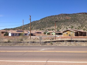
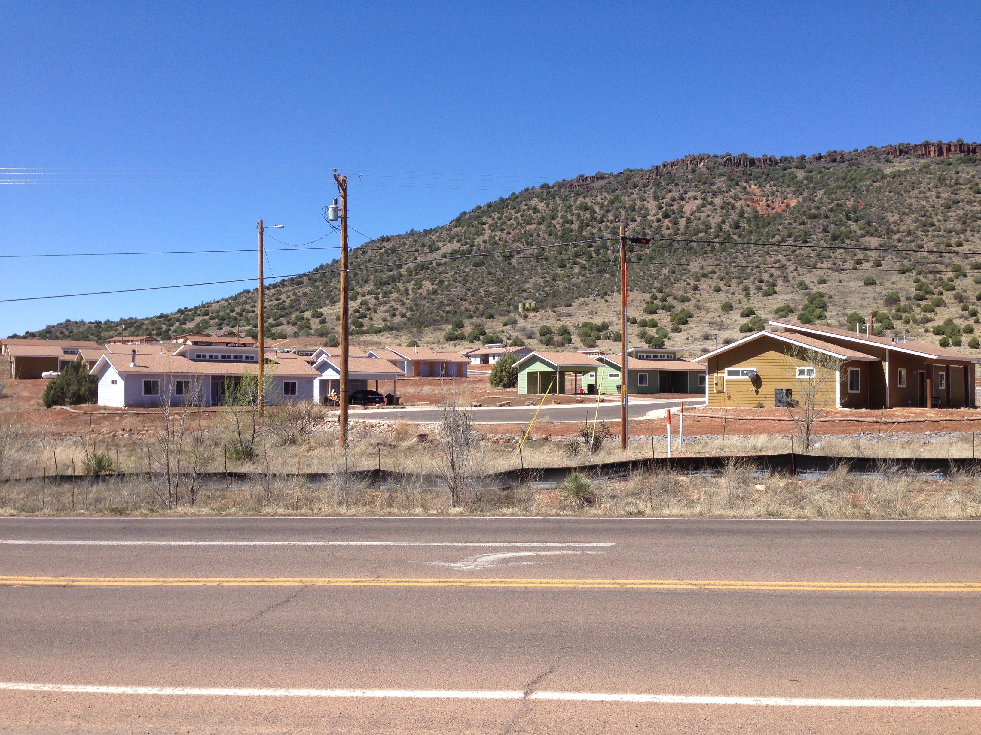
There are new, low-income homes that are administered by the White Mountain Apache Housing Authority. They have a modern medical facility and a new, fully equipped fire department. I’m convinced these things don’t happen on the rez without casino money.

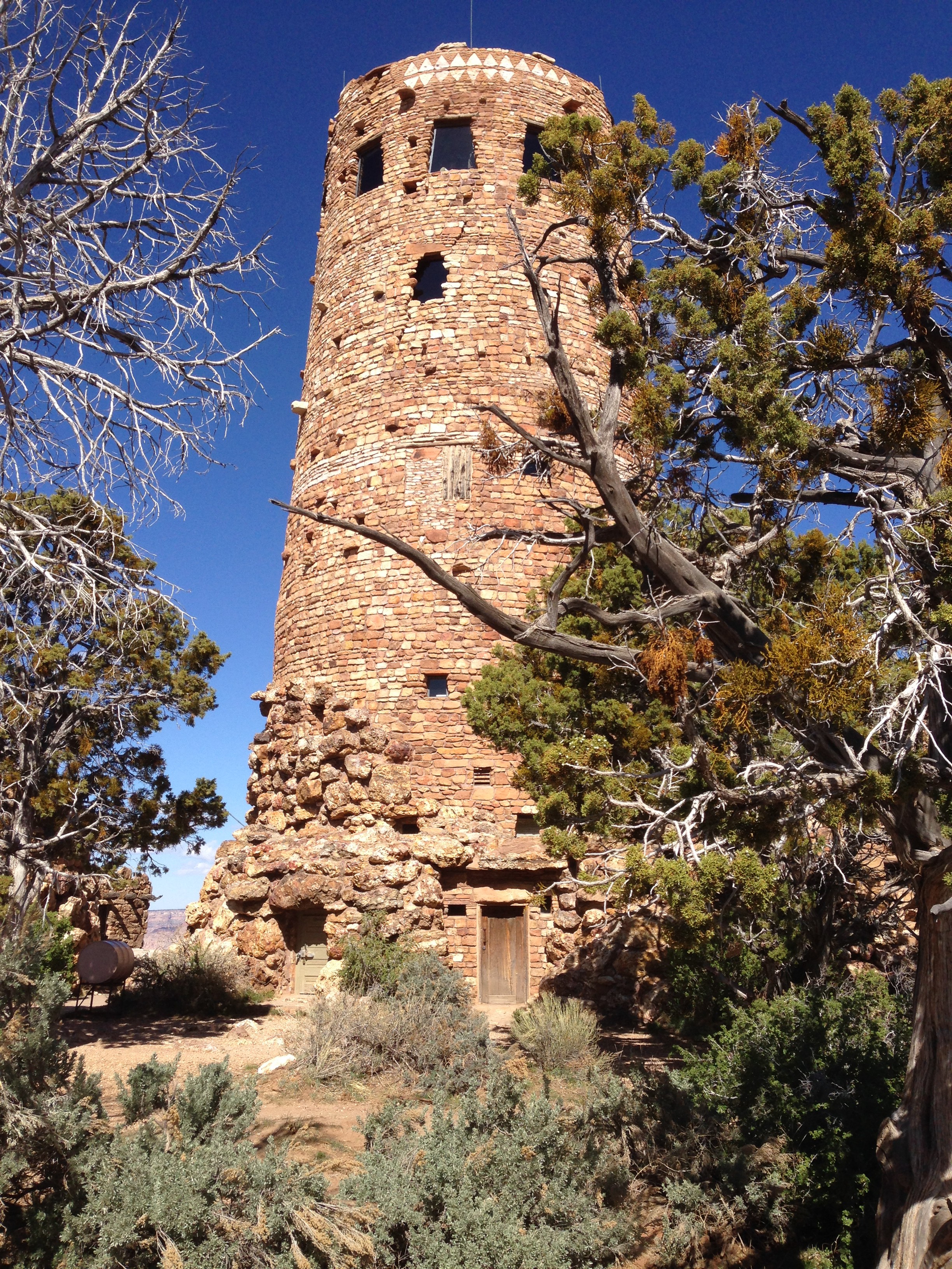
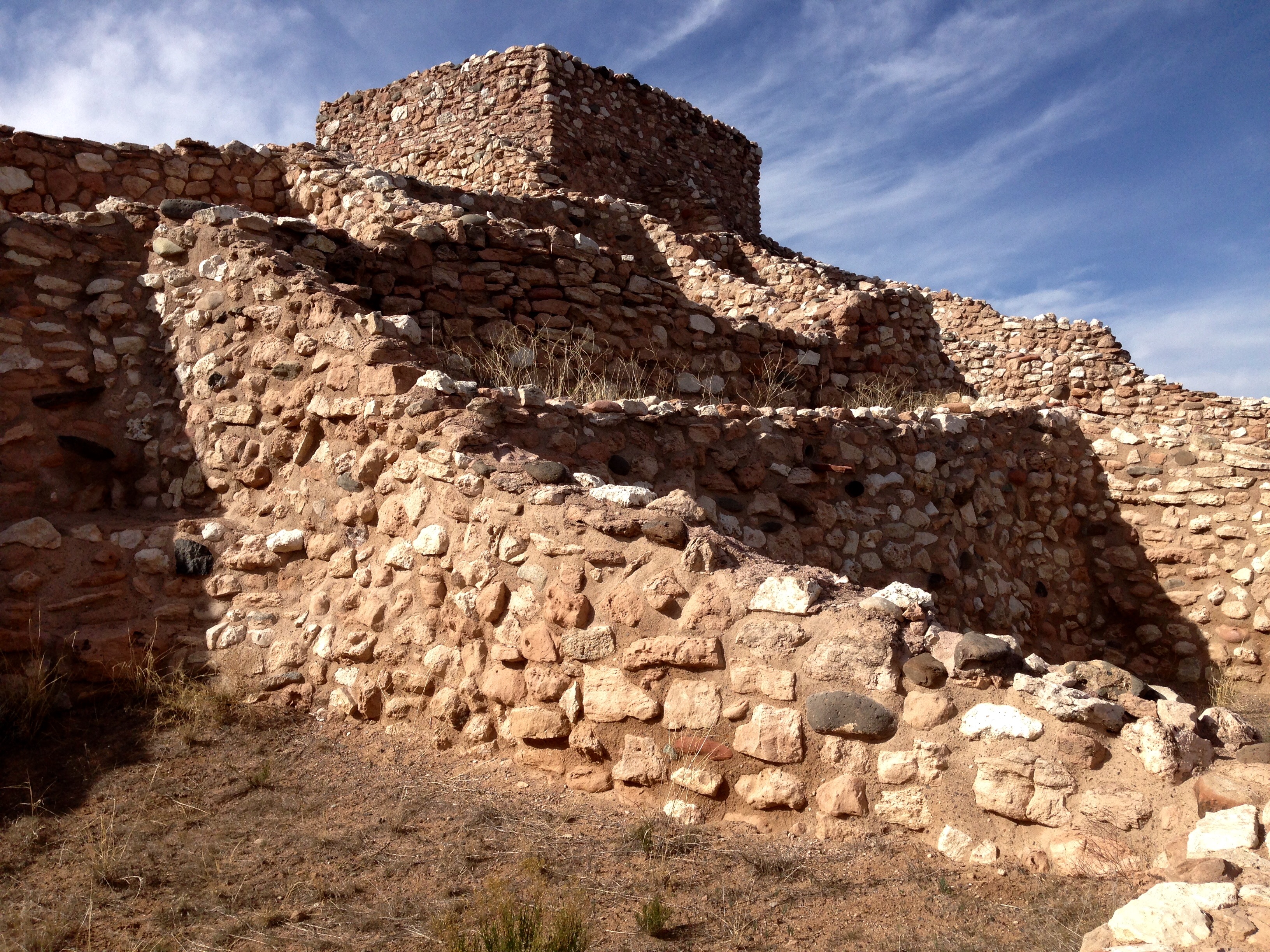
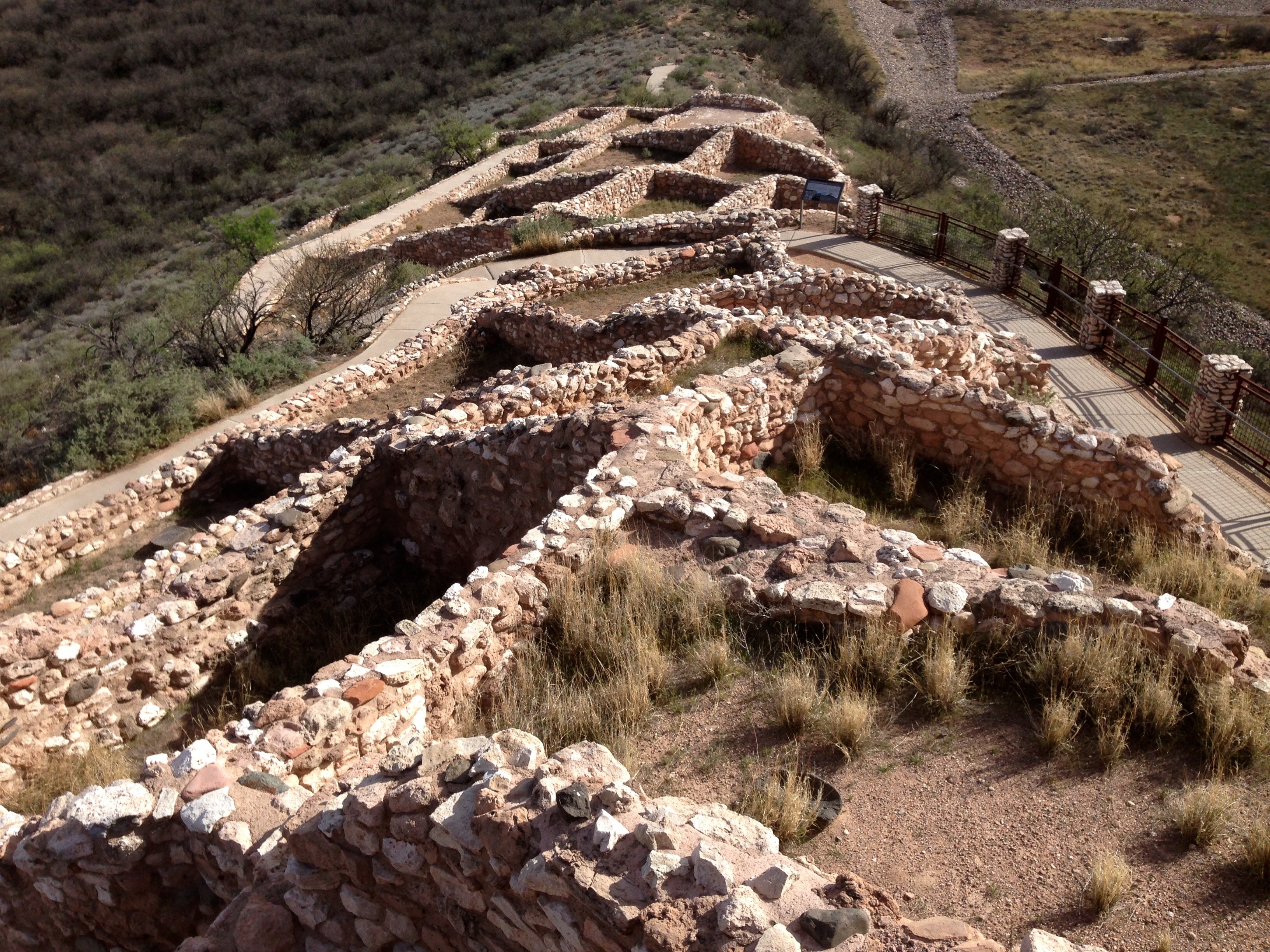
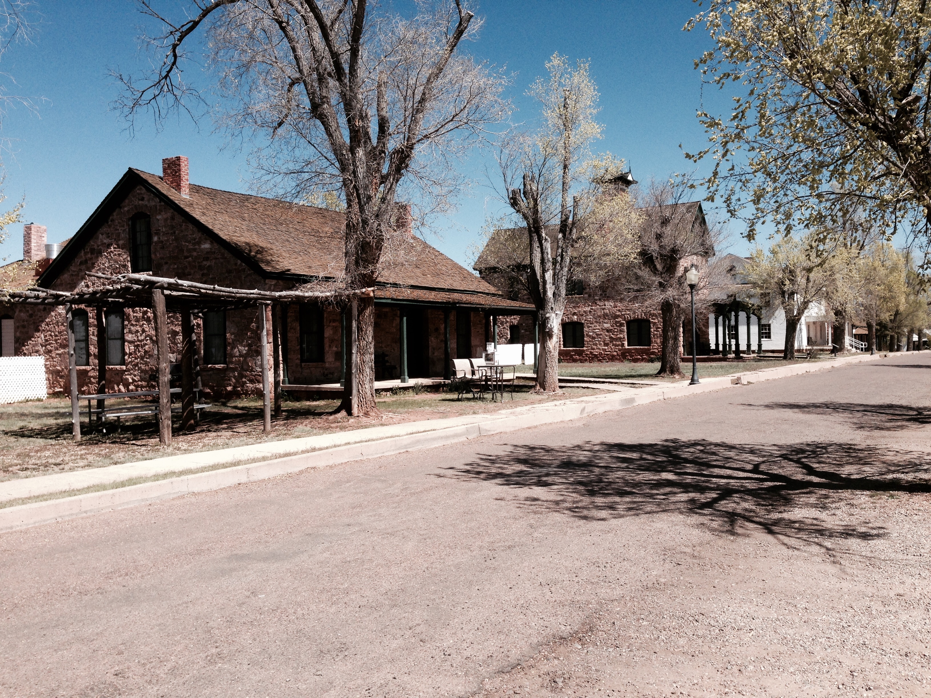
I’m not sure I would recommend Ft. Apache as a side trip to the casual traveler. But to anyone who likes history it’s a good diversion. However Rin Tin Tin is not here nor is there any evidence that there was ever a stockade at Fr. Apache. The army just moved into the area en masse and started establishing the buildings that army posts of that era had.

firstcommander

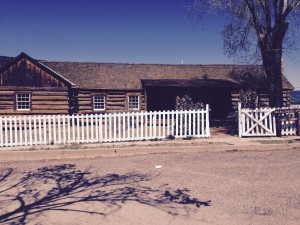
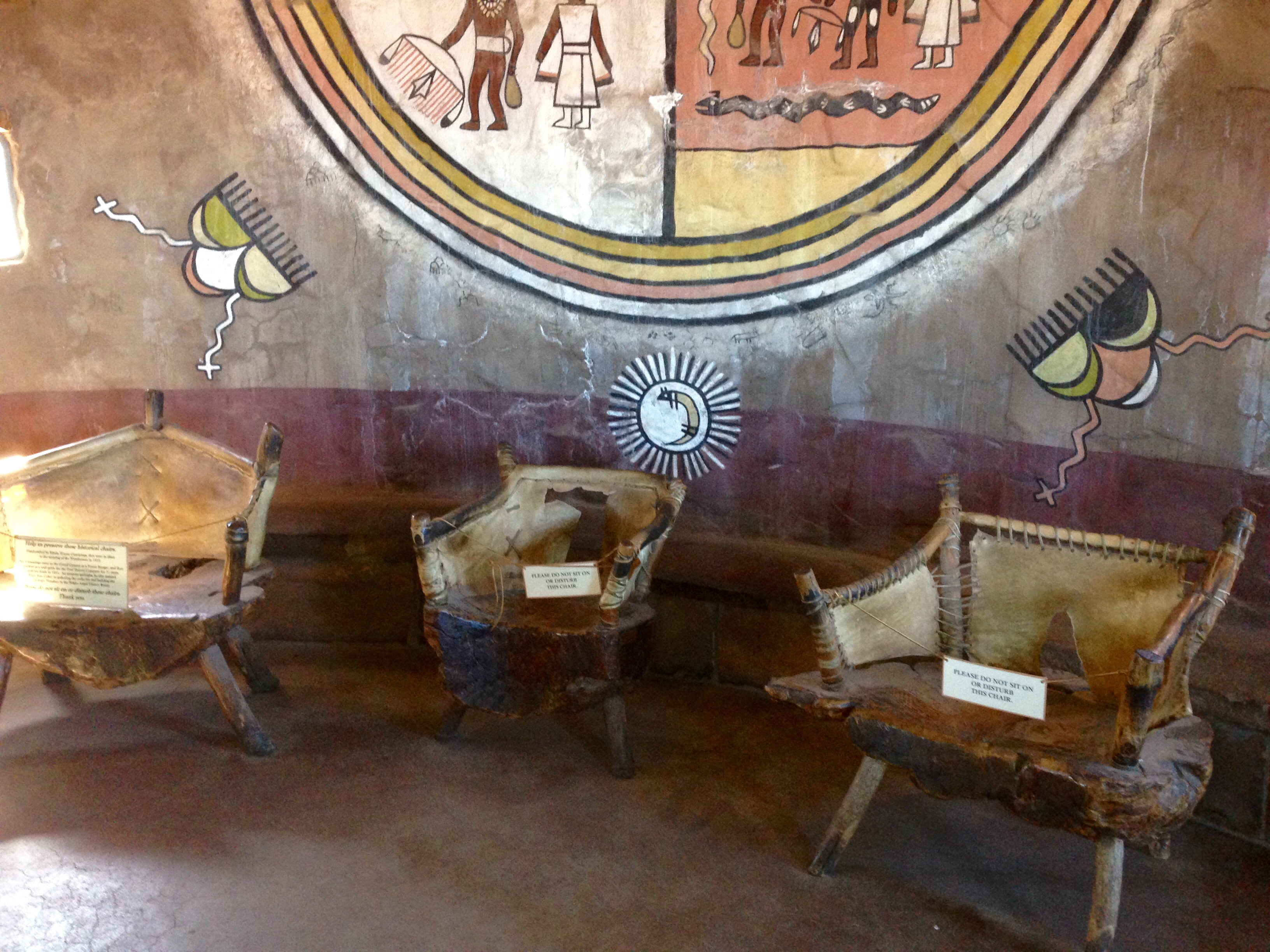
The original quarters of General Crook was one of the few wood structures to survive a fire that swept the north side of the fort in the 1880s. The fire was not the result of an attack but rather a faulty chimney fire swept by high winds. Ironically, the Tribal Cultural Center undertook to restore the building in the 1990s.

officers

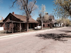
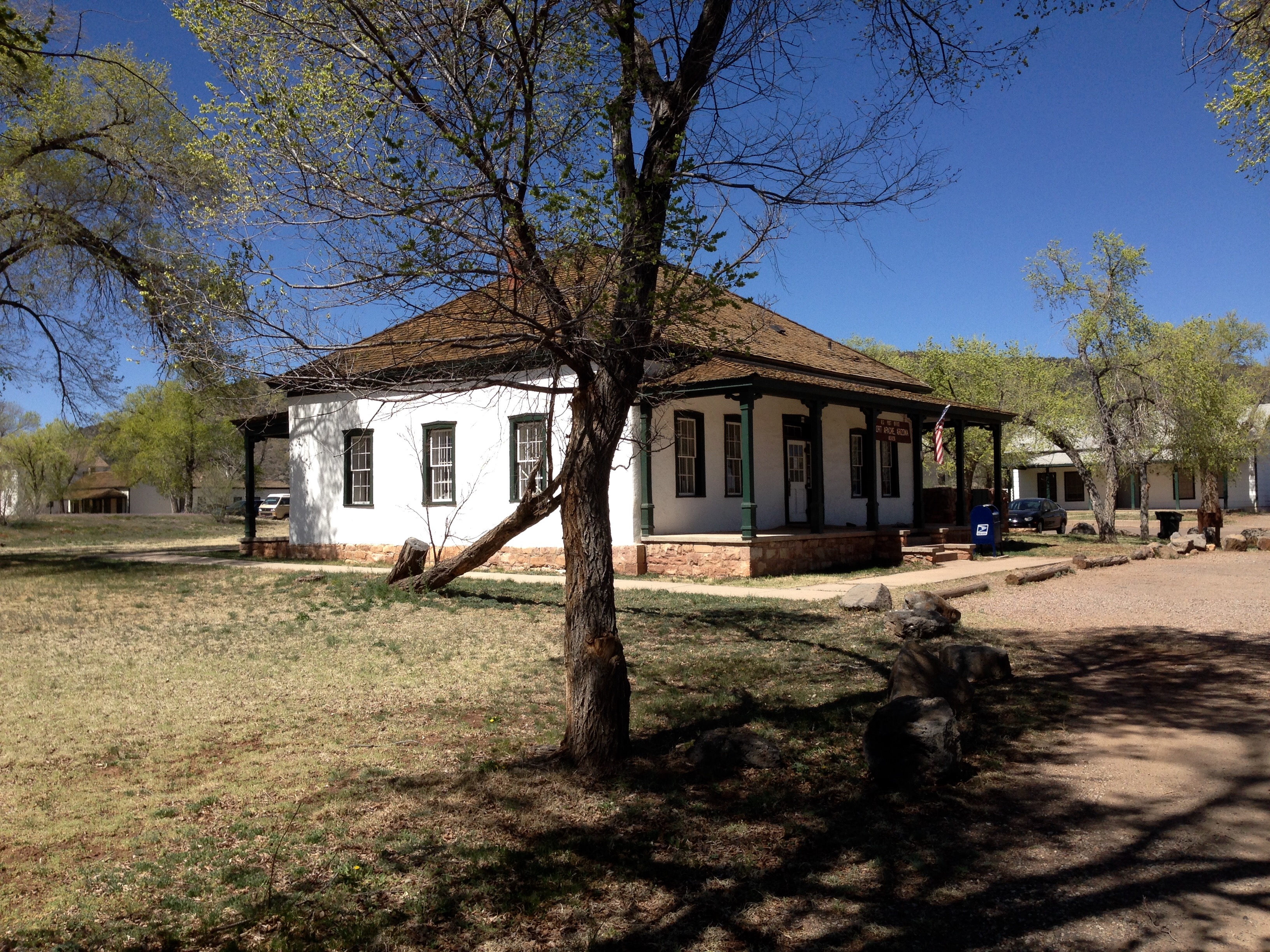
The replacement buildings were almost all built with limestone blocks or limestone and stucco. The fort grounds are administered by the local tribe and the original Adjutant’s Office is today a working Post Office.

po

school

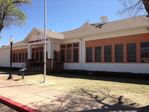
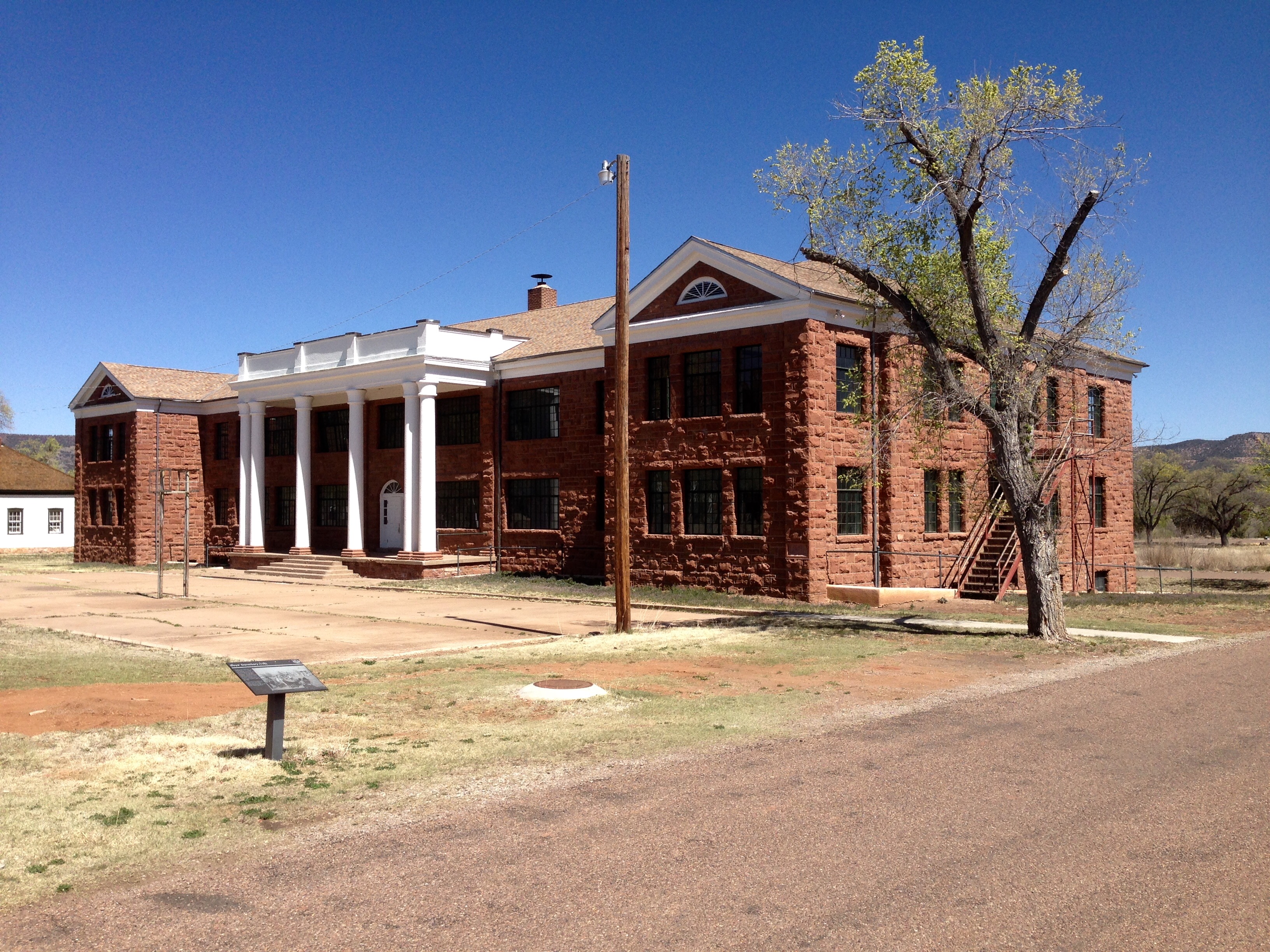
As the war with the Indians wound down and the army began to abandon the site, Teddy Roosevelt established a school for Indian Children. Many of the original children were Navajo, but eventually it became a mix of Navajo, Hopi, and Apache.

dorm

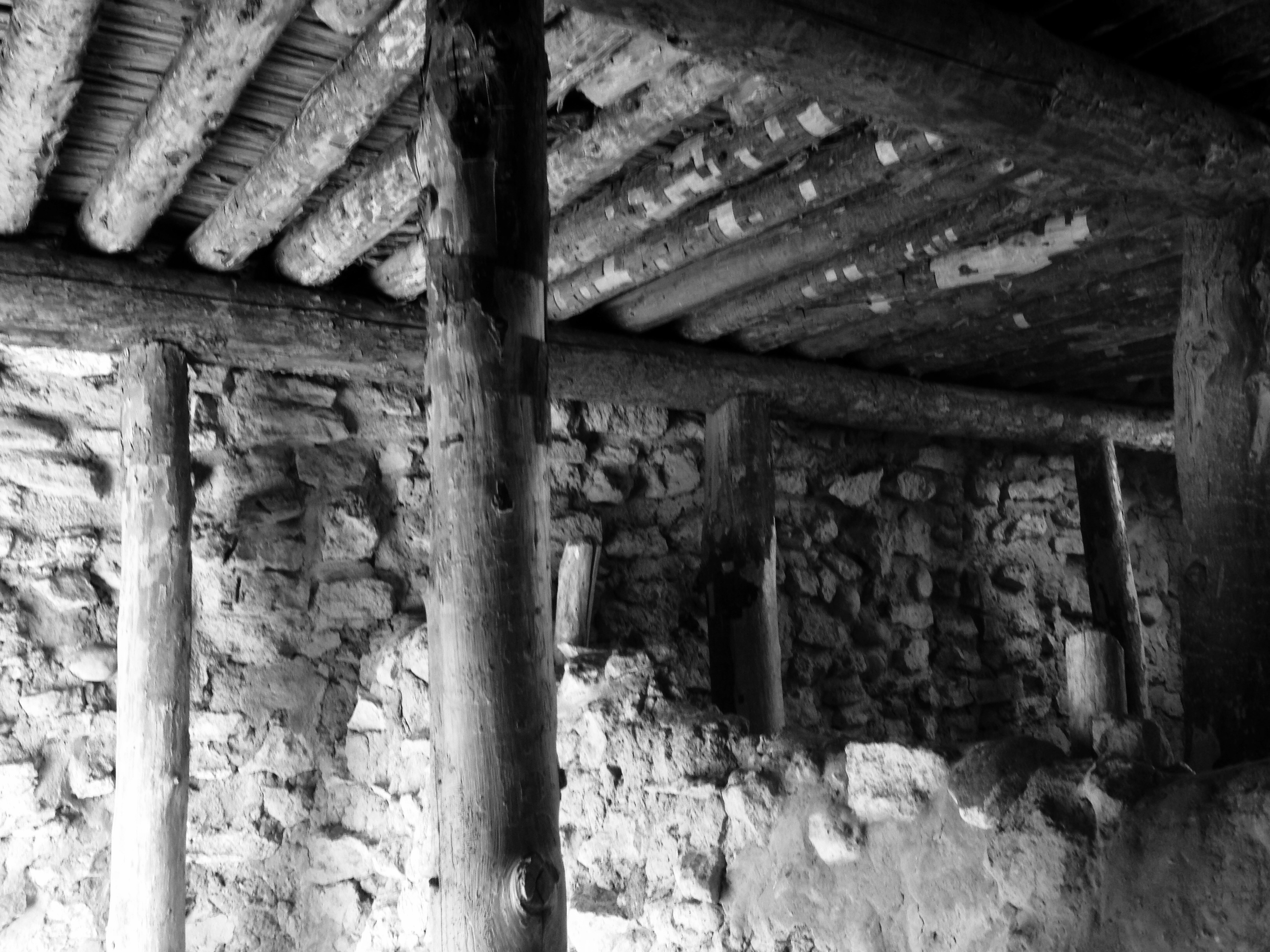
This boy’s dorm was built in the 1920s. A similar, but not identical, girls dorm is built at the opposite end of the parade grounds. As far away as possible from the boys. 🙂

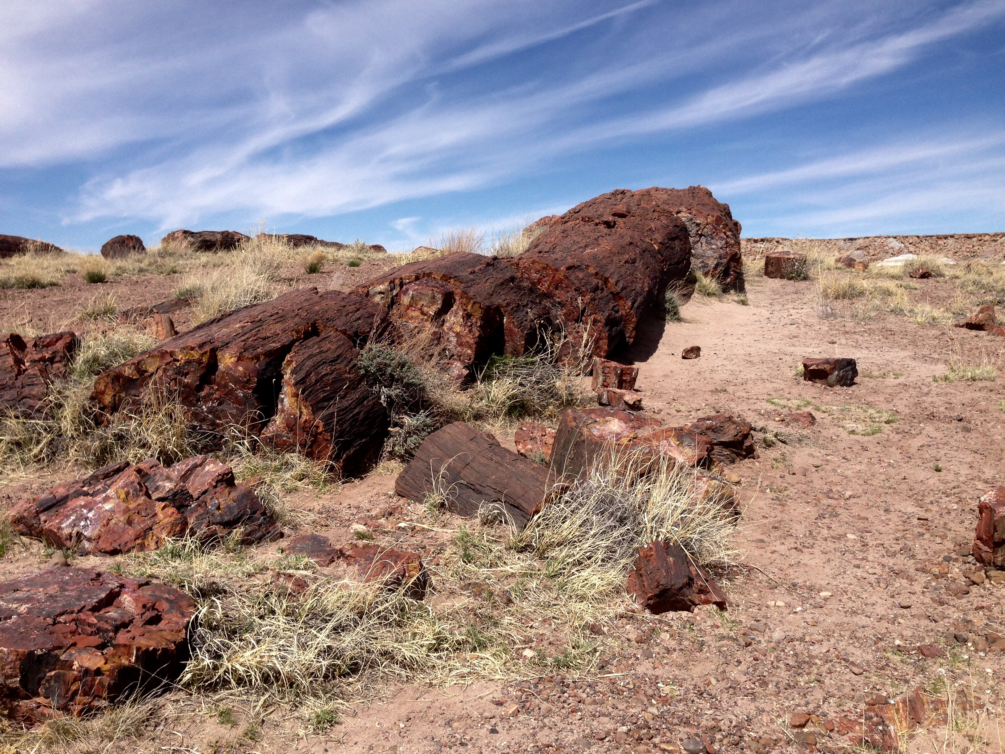
There were two sites I searched for off the Fort Grounds, the cemetery and an old mill site. I found the cemetery with some difficulty. This cemetery was originally used for soldiers and their family members as well as scouts and their families. After the army abandoned the fort the remains of non Indians were moved to the National Cemetery in Sante Fe, NM. The grave sites of the Indians were undisturbed and some remarked.

marker

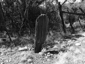
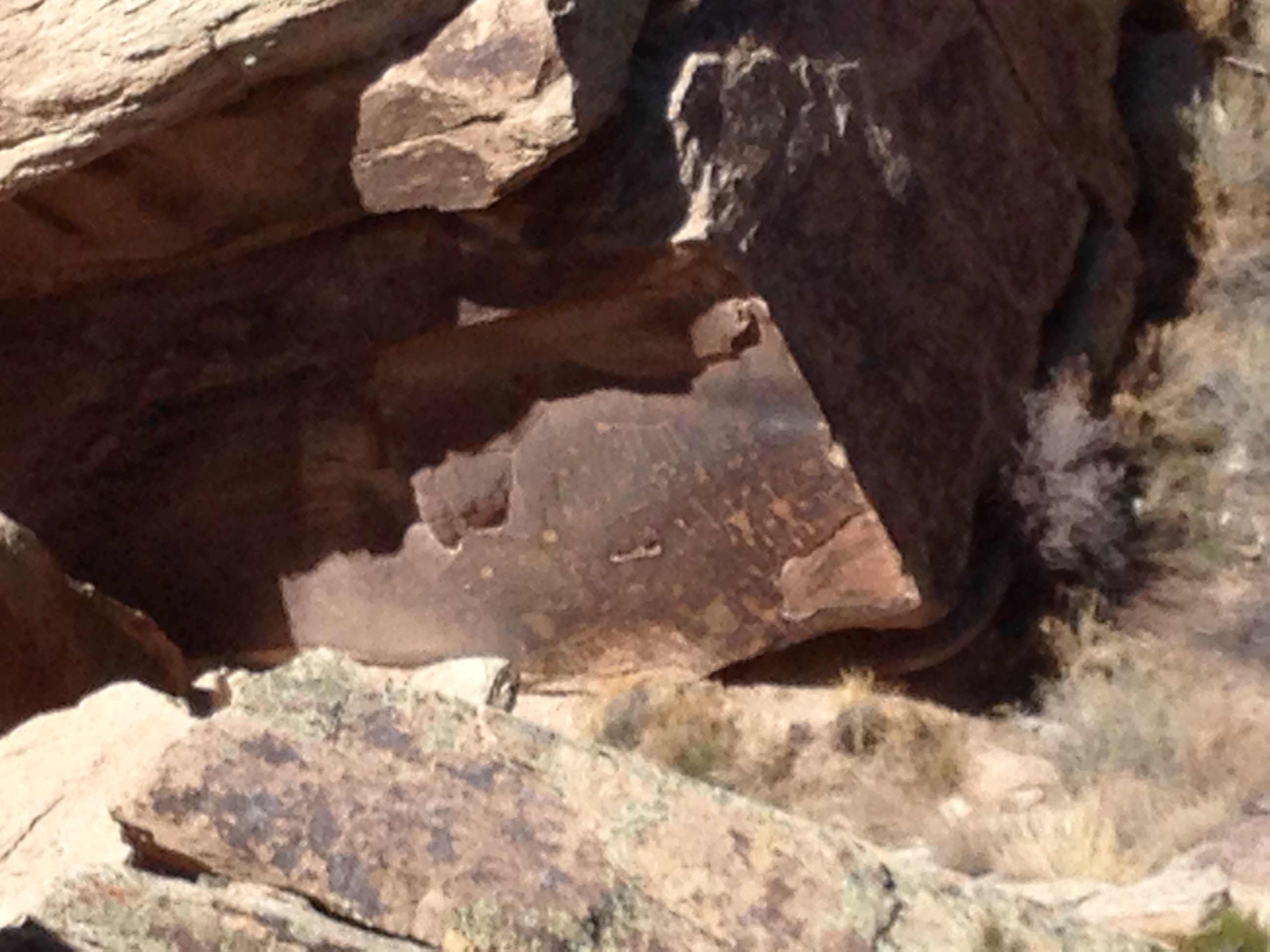
This is a photo of what appeared to be the oldest marker in the cemetery. There were no discernable markings on either side. It is the only photo I took. I felt my presence there was disturbance enough of the grounds.  Many of the markers say simply Indian Child, Unknown, or Scout.  One simply said, Teacher.

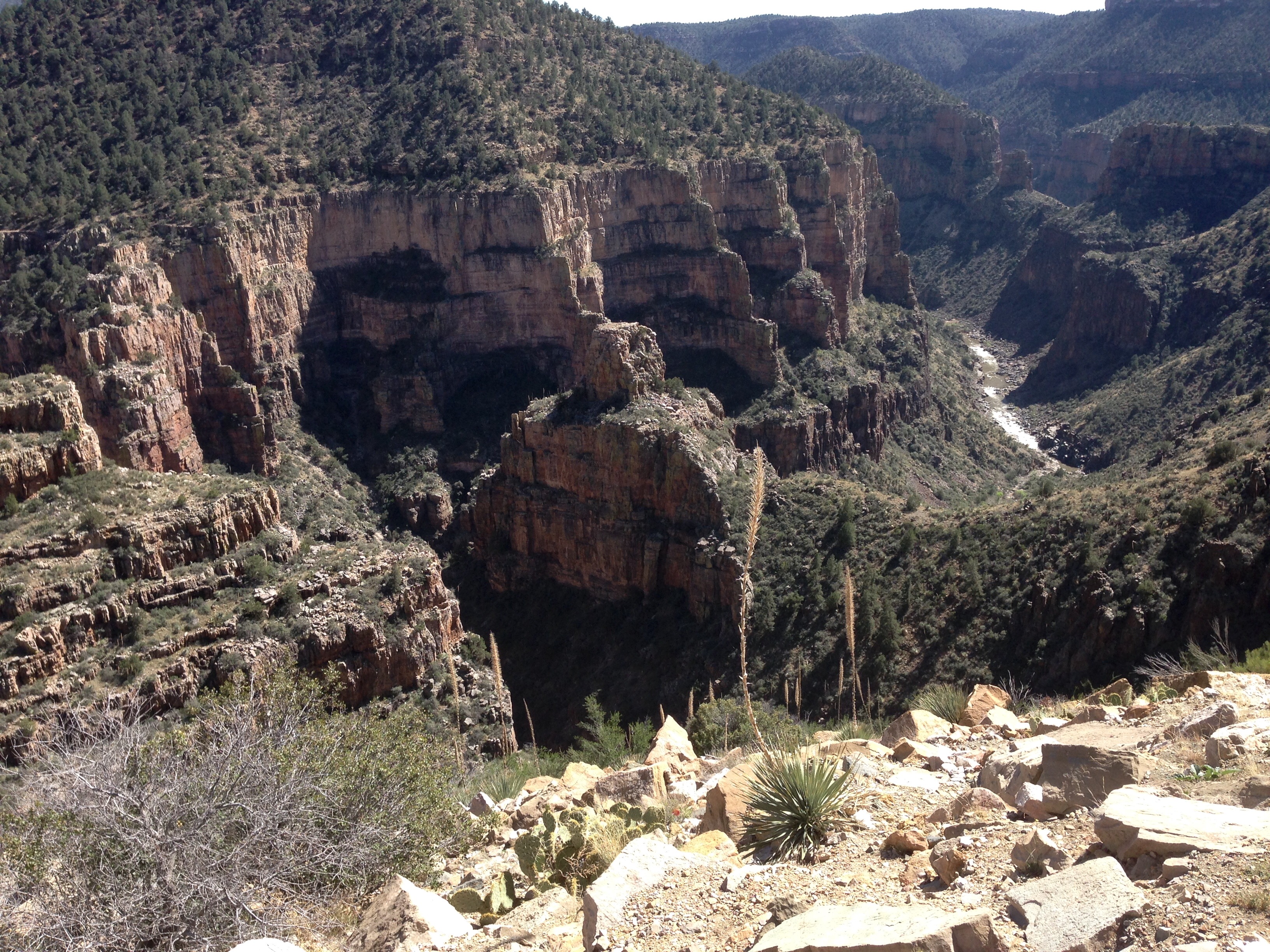
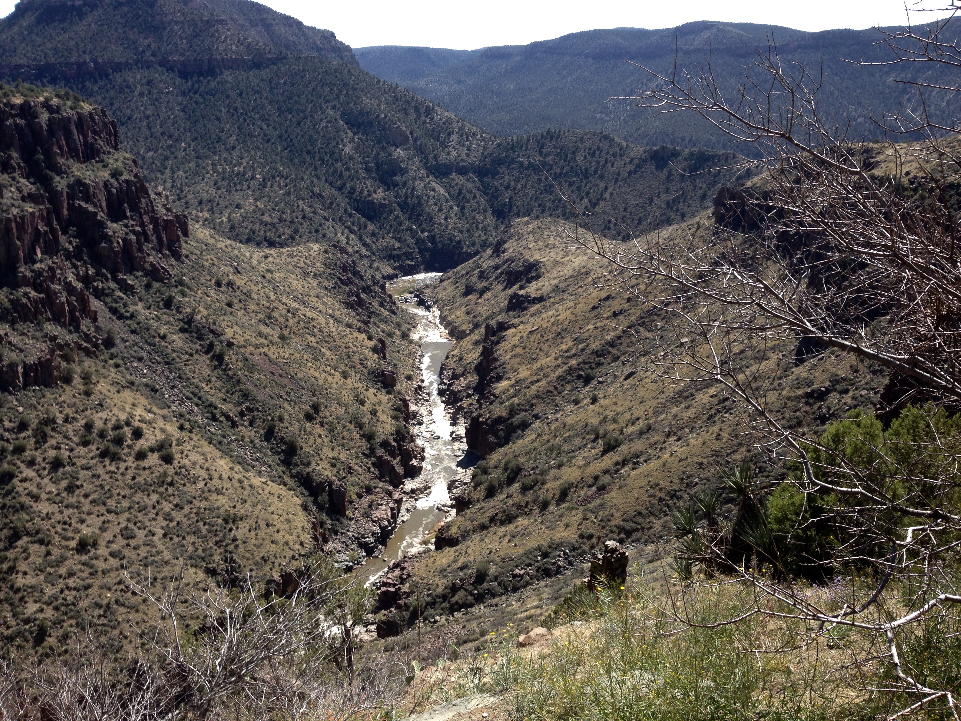
The old mill site I never found. I remembered from a map of the grounds outside the museum that it was near a ceremonial site, so I didn’t want to wander into a place where my presence might be disrespectful.

barracks

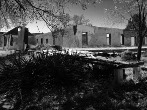
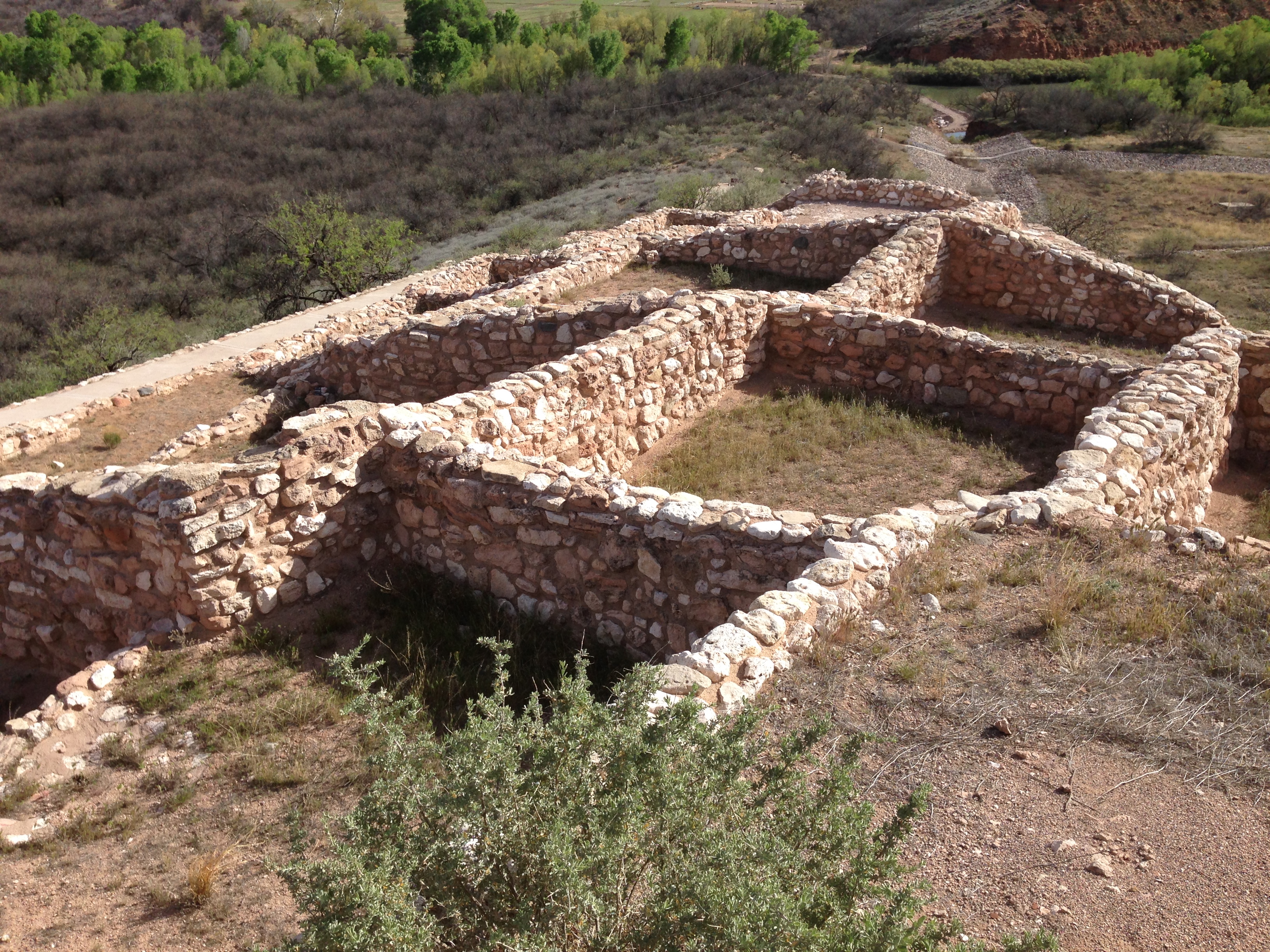
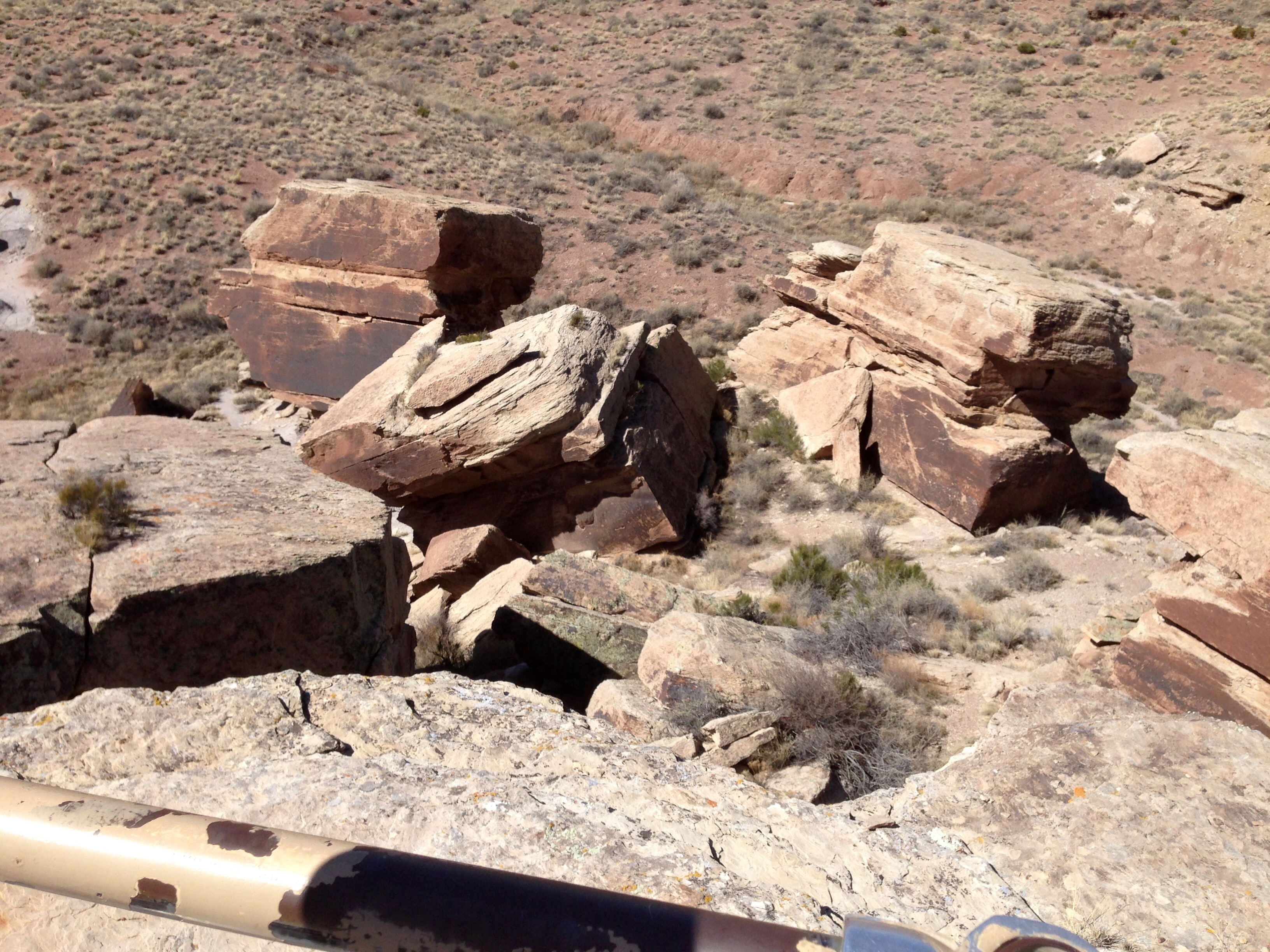
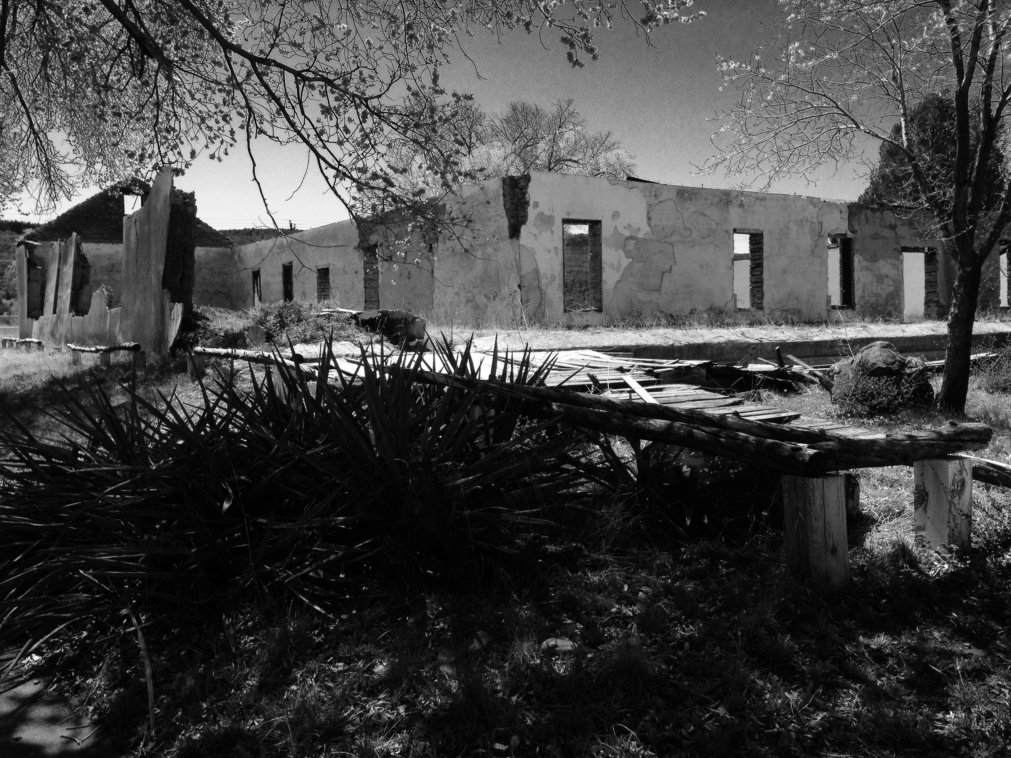
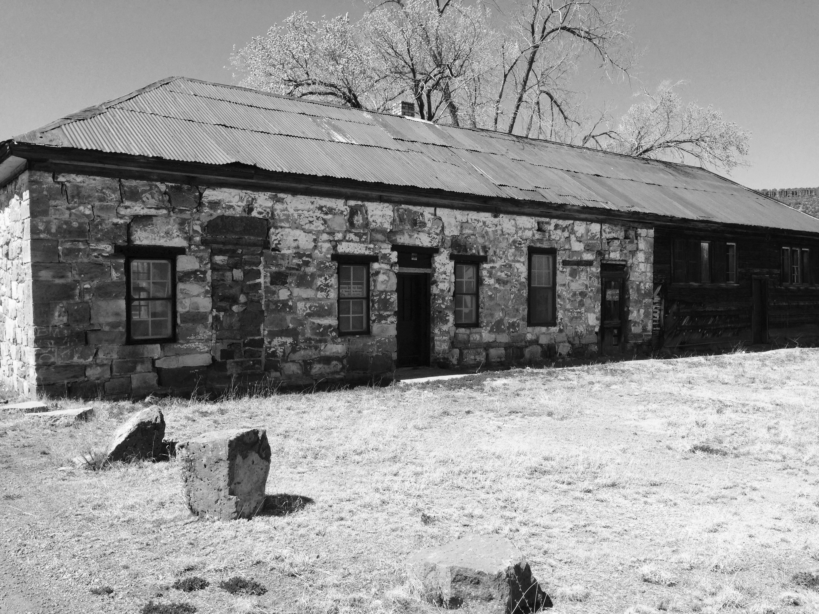
This is the disheveled remains of the only identifiable location of the enlisted men’s quarters. Isn’t that just like the army; the officer’s row was rebuilt and preserved while the enlisted quarters slowly go back to mother earth.

guardhouse

The old guard house. This was a long post I know.  I struggled with this one, as evidenced that it was Saturday and I’m finally posting it on Tuesday.  A lot of what I wrote for a couple of days I never used.  But this is what survived.

Incidentally, I was the only white person I saw here all day.  You can’t tell from the photos but when I first got here there were about two hundred little Indian kids running around having an Easter Egg Hunt.  No one seemed to mind my presence.  The kids were a treat and the best place I can think of to end this post.

gathering


Friday, March 18th, Day Two of Week 9


salt2
Today I crossed first the San Carlos Apache Reservation and then the White Mountain Apache Reservation. They are separated by the Salt River and the spectacular Salt River Canyon was the highlight of the trip.

salt

It’s amazing to think about these canyons being formed over thousands of years. I stopped so many times just to take it all in. The alternative being trying to see and drive at the same time. 🙂 I love being in the mountains. These are the Sierra Ancha Range.

salty

I fell in love with the mountains when I lived in Colorado and traveled Colorado, Wyoming, and northern New Mexico. If you’ll allow me just a moment of pure schmaltz, the desire to explore and the feeling of belonging I get in the mountains makes me think I was born about 150 years too late. My favorites are the Big Horns and the Tetons, both in Wyoming.

At the end of the day I landed at the Fool Hollow Lake Recreation Area in Show Low, AZ. Show Low is a mountain town and it reminds me of a slightly larger version of Jackson, Wyoming. It’s the kind of place where you wouldn’t be shocked to spot an Elk right near town. Unlike Jackson, it lacks an old town center, but it just seemed to sprawl out from the intersection of three highways. The newer parts of Show Low are highly gentrified.

foolhollowcamp

The campground is basically right in town. You drive through a neighborhood to find the entrance and then it just opens into a huge park area. It’s very nice here and in the mountains, so, ‘nuff said. It will be nippy at night.

foolhollowlake

Tomorrow will be a trip down to Historic Fort Apache and then Sunday will be church and a day trip up to the Petrified Forest.

I am well and hope you all are too.

Kartchner Caverns State Park, Benson, AZ

Having left the friendly confines of Casa Weldon, I toured south and east to Tubac, Nogales, Patagonia, and Tombstone. All of which inspired nothing more than a good nap. It started with me waiting in Tubac for about fifty minutes so I could get a few cigars from The Grumpy Gringo Cigar Store when he opened at 10. Of course that turned out to be the morning he wandered into work about 10:30. His Grumpiness wasn’t even apologetic. I doubt I’ll be going back.

karchcampsite

So let me say right up front that there won’t be any more cave pictures. But that’s mostly because Kartchner Caverns takes a rather strict approach to cave preservation, as opposed to Carlsbad for example. You literally can only enter the caves with the clothes you are wearing. No cameras, purses, backpacks, cell phones, or anything.

karch2

As you enter the caverns you are “misted” to reduce lint and skin cells from sloughing off your body. The only parts of your body allowed to touch anything are your feet on the walkway which is washed down to collection points every night. At Kartchner they are fond of telling you that at Carlsbad Caverns, every year, they have a lint picking project that involves teams of people with black lights and tweezers picking hairs and lint off the rocks along the walkway. They collect about 50 lbs. of lint. The preservation of the delicate cave environments and the minimization of human impact is serious business. The unique formations that you see in caves and the time they take to form are pretty much the same.  The history of the discovery and preservation of the Kartchner caves is really quite moving but is way to long and involved for me to write about.  So, you guessed it, google it if you’re interested.

Karchmorn

I have to say the best part of Kartchner Campgrounds was meeting up with my fellow retired Applied Power Products vet Phil and his wife Nancy. They in turn introduced me to some new friends, Mark and Kay, who hail originally from Wisconsin and now live full time “on the road”.

Not surprising, the two couples met at a campground, in southern Texas, and have kept in touch and travel together. Meeting Phil and Nancy was no accident. Phil and I talked about our winter plans in general last summer and have kept in touch. Phil was watching my whereabouts on my blog and when he knew I was getting close emailed me their location plans. It was fun reconnecting, and the five of us shared a traditional St. Patty’s Day meal of corn beef, cabbage, and taters. It was my second one of the week ‘cause I shared the same meal with Ro and Tim before I left. Both were wonderful meals shared with friends. What could be better.