Canyonlands National Park is naturally divided into three sections by the Green and Colorado Rivers that both enter the park from the north and come to a confluence in the middle. Until that point they are calmly flowing rivers. Once joined, the Colorado becomes a lively little number careening down a canyon in a section called The Cataracts. Upon my almost certain return to Moab I hope to one day do one of the raft trips through there.
The three sections of the park are The Needles, The Maze, and The Island in the Sky. The Island area can be explored by entering the park road from the north, which I did Sunday, and The Needles area is entered from the east on a park road. The two routes do not meet in the park. The Maze is the most remote area of the park being accessible only by foot or the Green River. There are two, high-clearence, 4×4 only, dirt tracks that enter The Maze from the west.
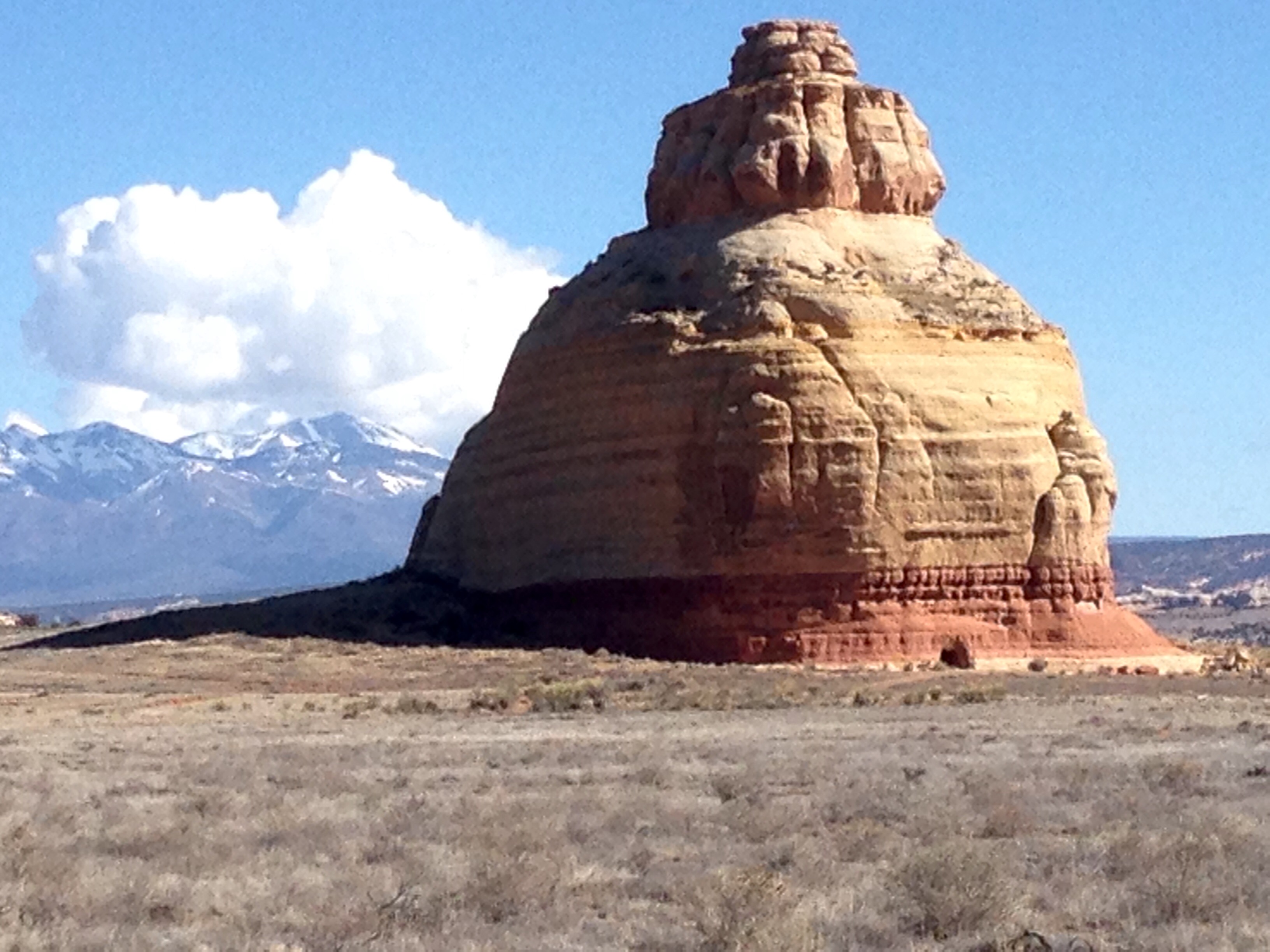
Right by the turn onto the road that goes into the Needles is Church Rock. This formation is actually on private ranch land so, although there’s a dirt road going out to that intrigueing “entrance” at the base, one can’t drive to it.
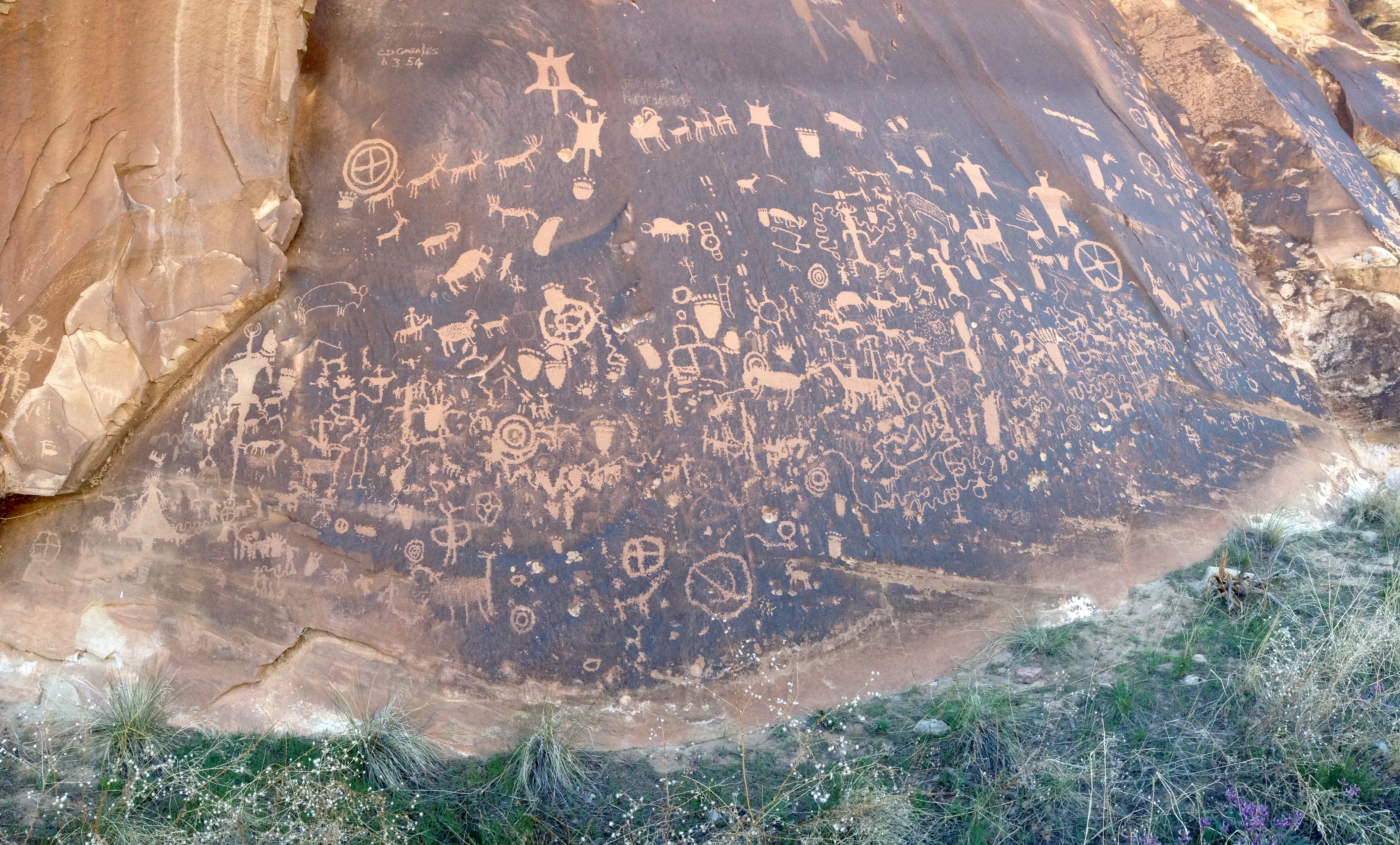
On the road in, before the park boundary, is another “Newspaper Rock”. This one, unlike the one in the Painted Desert Park, can be viewed from just a few yards away. This is a “pan” picture so it looks deceptively like I’m back from it a ways. I was in awe, and so appreciative, of being able to walk right up to it. With the exception of a few modern day air heads who just had to deface this historical treasure, the youngest petroglyph is from about 1300. Some analysts of this rock think the stories left here may span as many as 2000 years.
The hiking in all of these places is so incredible. Deciding which ones to take is the hard part. I had several picked out that I thought would be about four and a half to five hours of so. That’s total. 🙂
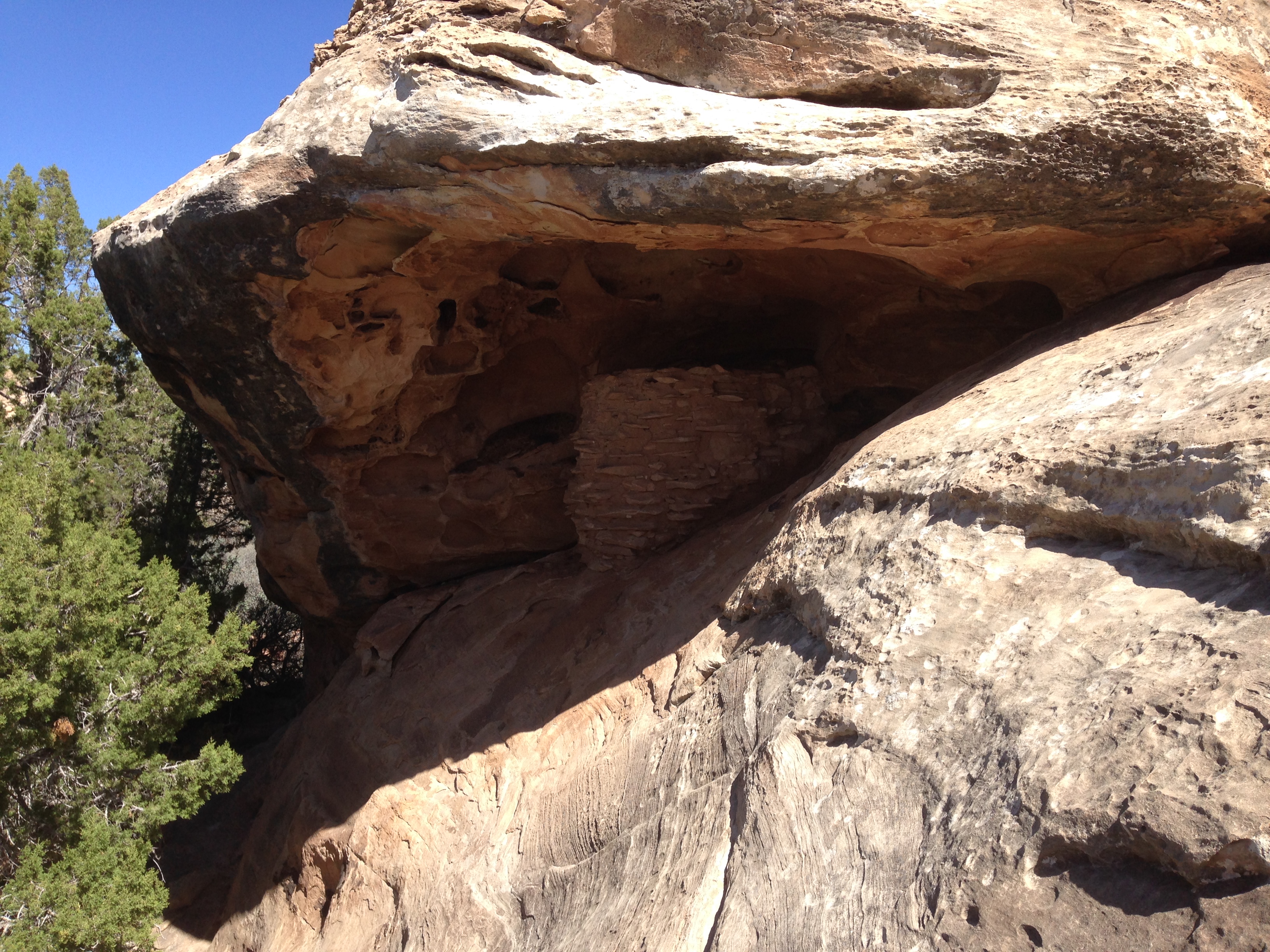
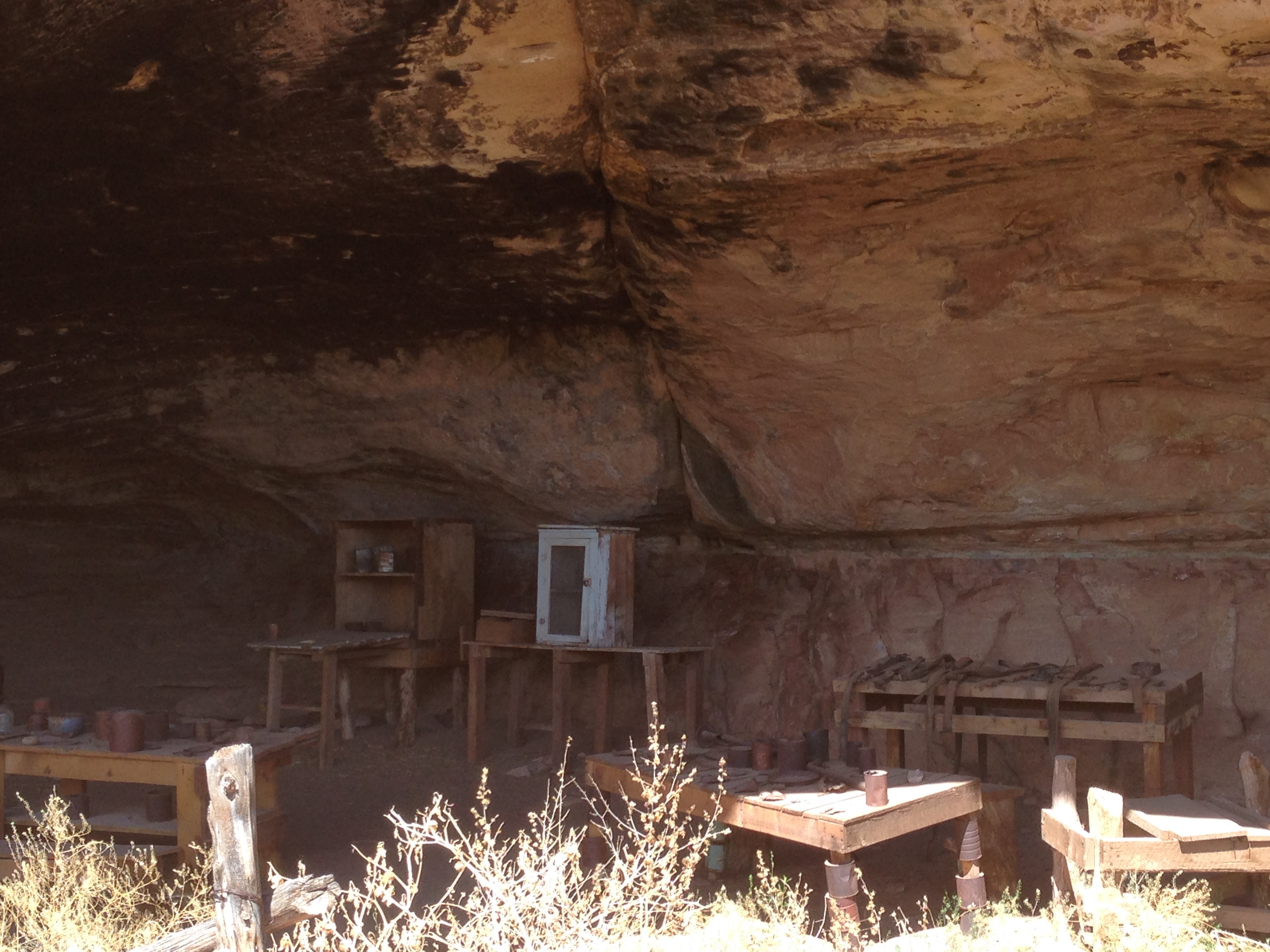
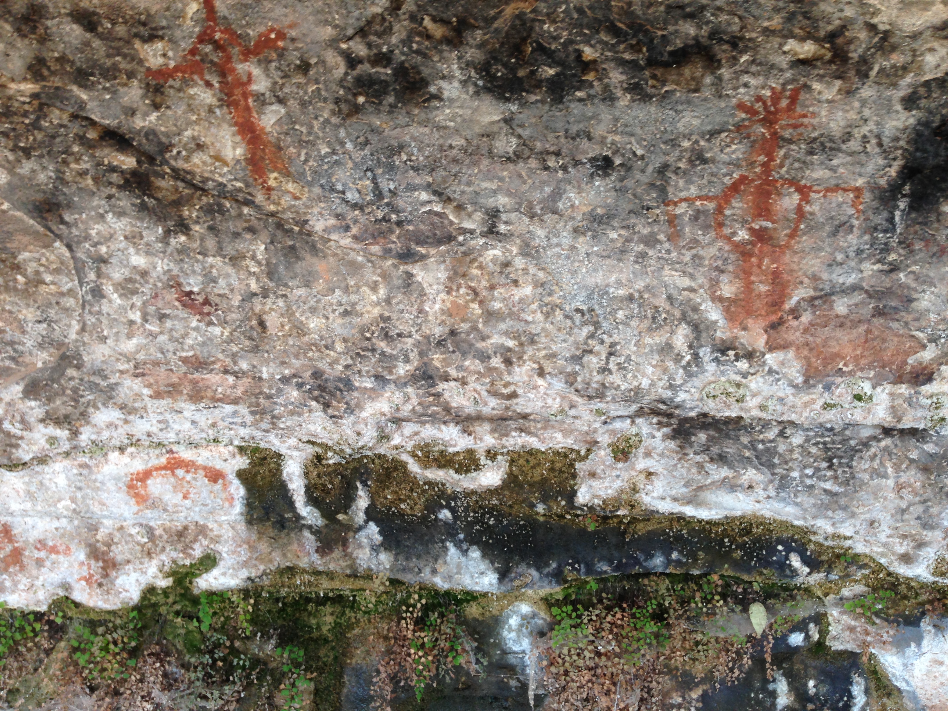
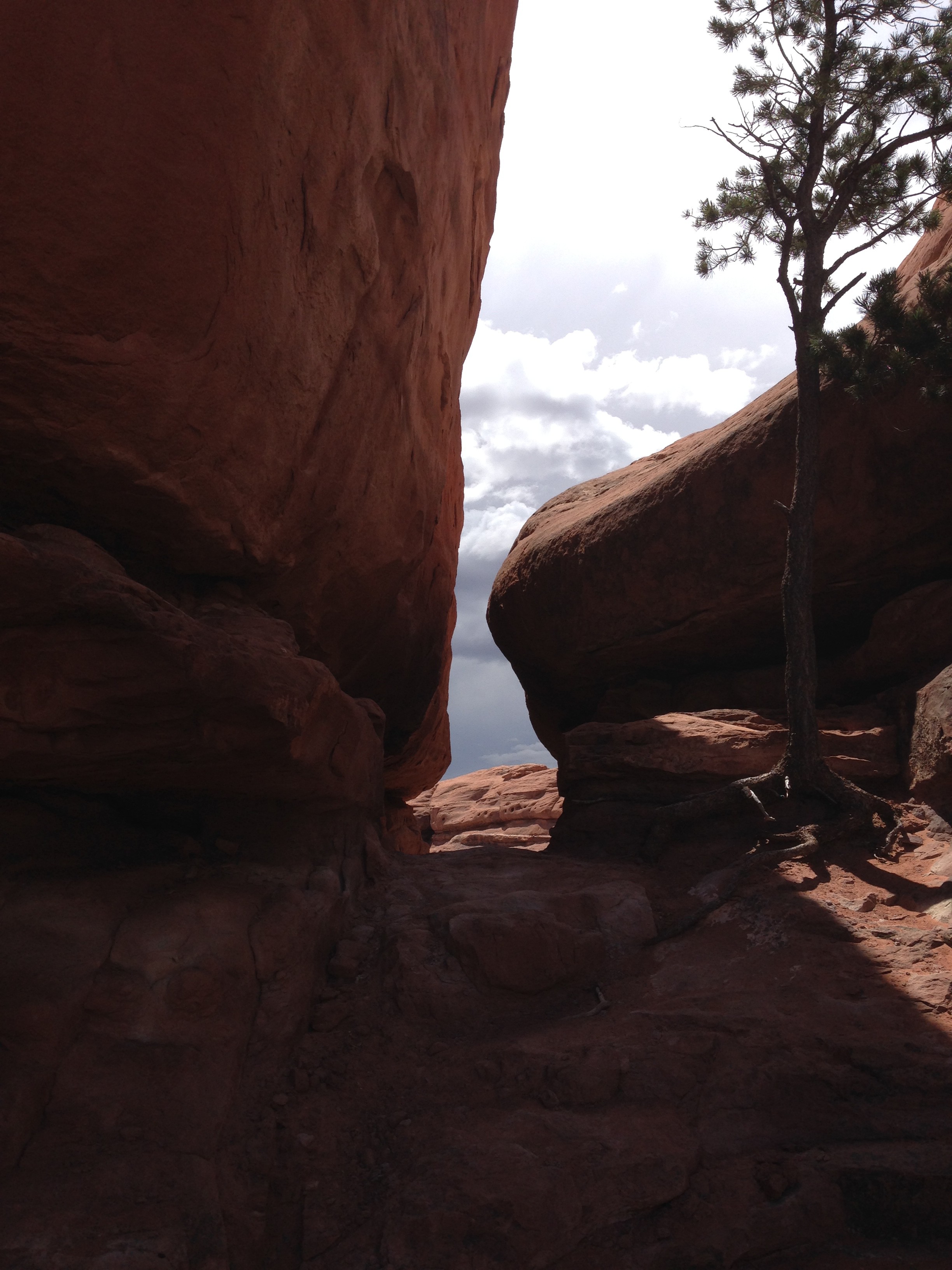
The Cave Spring Trail has preserved sites from two distinctly different eras of inhabitants. These are from an old cowboy camp. It’s easy to see why people used this area extensively as “home”. It has a spring and numerous shallow caves and overhangs to provide shelter from the weather.
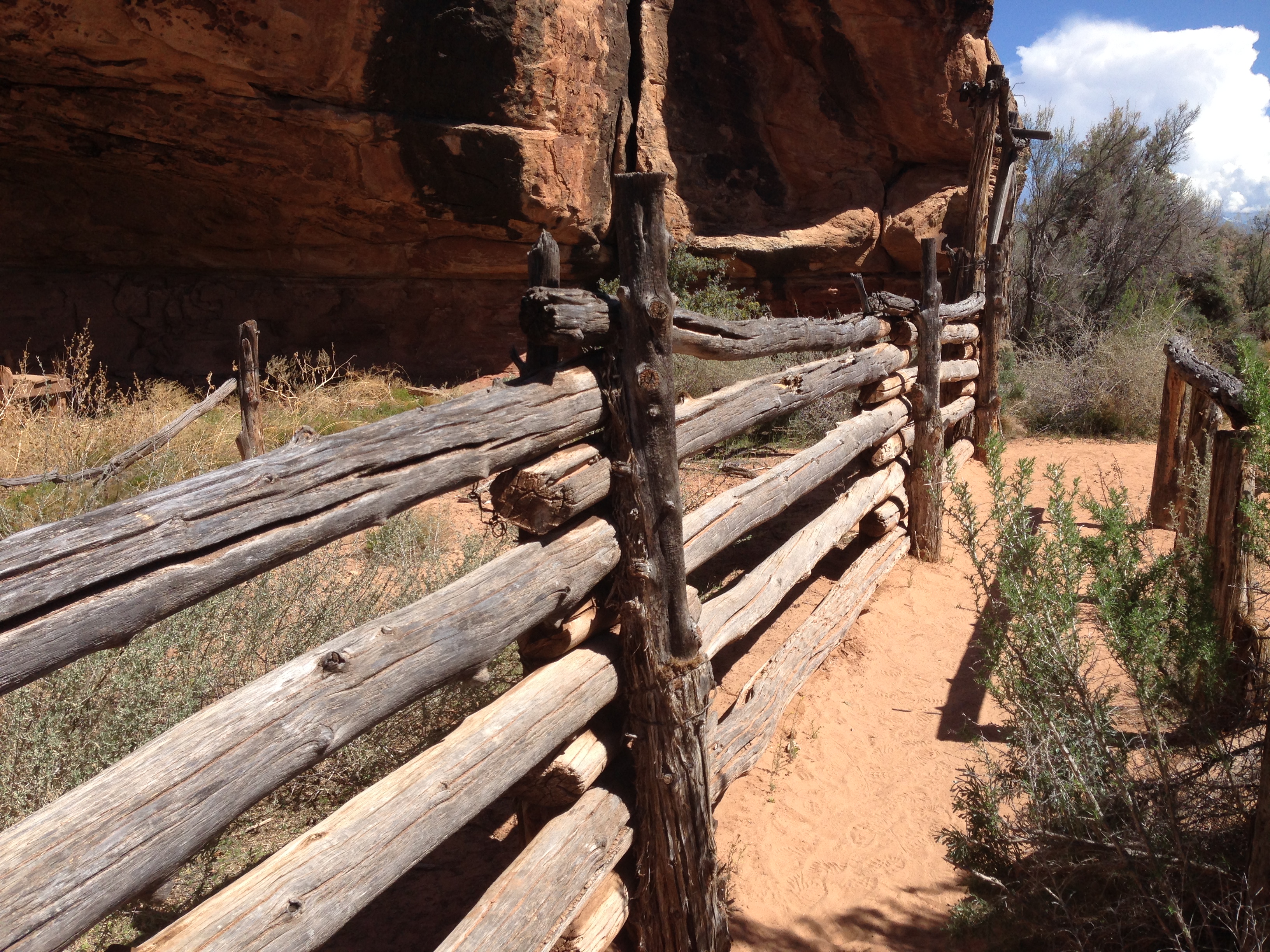
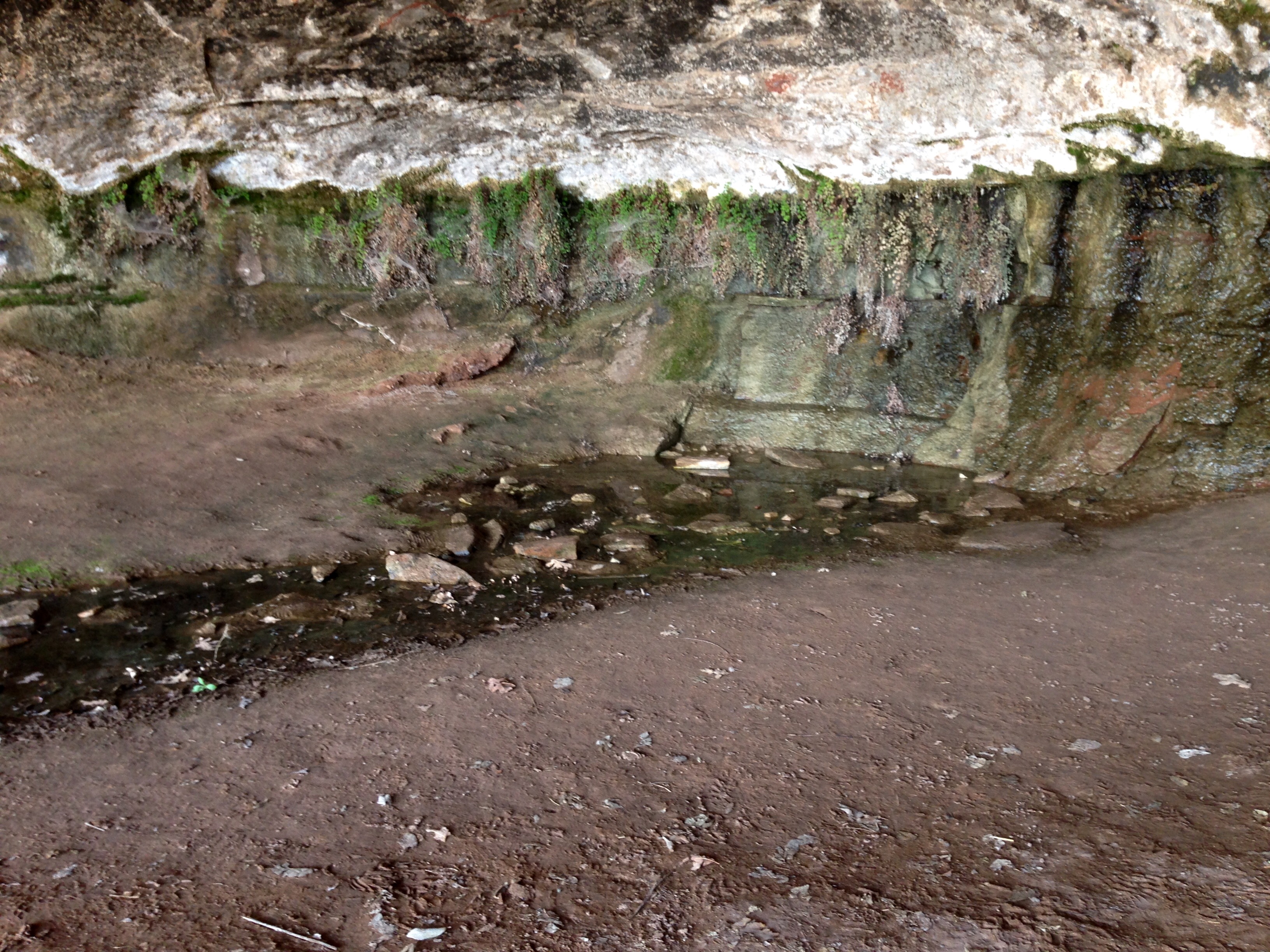
The Spring Cave overhang and pictographs.
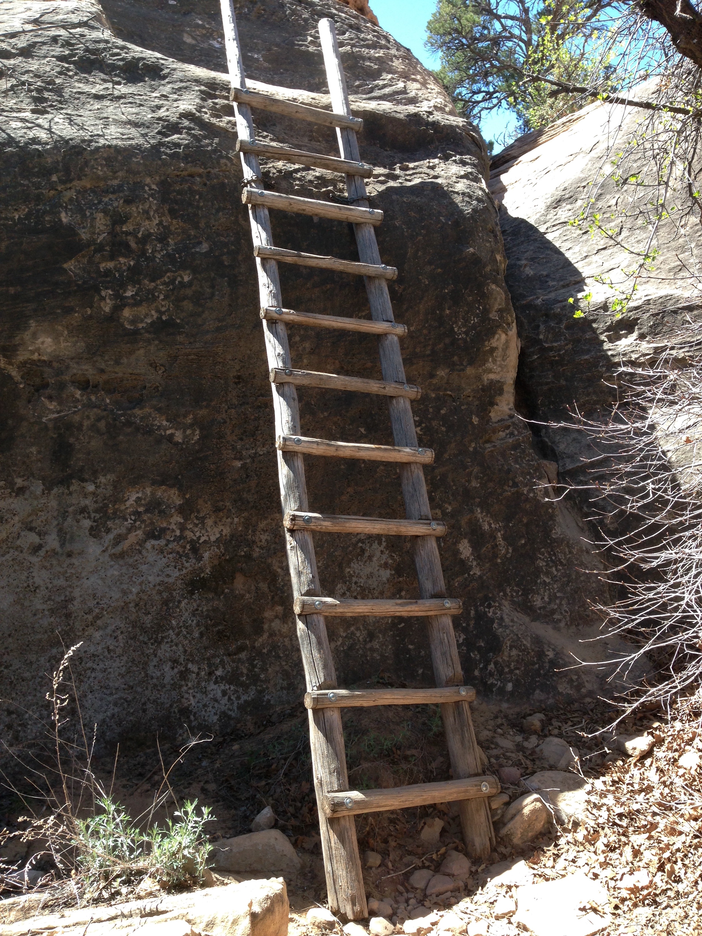
This trail had some interesting pitches to it. There were two of these on this hike.
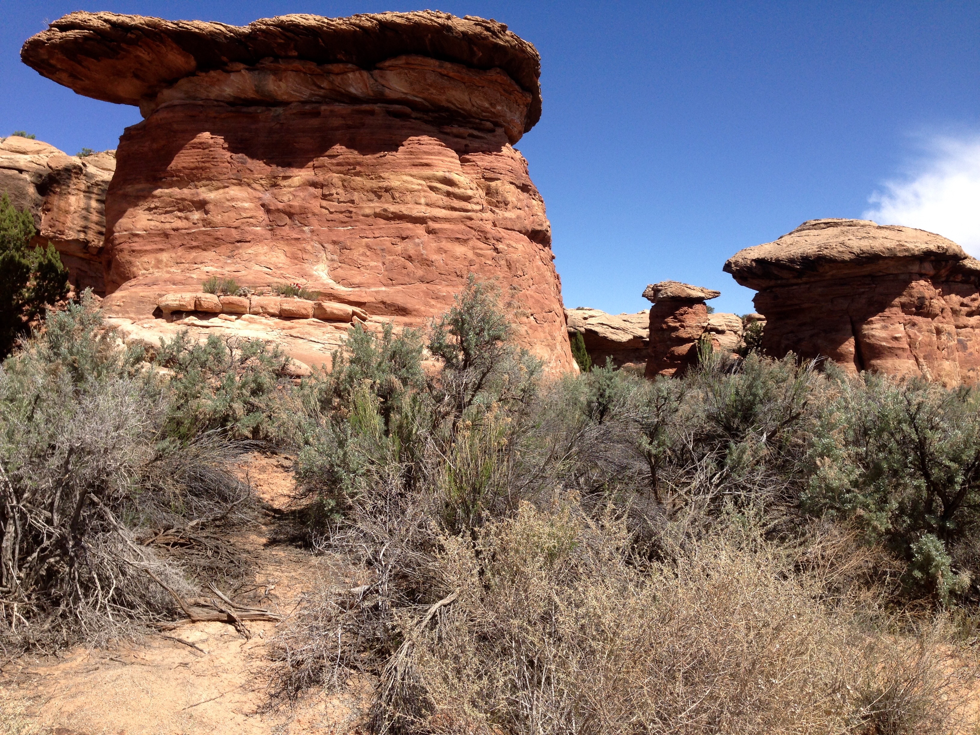
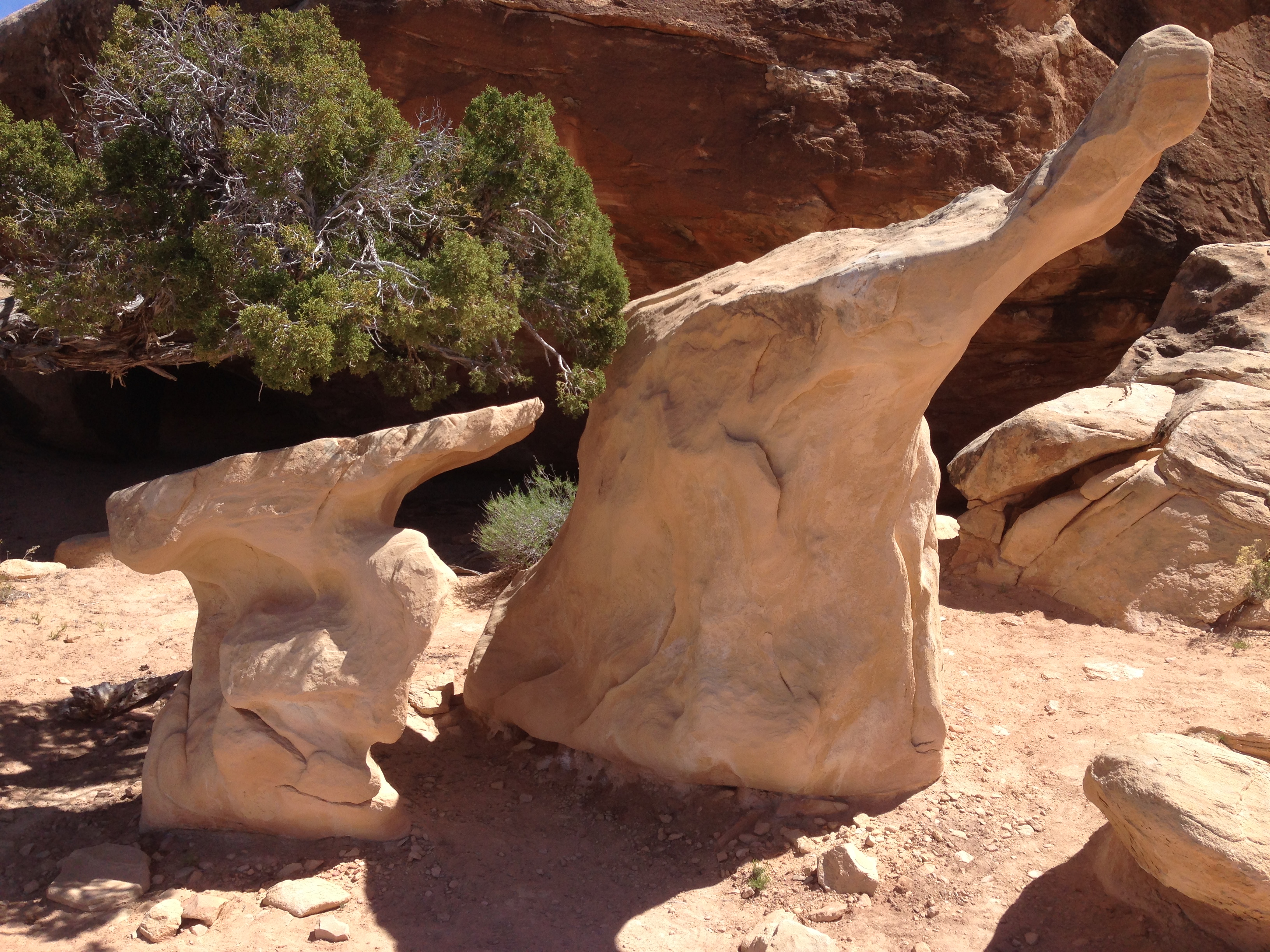
There were also a lot of pedestal formations that have harder rock perched on a more easily eroded sandstone.
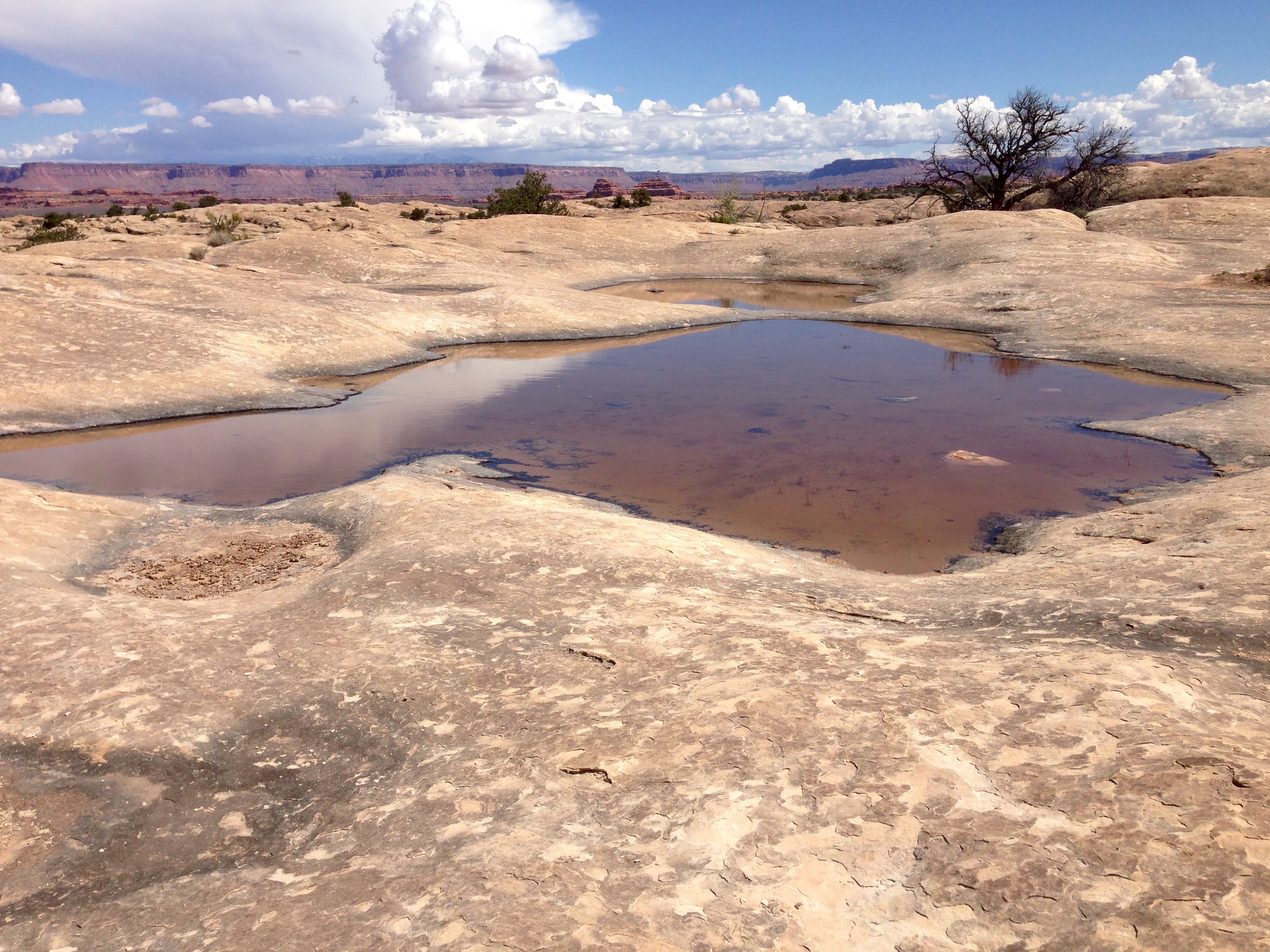
I’m no biologist but these pools while they hold water are critical to the lives in the park. When in these pothole areas it’s important to not walk in or touch any of these potholes, wet or dry.
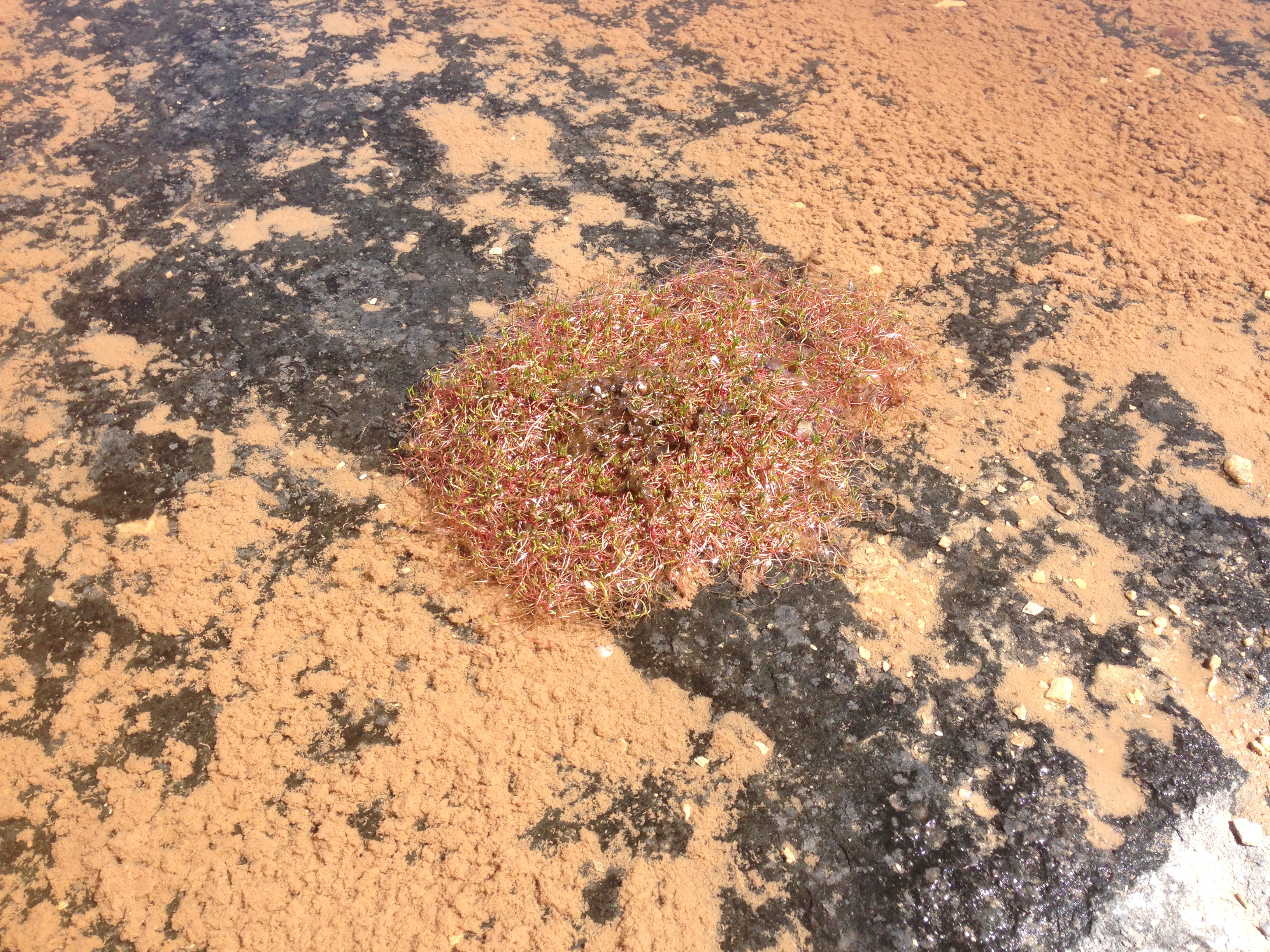
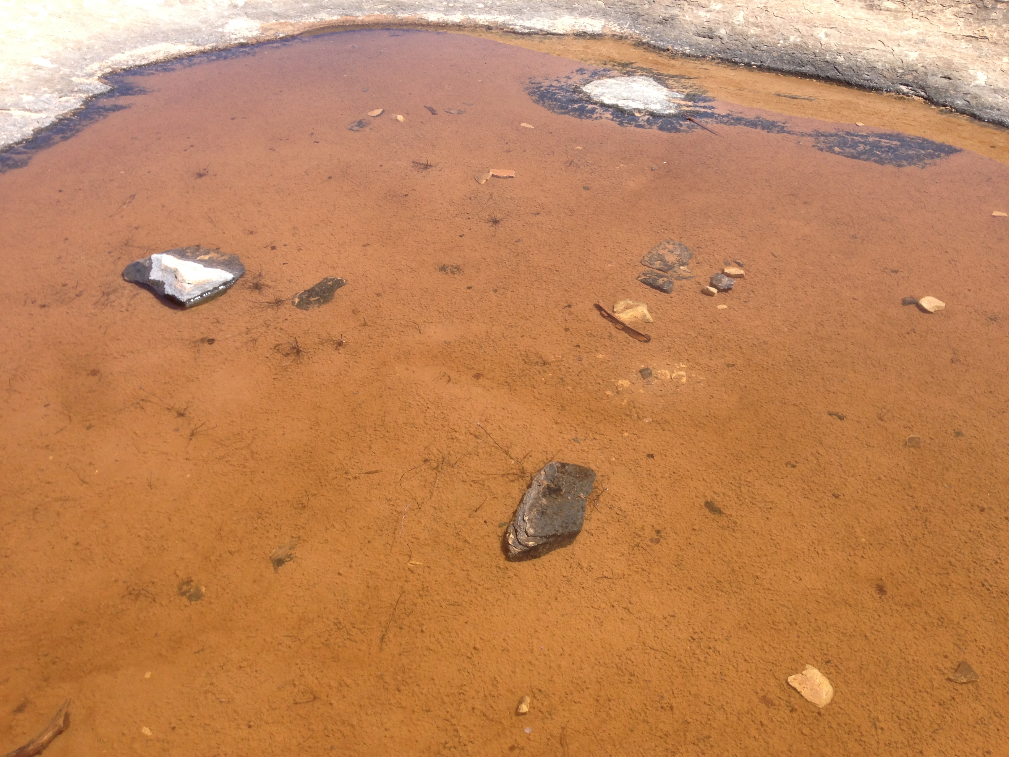
You can’t see them of course, but there are actually little marine lives moving across the sediment of this pool. For most, their life cycles only last while this pothole has water.
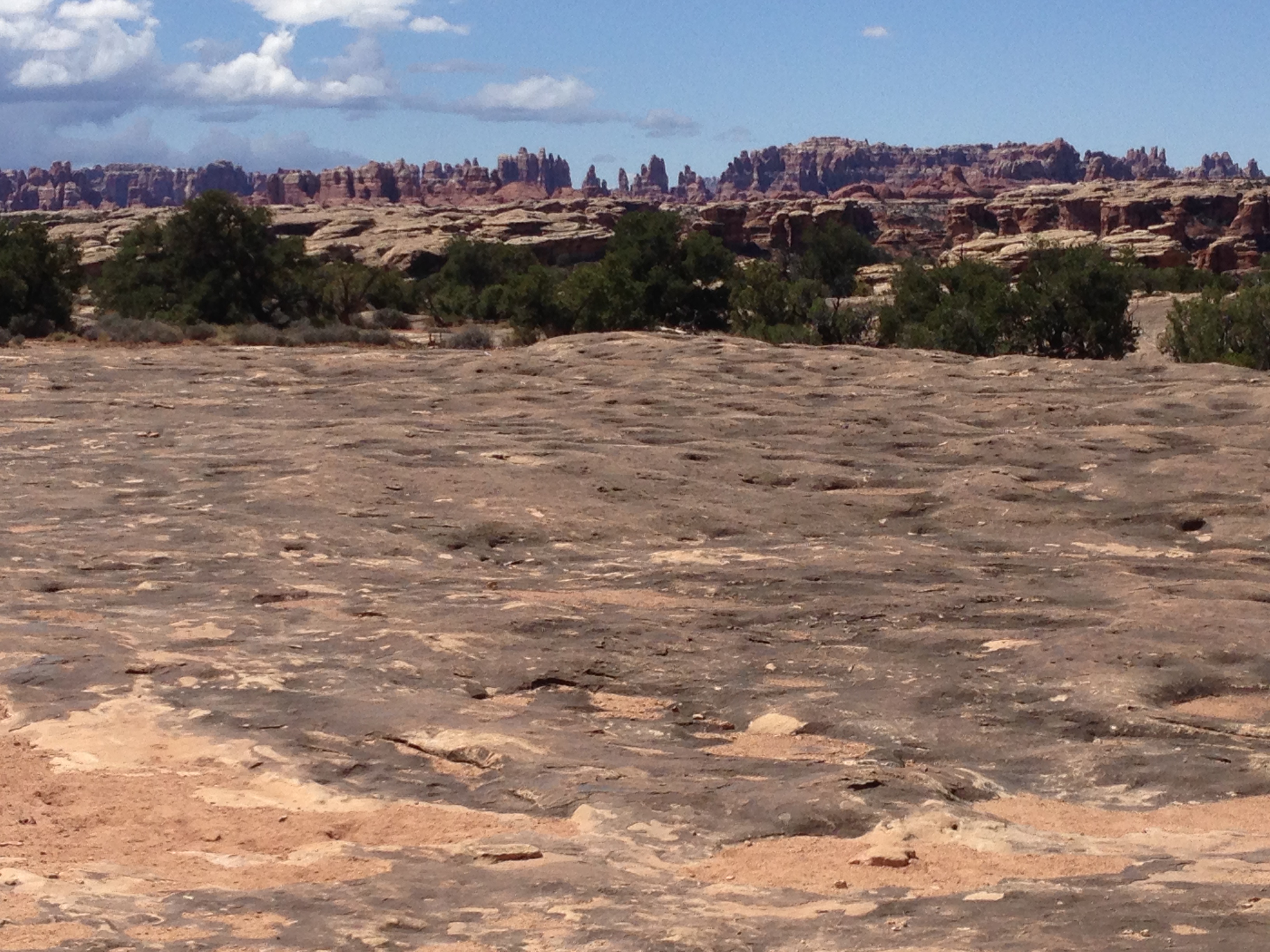
You can photograph unusual rock formations until the cows come home in this section of the park. And here is the requisite picture of a vista section that gives this area it’s name.
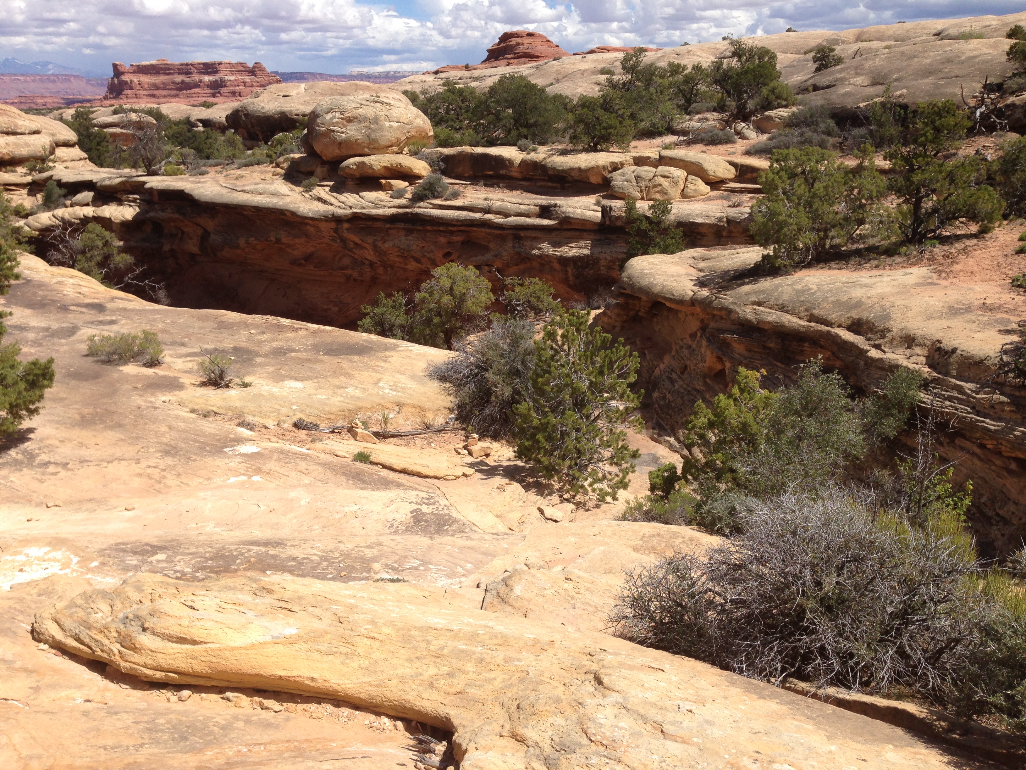
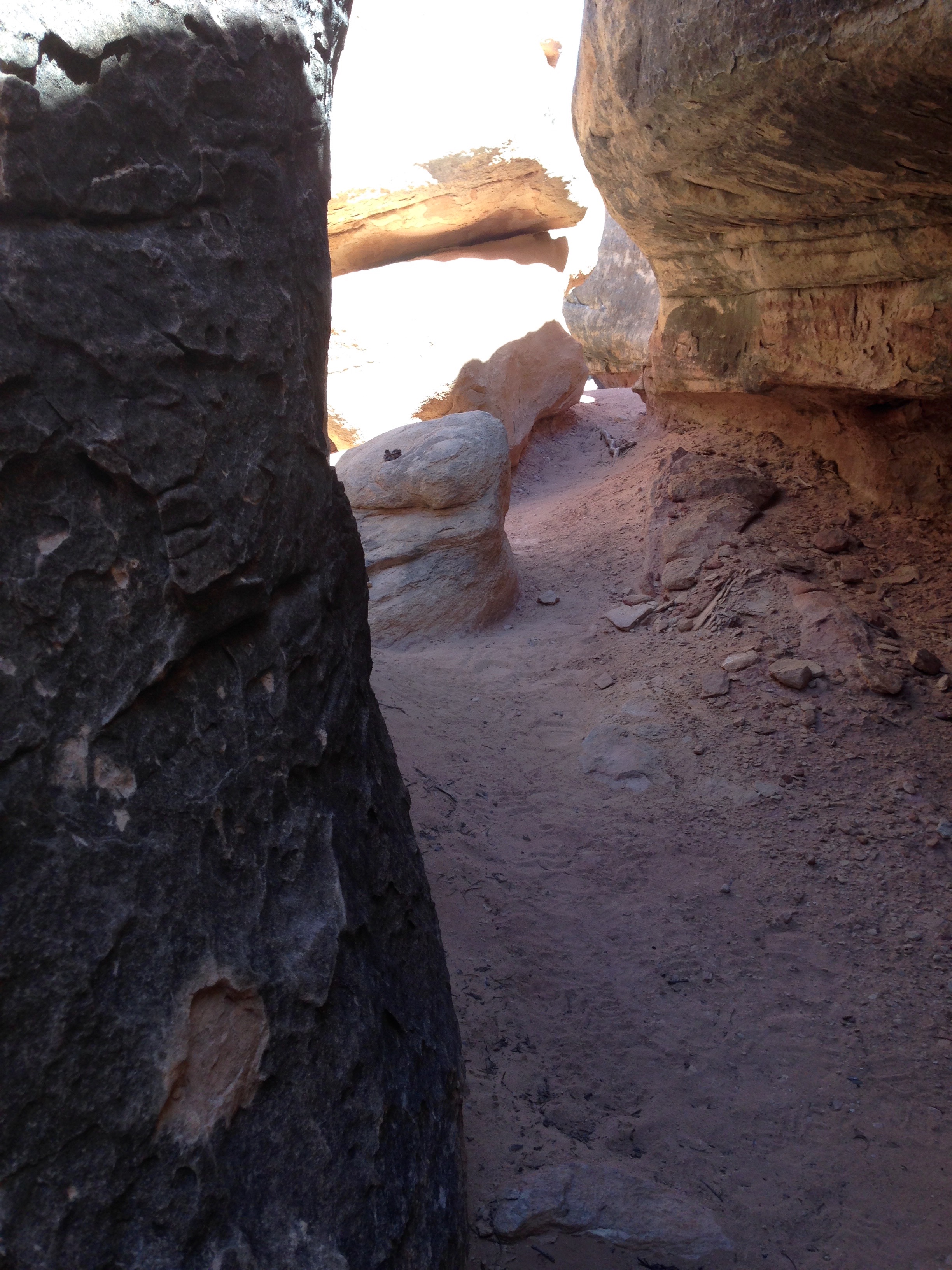
My final hike was the longest and most strenuous of the day. I came up through this narrow canyon, and headed up to that cut you can see up above in this next pic.
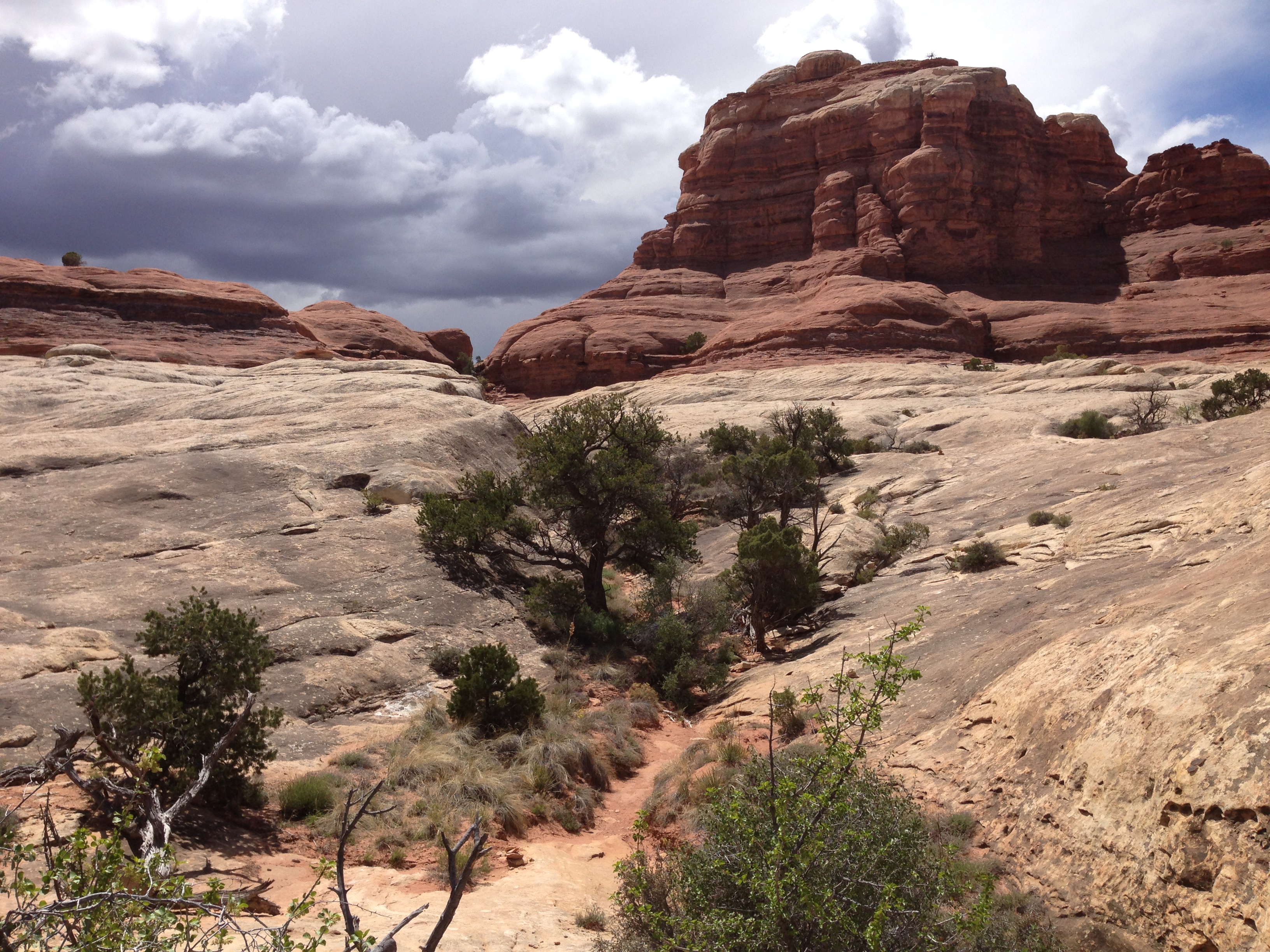
By the time I got through the cut those darker clouds you can see were looking grumpy. The wind had picked up and the temp dropped enough so you noticed it. It was time for a flash flood avoidance return to where I’d left my truck.
This is my last post from my time in Utah. As I’m putting together this post I’m actually sitting in my camper, at my mobile office, in Durango, Co. It’s a great feeling for me to be back in Durango, one of my favorite Colorado towns from my years working and traveling this area.